
Durd Durd to Yarram
We respectfully acknowledge the Djab Wurrung and Jardwardjali people as the traditional custodians of the lands and waters of Gariwerd.
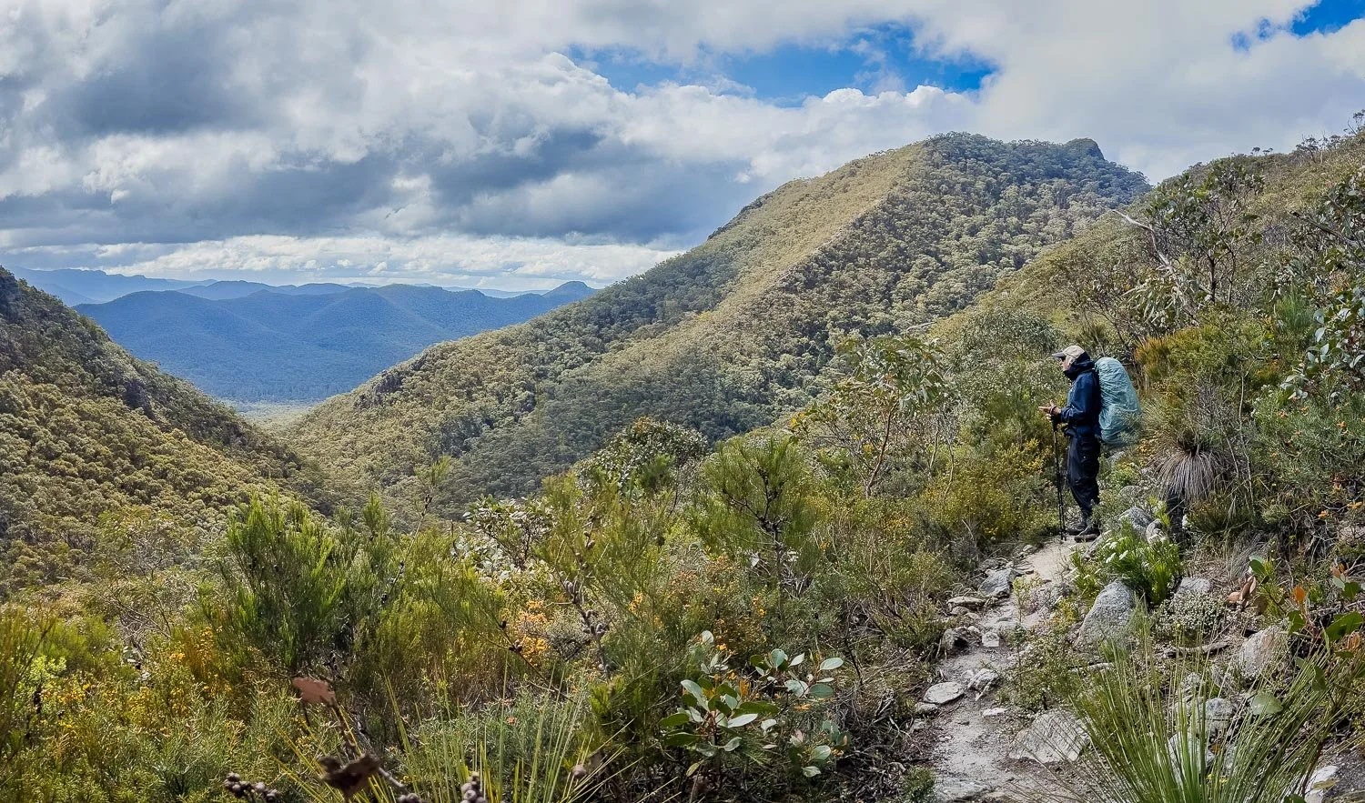
Wildflowers, rugged terrain and yet more views

Spectacular evening views over the Serra Range
On many hikes, you walk for a time and then reach a view, rinse and repeat. We can’t emphasise enough just how extraordinary the Grampians Peaks Trail is in terms of views. They change, and change quickly, unlike vast plains where you have a view that stays, but which remains basically the same the entire time you cross, or hiking in forest from which you briefly emerge for a peek. The GPT has a new view around every corner, multiple times each day. And today the vegetation also changes rapidly, with new and different species appearing for the first time: a real treat for botanists.
But not just botanists. In our opinion, the GPT is one of the best hikes in Australia for those whose hearts are gladdened by new vistas. If you are one of them, you will be a very happy hiker!
Today, the GPT offers all this and more. You have a long descent from Duwul to Jimmy Creek, before climbing to Yarram. The new trail on the descent is good underfoot, and you will likely make good time even if you are tired from the demands of the last two days.
If you have left a food drop at Jimmy Creek (we highly recommend you do), you will also have a light pack for the morning’s walk. However, the afternoon with a steady climb is more challenging, not only because of the elevation gain with a heavy pack loaded for the Southern Section, but also because the last part of the track into Yarram has scree, boulders and rocks to negotiate.
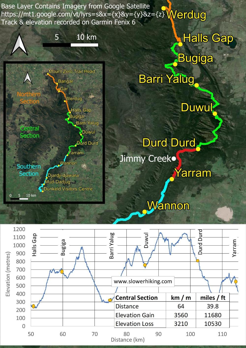
Overview map, Durd Durd to Yarram. You’ll be at lower, less exposed elevations today: no problem with poor weather forecasts.

The day’s details: Durd Durd to Yarram
Fortunately, today’s 11.9km (7.4mi) distance and 510m (1670ft) elevation gain is reasonable, though again the bouldery track at the end will take longer to complete than you might expect from the numbers.
How to Make Today Easier

Jimmy Creek Campground
Your best option is simply to split the day in two by staying at Jimmy Creek Campground overnight instead of continuing to Yarram. Jimmy Creek Campground is perfectly placed halfway between Durd Durd and Yarram, giving you two short days before starting the Southern Section. You could even stay two nights at Jimmy Creek for an extra rest day: the campground is lovely, and you need only carry any extra food from your food box a couple hundred metres.
If not staying at Jimmy Creek, you can still make the most of the water tank and refill at the road crossing so you’re carrying only water for the morning.
Walk with Us:

The morning dawns grey and misty. No views yet!

It’s raining, so Geoff cooks breakfast in the XMid Pro2 tent. You can only just see it here, but I was amazed by how well the vent expelled steam.
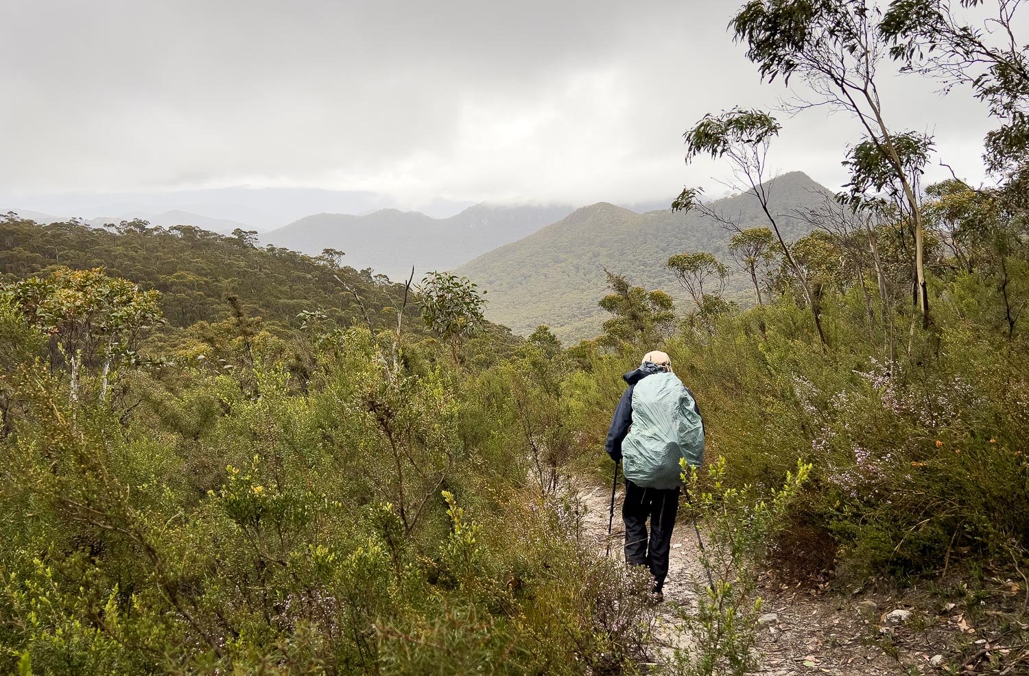
By the time we set off, the low cloud is rising and the views returning.
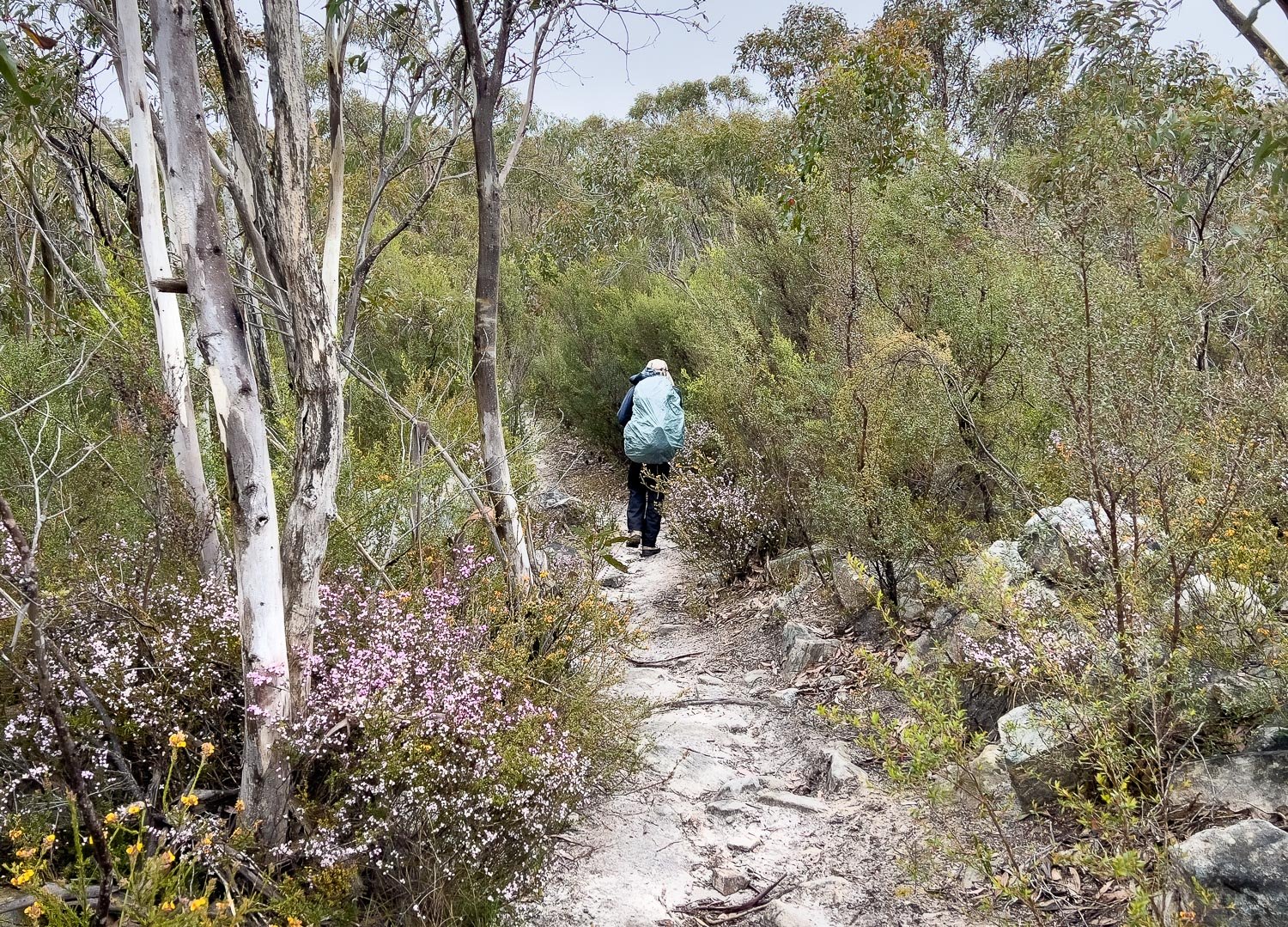
The vegetation, including pink boronia, is quite different to that of the previous few days. Botanists will love this section of track for its rich diversity!

And here is one reason for that diversity: the soils are varied, supporting a wider range of species.

Bushy Needlewood (Hakea decurrens)
Some areas have been burnt. It’s always worth checking these the following spring for fire-responsive orchids and other wildflowers.

Sadly, through this section we saw many plants affected by Phytophthera, an introduced fungus that kills grass trees and species in the Proteaceae family such as Banksia and Isopogon. As this is a new section of track, it was almost certainly introduced by the machinery used in construction. Stick to the track.

Keep your eyes peeled for these tiny Bronze Cap orchids (Caladenia iridescens): there are many right beside the track.

And you may even spot a Flying Duck Orchid (Caleana major) in the areas with white sand.

It’s been cold and rainy. Some people prefer rain kilts/skirts and they are great in warmer climes but, for Victoria in this weather, we have chosen medium weight three layer goretex jackets and slightly lighter rain pants. We own ultralight breathable Visp rain gear but decided it was too fragile for the scrambly terrain, and it is also insufficiently warm: the same features that make it so breathable also allow a fair bit of wind chill.
On Geoff’s shoulder is a PLB and I’m carrying an Inreach Mini. For a few years we carried only one device but, if the person lying unconscious at the bottom of a cliff is the one with the satellite communicator, it’s not going to be of much use, is it?
The PLB has a stronger signal, but the Inreach can be used for two-way communication, which is why we have one of each. Although some new phones have satellite emergency capability, we won’t be discarding our other comms just yet: phones are far more fragile, and of course we use them for other things that flatten the battery.

And here we are at the food drop! It’s between rain squalls, so we quickly change into clean base layers and socks, stash our rubbish into the box and pack our food and fuel into our bags. Always thoroughly secure food containers like this: we used tape as well as choosing a container with clips (screw top barrels are good too). Animals quickly learn how to open poorly secured food containers!

Into different vegetation again and here is a glorious clump of Blue Tinsel Lily (Calectasia intermedia).

Steeply contouring track, rain showers and more phytophthera-affected plants. Whenever you clean your boots at wash down stations, remember to spray the tips of your trekking poles too.

It’s fascinating how simply crossing a drainage line gives rise to completely different plants on a different aspect.

We stop for lunch on the track, with easterly views. Etiquette generally dictates that you leave the track for stops like this but it is steep, there is room to get past, and the other hikers are ahead of us.

The track becomes increasingly rocky and demanding.

This bouldery scree patch is the track itself. You can tell it’s the track only because it has no bushes growing on it!

More marvellous views...

… and more rock-hopping. It will take you longer than you think to reach Yarram.

A little scrambling, too.
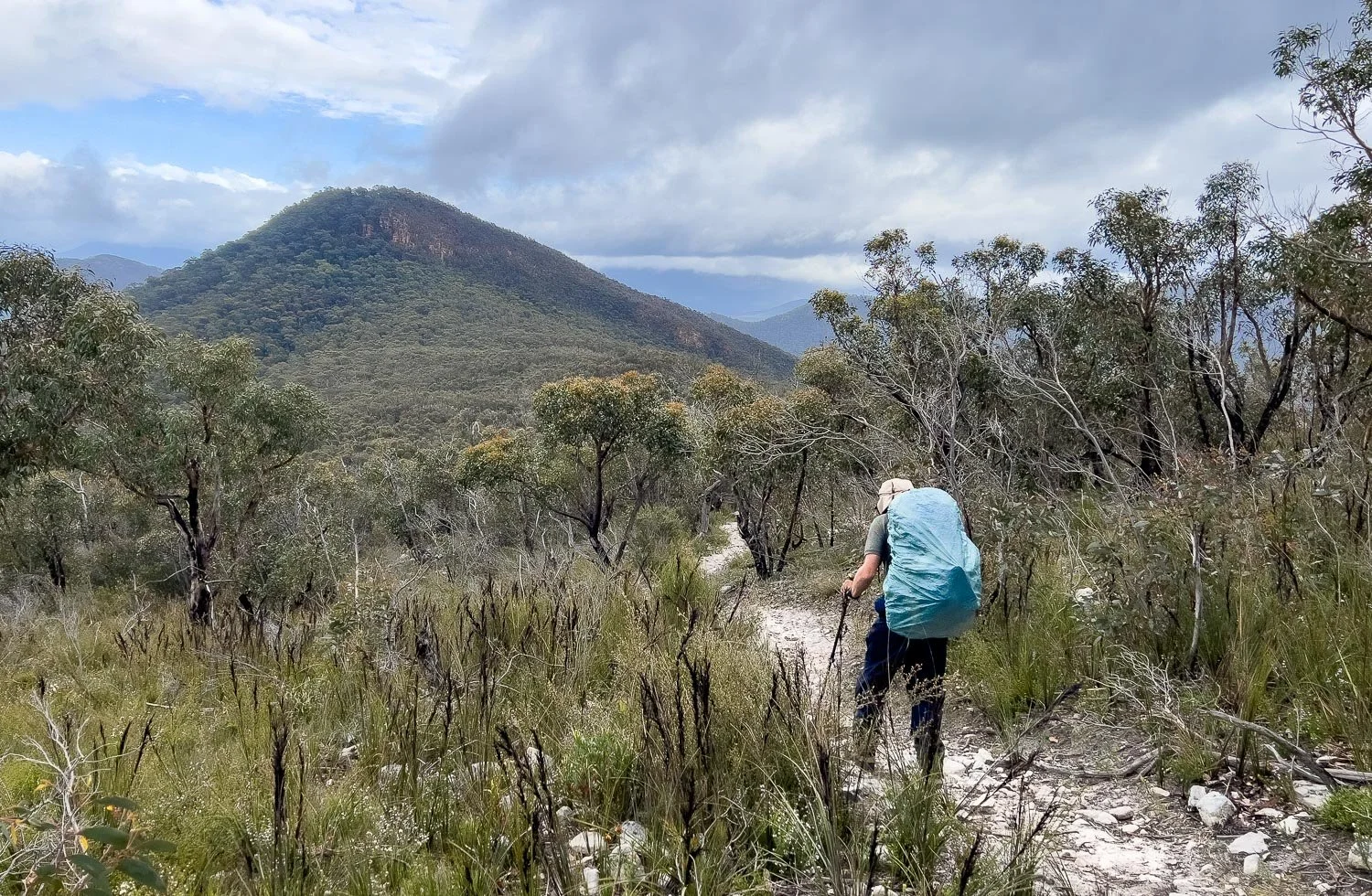
You’ll get enticing glimpses of the Serra Range on the other side of the Valley.

A hiker is backtracking to find a companion who has dropped behind. We had passed him and knew he was having some difficulty in the rocky terrain. He declined our assistance but we’re glad his mate is going back to him. This section would be nightmarish in the dark.

Snow gum (E. pauciflora), I think.

A mass display of wildflowers blanketing each side of the track.

Mosses and ferns thrive in the sheltered gully leading to Yarram.

Yarram Campground: you come across it unexpectedly because the terrain is so steep.

Here it is, an engineering marvel set in a steep gully with tent platforms stepped down the slope. The hut is welcome after three nights without one, but perhaps the money ran out because, unlike all the other huts, sliding doors are missing. No matter: with the evening sun streaming in, the space is cosy and congenial with our trail friends.

What a day to finish the Central Section, with that spectacular sunset over the Serra Range. You have completed the most demanding part of the GPT and will cross the valley tomorrow on the first day of the Southern Section. Stay tuned for our description and tips, coming soon!