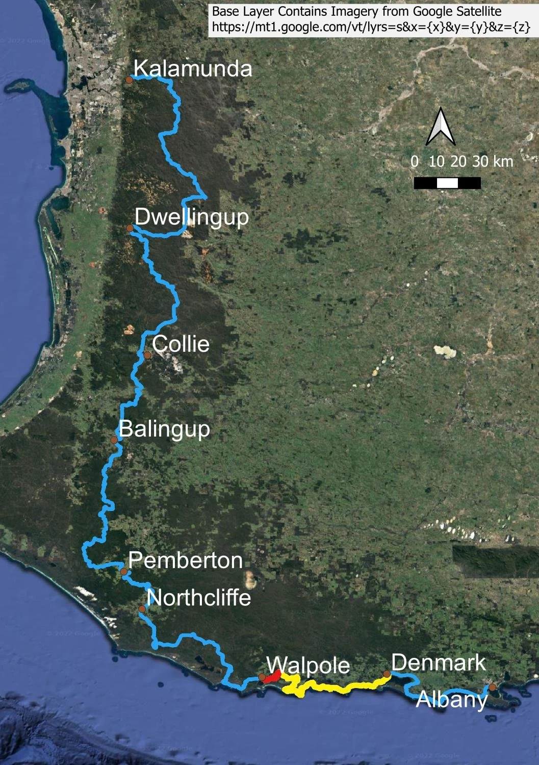
Days 58 to 59: Walpole to Frankland River Feb 18 Written By Slower Hiking We acknowledge the Nyoongar People as the traditional custodians of the land and waters along the Bibbulmun Track Today comprises forests, views, rivers and treetops; here, Hilltop Lookout. Overview map Use Bibbulmun Track Foundation Map 7: Walpole Today has an elevation gain of 400 metres over 18.4 km. The first 4.8 km is very flat and made a nice return walk into Walpole yesterday after being dropped off at the South Coast Highway track crossing point.The section from Walpole to Denmark is many hikers’ favourite. It really has everything: sandy beaches, rocky headlands and rockpools, high cliffs, towering karri, massive tingle trees, coastal heath ablaze with colour, a treetop walk amongst the forest canopy and even fun estuary crossings on foot and by canoe. The scenery changes hourly, with fabulous views every day. The track is initially flat around the inlet; we hiked this bit yesterday on our second ‘rest’ day (see here for more) but thought we’d share some images here to give you the flavour of the conventional day. Glimpses across the water as you leave town This part of the track comprises a section of a day walk loop, and is more manicured than much of the track. You’ll likely set a good pace! Very quickly you’ll enter forest: jarrah at first… … before a long steady climb to higher elevations and into the karri. On top of the range you have marvellous views back towards the coast from Hilltop Lookout. Now that you’ve climbed to the top of the range, the land is undulating - there’s little more gain today. The dense shrub understorey means that you’ll see fewer flowers than in more open country, but you’ll pass through sunlit glades and of course the trees are awe-inspiring. Just look at the size of the bole of that fallen tingle tree! It’s enormous! Every time we think we’ve seen what must surely be the biggest tree, a larger one appears. Astonishing. Apologies for the image quality, but you’ll get an idea of the Tingle tree’s size. Tingles were once much more widespread, but they now exist only in a tiny 6,000ha area around Walpole. They survived here because of the stabilising climatic influence of the Southern Ocean, ensuring an annual rainfall of about 1200mm (48 inches) that has, alas, already declined by 20% since the 1970s, and forecast to decline even further due to human-induced climate change. The prognosis is grim for these trees. In the past, it was a thing to drive your horse and cart/truck/van or car through one of the largest of the tingle trees. This practice eventually stopped because, even though the trees are enormous, they are shallow-rooted rainforest species and compaction was killing specimens hundreds of year old. Even foot compaction kills these trees, and platforms have been erected around the most visited ones to prevent further damage. Image Credit: State Library of Western Australia. The forest continues to delight. We keep stopping to marvel at individual trees. Because of a particularly stormy season, there is a huge amount of deadfall that has not yet been cleared by DPaW and volunteers. After a long, steady descent and two road crossings, we reach the dark waters of the Frankland River. You’ll find many spots for a swim here. Plus rock slabs on which to sit. The hut is beautifully situated right on the river bank. Pat and Helen on the verandah. Pat is reading the visitor logbook and it’s something we all do because it’s fun seeing others’ perceptions of the day. It’s also nice to see how our faster friends are travelling. A lovely spot to pitch the tent. Again. Knowing there is water, a hut or campsite plus a covered area for cooking in inclement weather makes a huge difference because you simply don’t need to worry about them during the day. And tonight, there is the sound of the river to soothe you to sleep! But first, dinner! When we prepare meals, we rehydrate by pouring boiling water into the vac seal bag, and popping it into a cosy for 25 minutes (YMMV, but shorter times are not conducive to a happy experience in our tent later!). When it’s ready, we decant half into the pot that was used to boil the water. Geoff pops the bag into a plastic screw-top container that we use to soak porridge, and eats straight out of the bag. It’s a good system for two people because you don’t need to carry plates or bowls. This Carrot, coconut and lentil curry is one of our lightest meals, but very filling. A splash of olive oil from a little 200ml bottle adds calories and mouthfeel. It’s a yummy end to a spectacular day. Next Day Walpole to Denmark Contents How to Stay Motivated on a Long Distance Hike Bibbulmun Track Contents Slower Hiking https://Slowerhiking.com