
Frenchman’s Cap - Trail Head to Lake Vera
Shadowy rainforest, rushing rivers, buttongrass plains and enticing views

Today offers splendid landscapes with tantalising glimpses of what is to come, and the not-so-sodden Loddens
We acknowledge and respect Tasmanian Aboriginal peoples as the State's first peoples and recognise them as the traditional owners and continuing custodians of the land and waters of this island, lutruwita (Tasmania) on which we work, learn and live.
The first day of this spectacular, varied and remote hike in the Franklin-Gordon Wild Rivers National Park offers an enticing taste of what is to come. After setting off from the car park, you’ll initially traverse undulating terrain, crossing the Franklin River before a steady southwesterly climb to Mt Mullens, where you’ll get your first inspiring glimpses of rugged Frenchman’s Cap and its surrounding ridges. Continuing southwest, a long descent brings you to the Loddon River and another fun suspension bridge, followed by the Loddon Plains with its golden buttongrass and tea tree. You’ll have one more climb through rain forest to reach Romney Plain and a short descent to the hut at Lake Vera.
Looking at the elevation difference between the car park (390m) and Lake Vera Hut (570m) is misleading, because you have several climbs and descents in between, so the cumulative elevation gain for the day is more like 700m (2300ft) than 180m. Although the terrain on the plains is now mostly excellent underfoot and much improved from the chest-deep bogs of the original route across the ‘Sodden Loddens’, you’ll still traverse muddy sections, as well as rough and rooty track in the rainforest. Slower hikers will enjoy this walk if they are conservative in their time estimations. We found it the most demanding day (and heard others did too) — it took us 8 hours at a relaxed pace — but we did encounter two runners completing the entire trail in a single day, so YMMV!

Yes, it’s 700 metres of elevation gain today!
How to Make Today Easier
As always, an early start is the best option for slower hikers aiming to complete a challenging section in a single day (transport and access details in Planning and Tips). For those travelling some distance to the car park, you have the option of a few small informal camp sites close to the start of the track so you can stay overnight before heading to Lake Vera Hut at sparrow fart.

Small campsite near the start of the track.
Alternatively, split the day in half and stay at one of the pleasant campsites right beside the Lodden River (bring leech repellant). The Yellow Toolbox tent platform (9.1km / 5.6 miles from the Trail head) only has room for one or two small tents, and is used by Parks Services for equipment, so may or may not be available.
You’ll find plenty of water along the track so need not load up for the entire day at the start; top up at Loddon River to keep your pack light. Although some hikers don’t carry a tent because of the (very comfortable) huts, we strongly recommend bringing one in this region: a shelter whilst on track is an essential safety item in case of accidents and the potential for hypothermia in notoriously changeable weather.
See our Planning and Tips for more logistics and details.
Walk with Us:

The track starts easily enough and it’s excellent underfoot.
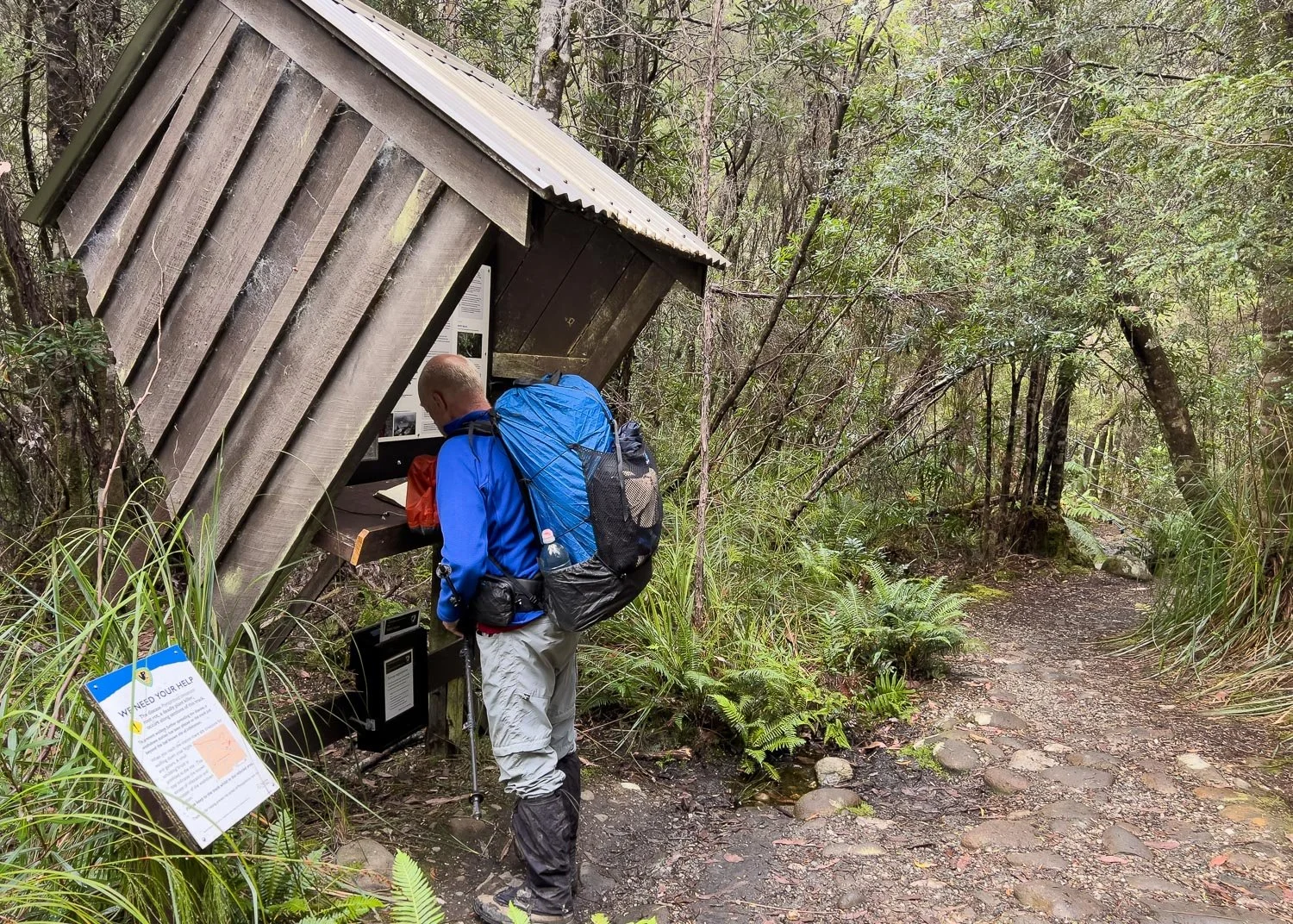
The registration booth is a short distance in. Note the phytopthera sign at left: please use the boot spraying station you’ll come to later, and make sure to spray your gaiters and trekking pole tips at the same time.

You’ll pass through lush forest and then cross the fun swing bridge over the Franklin River.

Overseas readers are often surprised by the clear, tea-tinted waters in southern Australia, but it’s simply stained by eucalypt tannins and is no indication as to its quality or safety for drinking. Flow rate, turbidity (suspended solids) and livestock/human activity upstream are far more reliable indicators. You can see here that the water is fast-flowing and clear, and the upstream catchment is largely pristine bushland in the Franklin-Gordon National Park. Hikers have different risk tolerances. If in doubt, carry a filter or purification tablets: boiling is a heavy/fuel-expensive option nowadays.

Even in mid summer, you’ll see prolific fungi, here Amanita ochrophylla…

…and Austroboletus niveus.

Shaggy Cap (Boletellus emodensis). It would be amazing here in Autumn!

More forest and great walking…

Before you emerge into the open.

Thank you Dick Smith for making this hike accessible to so many more people, and for greatly reducing the previous erosion issues.

When the path climbs or ducks into forest, you’ll often find sections like this. These tree roots are extremely slippery when wet but the track is very manageable if you take your time. Trekking poles are your friend!

There’s also a fair bit of boardwalk and duckboard topped with chicken wire. The wire has rusted away in parts but is being progressively replaced. Parts without wire are also extremely slippery when wet, as we can attest via a few faceplants!

Every time you emerge from the forest, new views open up across the tea tree and button grass, here to the Pickaxe Range.

Even here, well before the higher reaches, the track passes through temperate rainforest, lush and shadowy with every boulder and trunk blanketed in green, green, green.

And out onto buttongrass plains once more on improved track. Deep muddy paths significantly alter drainage lines in swamps, causing some parts to dry, and they also increase water turbidity. Both these things impact the environment far beyond the immediate vicinity of the track itself.

So yes, although many of us hikers dislike infrastructure such as duckboard, it hasn’t really been placed for us, but to protect sensitive environments.

After a long climb you’ll get your first exciting glimpse of Barron Pass that you’ll cross tomorrow; Frenchman’s Cap is in cloud here. Geoff has just begun to descend Mt Mullens, one of the big “hidden” elevation gains of the day. Looking only at the start and finish elevations give no hint of the climbs and descents in between! Make sure to calculate cumulative elevation gain!

And more fungi, here stunning red Boletellus obscurecoccineus under tea tree.

Another swing bridge, this one over the Lodden River.

More tea!

If you turn right after crossing the bridge and follow the river ten or twenty metres upstream, you’ll find a cluster of pleasant campsites right on the bank (there are also some on the other side). Very leisurely hikers or those with children may like to stop here for the night, allowing for this day to be split nicely into 6.5km (4 miles) and 8.5km (5.3 miles) distances. Bring Bushman’s for leeches!

2.6km (1.6 miles) further on is the eponymous Yellow Toolbox Campsite. This is not an official public site but is mainly used by Parks Staff. It’s worth remembering it as a bailout option.

Onwards in the patchy sunshine. It’s heartening to see the previous erosion slowly healing under and beside the boardwalk.

A rare pink double form of Bauera rubioides

Scattered tea tree (Leptospermum sp.)

This is the new route that bypasses the worst of the original ‘Philp’s Lead’ through the sodden Loddens. You’ll sidle around the edges: no more chest deep bog holes!

Spectacular country and it feels marvellously remote even though you are not even a day from the trailhead.

Boardwalk…

… and steps that have seen better days. You’ll be fine if you take your time.

More gnarled and twisted tree roots and broken steps through glorious forest; you wouldn’t be surprised to see a Hobbit! And you will be ready for the track to level off and descend into Lake Vera!

But it is spectacular. Just look at those Tree Ferns!

Nearer Lake Vera on Rumney Plain. This was on the return journey, when we set off from the hut in rain.

Plenty of wombats about.

And then quite suddenly you are at the hut and platforms. Consider pitching on the platforms in good weather because...

…they are nicely spread out. Older bladders and prostates may also appreciate proximity to toilets!

On our return we did sleep inside the hut as we beat the rain by minutes; that’s our gear top centre. We carry lightweight down puffies (the green Ghost Whisperer for me, a Macpac one for Geoff) for use in camp and in huts. Hiking in down in wet weather doesn’t work because a rain shell over the top, no matter how breathable, wets out the down from sweat condensing inside. Synthetic down is less prone to collapsing and retains more heat when wet, but you will still be pretty miserable hiking in drenched down of any kind.
Instead, like most hikers, we use a layering system. Materials vary but the principles remain the same: a sweat-wicking base layer against the skin, an insulating layer over that, and a waterproof rain shell on the outside.
We use a light wool baselayer (short or long-sleeved); other people prefer silk or synthetic, but never cotton or bamboo, both of which are cold when wet, absorb moisture and take forever to dry. Next is a fleece, usually synthetic — cheap brands are often equally warm, just a little bulkier, heavier and less durable than expensive ones — and last is the rain shell on the outside.
When you stop for a break in very cold weather, you can layer the puffy between the fleece and the rainshell, but need to take it off again when you start walking. In camp where you’re not exerting yourself, you can wear all layers too. A layering system is considered best practice: avoid buying a heavy insulated waterproof jacket because it will be too hot for hiking in and has the potential to wet out. Ensure a rain shell is sufficiently loose that it doesn’t compress the fleece and/or down insulation when it’s layered underneath.
Highly breathable rainshells like the Visp may be insufficiently warm in camp because they aren’t windproof. For this region, we’d recommend a 3 layer goretex (or equivalent) jacket with a hydrostatic head rating of at least 20,000mm and preferably around 30,000mm, especially if your pack is not ultralight, or your jacket will seep at the shoulders and back. Many hikers also carry rainpants, especially if their jacket is hip length rather than thigh length.
Fortunately, this afternoon there is no need for rain gear: the hut is warm and comfortable with the sun pouring in the west-facing window. A sturdy soul has gone for a dip in the lake (more details in Planning and Tips).

Stainless steel benches and plenty of room for everyone. Beware the carbon dioxide and smoke alarms here, both of which you’ll set off if you happen to burn your dinner as a couple of lads did when we were there! You can see our red and orange food bags on the shelf behind Geoff: we hung them from roof beams overnight. We hang our bags on every trip we’re permitted to do so, in huts or when tenting because you only need to have one mouse chew through your supplies and Murphy dictates it will do so straight through every single one of your most important meals for the trip!
The first day of this hike has lived up to its promise of variety, beaut views and a remote ambience, and we have been told that each successive day is more spectacular than the last. This is exciting because we both loved today’s views. What will tomorrow bring?