
Day 10: South Cape Rivulet to Cockle Creek
Easy track, beautiful beaches and coal black cliffs

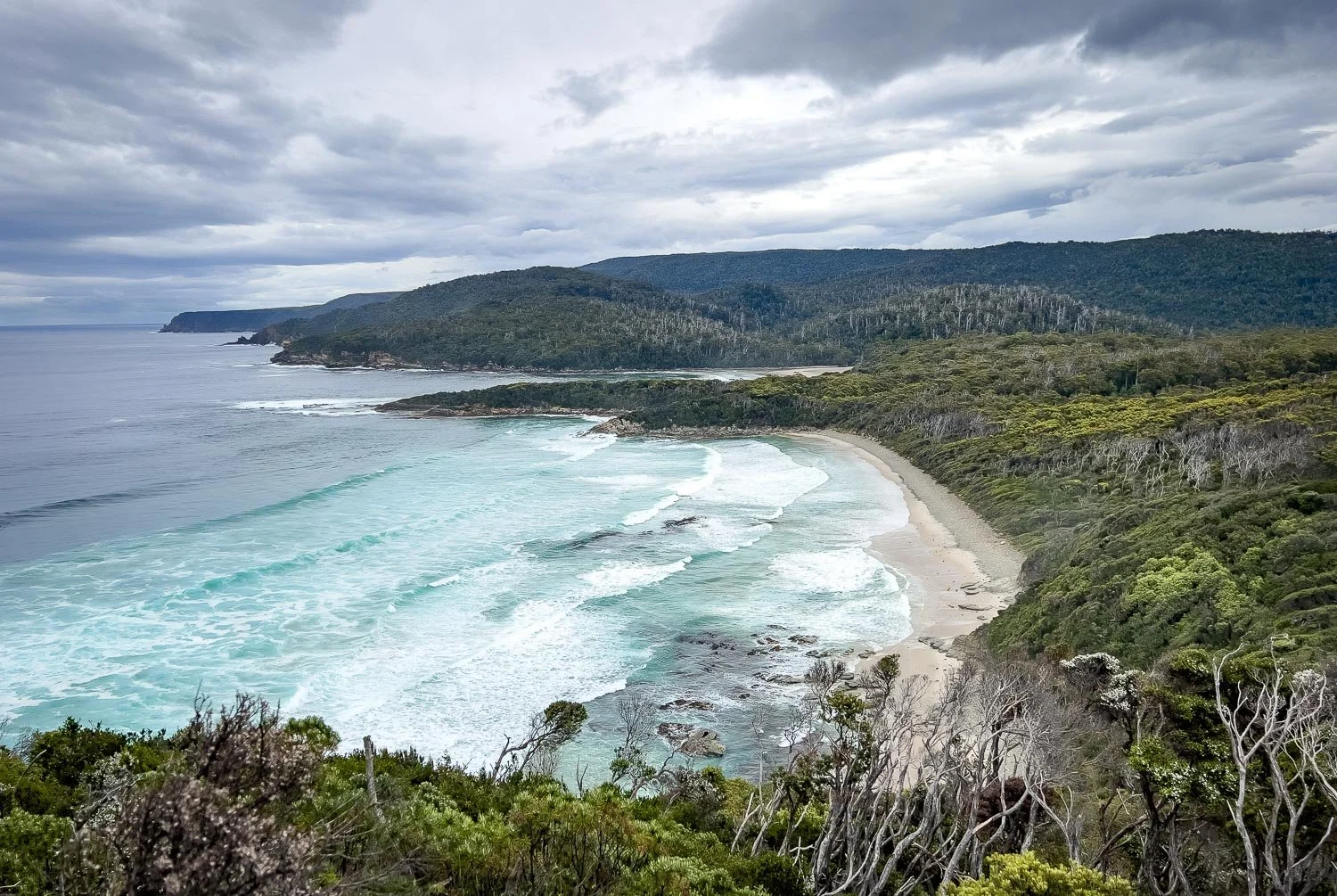
Early morning in South Cape Bay with Coal Bluff, Lion Rock and, in the distance, Southeast Cape.
Today’s hike is your final day and is one of the easiest on the track, making for a relaxed finish into Cockle Creek. You still have spectacular views to Australia’s southernmost point, inky Cliffs, glorious beaches and completely different vegetation.

You can see from the elevation profile that your biggest single climb is only about 120m (394ft) over 1km (0.62mi) at the start, followed by another 120m/394ft of multiple small ups and downs spread over the remaining distance, which is primarily through Blowhole Valley and along Cockle Creek. If you're skirting Coal Bluff instead of climbing it the day is easier, but you also miss some fabulous views and terrain on top. We recommend the climb!
How to Make Today Easier
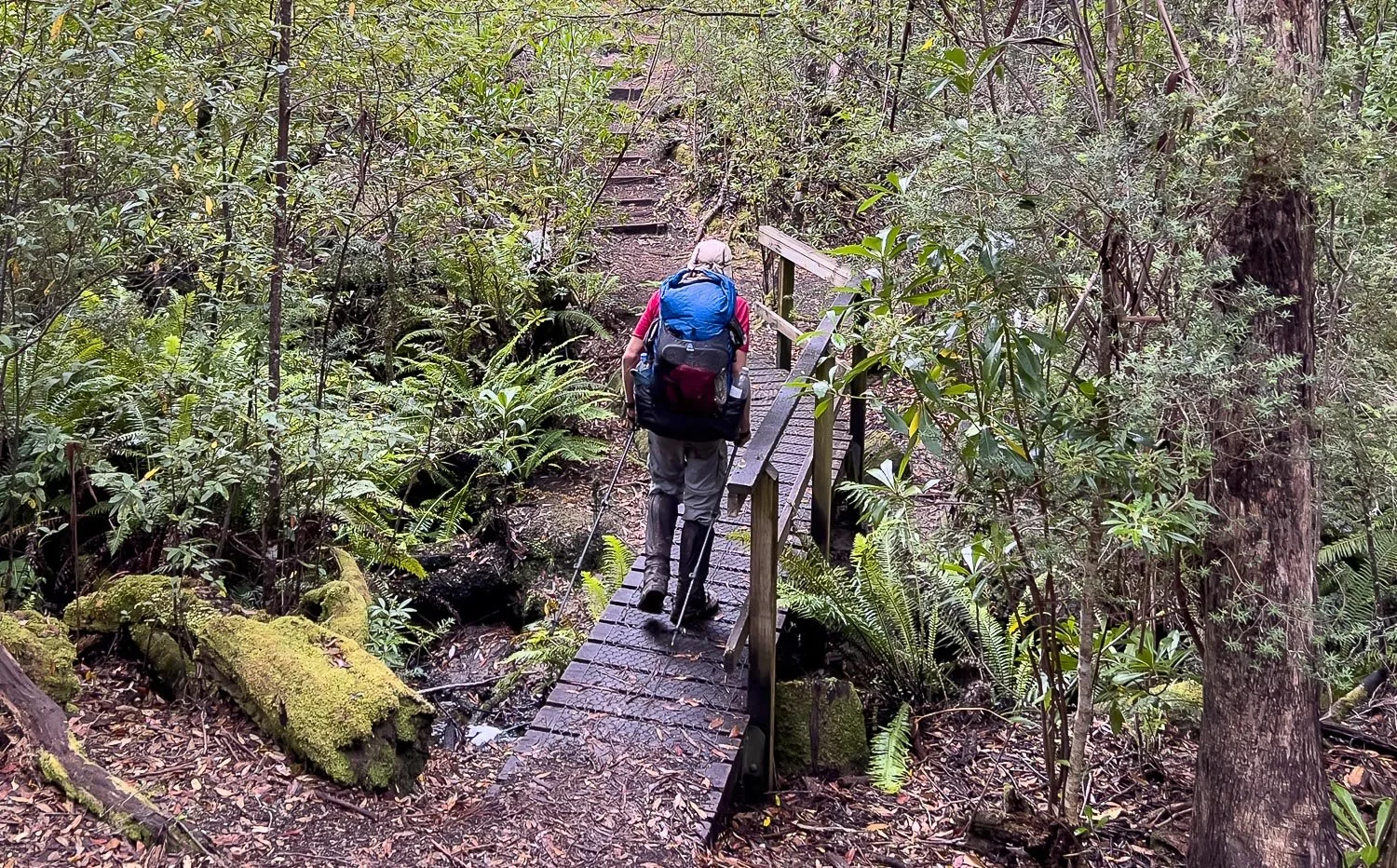
Today really is easy hiking. Maintained for day walkers and those on an overnight out and return to Surprise Bay Rivulet, the track is excellent and you have pretty much left the mud behind. Small bridges over creeks, boardwalk, formed steps, overgrowth slashed: you won’t have a problem. Conversely, those travelling east to west will likely be lulled into a false sense of security!
Skirting Coal Bluff along the beach halves your elevation gain and, of course, makes the day easier: you could wait for low tide, although 120m (394ft) elevation on good track should be comfortably within your ability if you've come this far. However, it’s potentially helpful if you’re injured or exhausted.
You could also split the day (3 km, 8km) and stop at Lion Rock for an extra night on the trail, but we suspect that by now you’ll have hot showers and pub grub in mind, and practically sprint to Cockle Creek!
Walk with Us:

An early start onto a beautiful beach.

But soon you leave the beach for your climb.

Firm track underfoot!

Hop Goodenia (G. ovata)

Down onto the second beach and to its end: it's time for your main climb for the day.

Lush ferns...
... and, higher up, stunning views westward.

A long descent down to the beach again, through forest initially and then pretty dunes.

Beach again, with gulls and striking black cliffs behind.

A short climb up stone steps.

Lots more signage today, and more people too.

It's marvellous walking...

... and the dramatic colours here are extraordinary. Coal, I assume!

Equally spectacular views westwards.
You're now on one of Tassie's Great Day Walks, and the track improves even further. Huge tree ferns line the creek to your left as it gurgles alongside.

Luuuuxxxuuury!

And new plants as you emerge into the open, here Mountain Guitar Plant (Lomatia polymorpha).

Boardwalk all the way through the buttongrass swamps in Blowhole Valley. The slashed strips either side are rich with wildflowers, just as they were on our very first day leaving Melaleuca.

Prasophyllum australe...

and the tiny Eriochilus cucullatus.

The Moose Orchid, Cryptostylis subulata.

You finally leave the low ground and enter sclerophyll forest, completely different to all the terrain you've traversed thus far.

Bushy clubmoss (Lycopodium deuterodensum) is an ancient plant with relatives that once grew like trees. Clubmosses aren't mosses at all, but are more closely related to ferns. They are a living hint of what used to be, a bit like stromatolites.

The different terrain is refreshing, with new plant species and granite boulders.

Cockle Creek and the first sign of civilisation in ten glorious days.

After signing out in the registration booth, you're nearly done. We took a leisurely ten days rather than the suggested six to eight days, but this track is highly customisable with many intermediate campsites.

Still smiling even as the rain comes down!
The South Coast Track is challenging by mainland standards, but one of the easier ones by Southwest Tasmanian standards. It has been an amazing hike, with a real sense of remote solitude, at least when we walked. The rhythm of buttongrass plains, rainforest, creeks and beaches provides variety every day, with sheltered campsites, regular waterpoints and options for swims throughout.
If you have considered this walk and been daunted by what you've read online, remember that most hikers do this in far fewer days, requiring longer daily distances and a faster pace, which is particularly challenging in terrain like that of the Ironbounds or between Granite Beach and Surprise Bay. It is not a hike for novices because mistakes are costly in such a remote environment, but our relaxed itinerary brings this walk into reach for experienced, well-prepared slower hikers with a reasonable level of fitness. Start planning for next summer!
We acknowledge the Tasmanian Aboriginal people and their enduring custodianship of lutruwita (Tasmania).