Trail Head to Nina Bay
We respectfully acknowledge the Bandjin People as the traditional custodians of the land on which we walk. We pay our respects to Elders past and present and to the Aboriginal people present today.
Spectacular views from Nina Peak
Today’s hike is a complete delight with mangroves, beaches, rainforest, wildlife and spectacular views. The climb up Nina Peak (190m over 650m) is steep and rough, but when you reach the top there are wonderful vistas and rocky outcrops with cool breezes from which to savour them.
Including the climb to Nina Peak, the daily distance is 5.4km with an elevation gain and loss of 400m.
It’s an early start with Hinchinbrook Island Cruises to catch the tides. The five of us are picked up from our accommodation in Cardwell and driven to the marina where Brad checks off our names (the number of Thorsborne hikers is capped). He then runs through safety checks: boat, tide times, estuary crossings, fresh water availability, crocodiles, and cell phone reception on the island (very little). He gives us each a basic map and is pleased we’re carrying Inreach Minis because he is regularly called upon to find and rescue unprepared hikers, particularly in the hotter months.
The boat ride can be quite windy and cool, so have your jacket ready.
The trip takes about an hour, with pauses along the way to see elusive dugongs - or at least the tiny splash as they disappear beneath the water! Cyclone Yasi decimated the seagrass beds upon which they rely and the population is taking time to recover.
We pass the imaginatively named creeks (one through eight) before motoring up Ninth. The island is much steeper and more rugged than you might imagine - the rocky cliffs are spectacular. We disembark on the pontoon and within minutes are away.
After a short boardwalk through mangroves, you emerge at the official start of the track. Here is the obligatory shot, looking fresh and clean. It won’t last long in this heat!
Onto Ramsay Beach, our friends ahead. The terrain is stunning. That’s little Nina Peak left foreground and imposing 1,121m (3,678 ft) Mt Bowen, the tenth most prominent mountain in Australia, centre and right. While planning, we had briefly considered the route up but very quickly discovered it is notoriously difficult, certainly beyond our current strength and fitness level. On the boat, Brad tells us of a recent group of young blokes who tackled Bowen: half didn’t make it, and all returned injured. If you do want to try this route (not a trail), you need special permission.
Ipomoea pes-capri, named for the shape of its leaves, is a stabilising coloniser of foredunes.
Many lovely shells on Ramsay Beach but LNT means no beachcombing!
Nearing the southern end of Ramsay Beach.
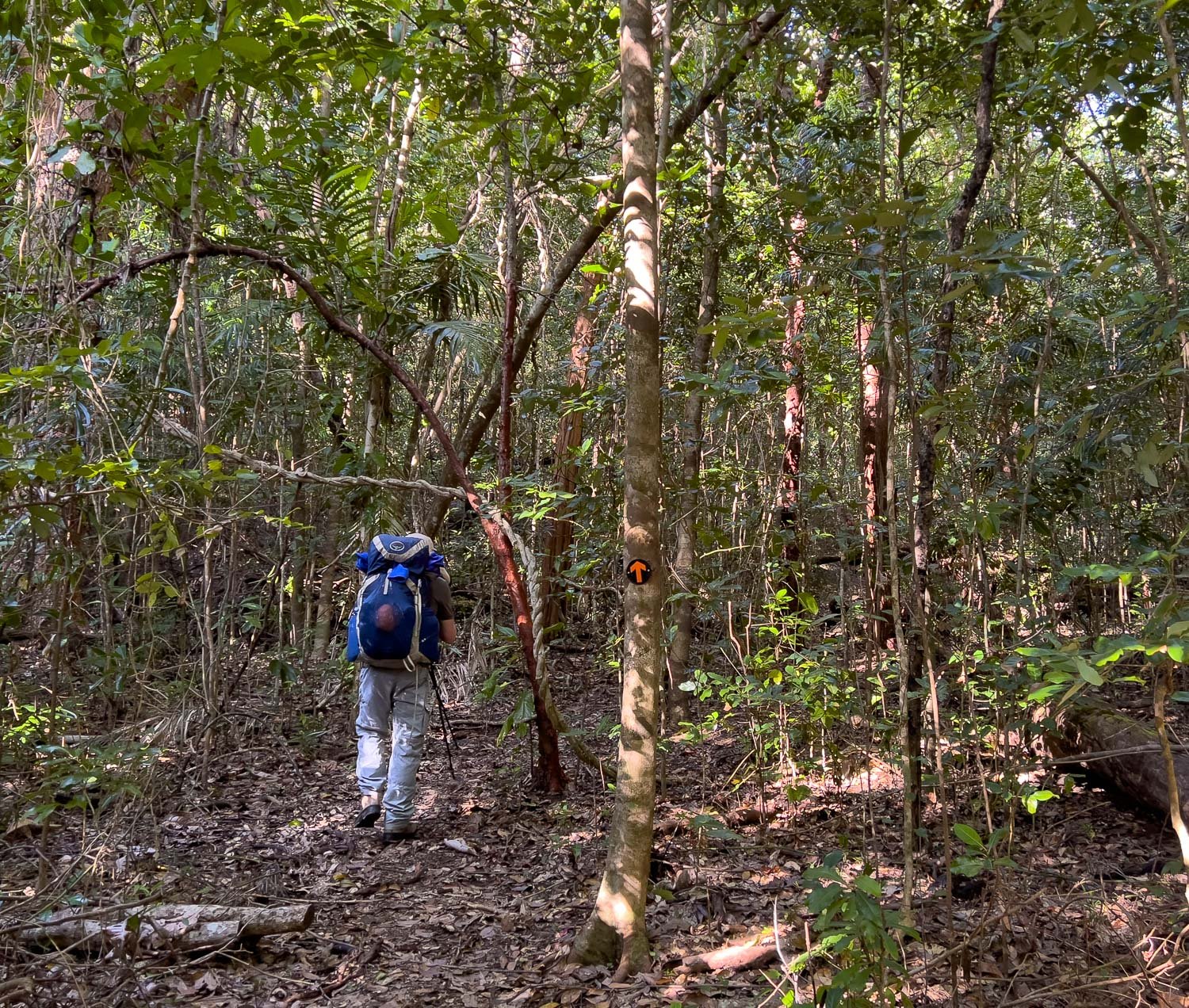
The trail ducks inland and we are instantly in a completely different environment. A little sun dapples the leafy ground, while birds flit into the greenery as we approach. Lianas and vines twist their way upwards.
The green is different to the olive tones we’re used to in South Australia, and the forest smells different too.
The creek emerging onto Black Sand Beach, with a boat/kayak campsite amongst the trees.
And indeed some kayakers have camped here overnight: you can see their gear on the right. The paperbarks are magnificent.
Back into the forest. Few flowers at this time of year and in deep shade, but a few fungi still clinging on.
This little Rufous Fantail (Rhipidura rufifrons) busily darts around as we stand watching him. The forest teems with birdlife both on the forest floor as well as high in the canopy.
When you reach the spur trail to Nina Peak, leave your pack at the intersection. A 30g (1 oz) ultrasil daypack is ideal for this situation: we carry up water, snack, camera and first aid kit, while I attach the Inreach to my belt loop. Those bushes just in front of Geoff are Borya, or pincushion plants: don’t put your hand in them! The climb is very steep and it’s hot and airless.
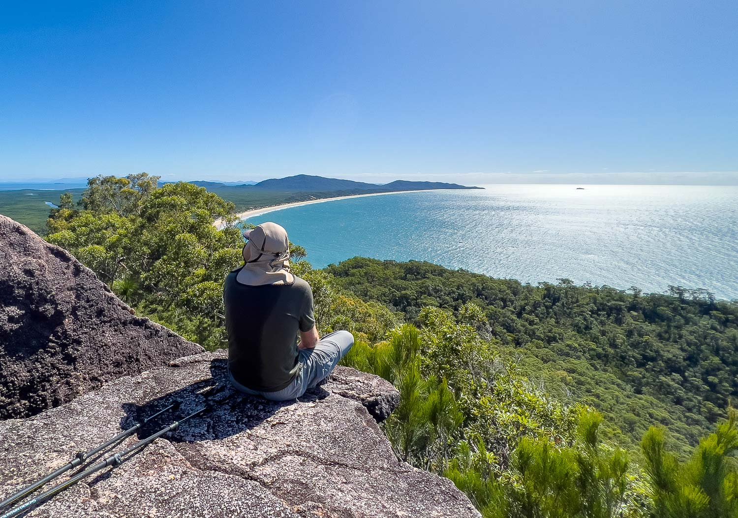
But the views begin very quickly and are enough to spur us on, though I’m wilting a little in the heat. Just look at that beach behind us!
A rocky outcrop offers welcome breezes to cool sweaty backs, and a wonderful view of Ramsay Beach. I think that’s Ninth Creek just visible far left. Other small groups of hikers are clustered at the base of a steeper section just behind us - we’re not quite at the top. Purists will want to go the last few metres.
Nina Bay. North Nina Bay campsite is in the forest at the edge of the beach, just out of shot to the left. Get your fill of the views before heading back into the forest: it’s all downhill now to your camp for the night!
Dampiera ferruginea. There aren’t many flowers but the species are nearly all new: it’s wonderful! Hours of fun with the species list when I return home!
Seasonal creeks can go from nothing to raging after rain, but recede just as quickly. You’ll never know what to expect when booking!
We’ve had sandy beaches, rainforest, heath, views and now these rocky creeks, all in one day.
These fat skinks are on almost every sunny rock and dash off the trail in front of our feet. Their slightly iridescent scales glint in rainbow colours when the light is right.
Here the more open forest with its sedgey understorey is different again. So much variety!
Beach myrtella (Lithomyrtus obtusa)
And here we are at Nina Bay Campsite. There’s a long drop loo, and many flat campsites tucked under the trees.
Look how close this particular campsite is to the beach! Presumably it’s safe from crocs! There are also sites a little further back if you’re nervous!
Although we have structured these posts to reflect our recommended itinerary - we suggest leisurely hikers stay here for the night - we were travelling with friends and continued on to Little Ramsay Bay to enjoy their company. However, leisurely hikers who climb Nina Peak, especially if it’s warm, will likely be happy to stop here, and also if your boat transfer is later in the morning. It’s only a few kilometres further to Little Ramsay Bay campsite, but there is a fairly slow section of beach rock-hopping on the way.
Because you book number of nights (maximum 5) on the trail rather than individual campsites, with two nights allowed at each campsite except Mulligan, you can structure your walk however you want. We have photographed all the campsites so by reading each day’s description you’ll have a good idea of terrain and the options that suit you best.
Today is a fantastic start to the trail, and we have been told it just gets better and better. We can’t wait to see more!


