
Hakea Trail - Cave Point to Hamersley Inlet
We recognise and acknowledge the Goreng, Menang and Wudjari people as the traditional owners of Fitzgerald River National Park

Pounding surf, clifftop views and deserted beaches on the Hakea Trail
Today’s hike of 13.9 km takes you between Cave Point and Hamersley Inlet Campground. We stayed in the campground the night before and, because I was recovering from recent surgery, Geoff dropped the car at Cave Point and rode his mountain bike back to the tent in the morning to reduce the distance we would need to retrace. If you have two cars, you can also do this and complete the easternmost section as a day hike.
However, if you are following our recommended leisurely itinerary, you’ll be starting at Cave Point and heading west on the first day to finish at Hamersley inlet, so you’ll be hiking in reverse to what you see here.
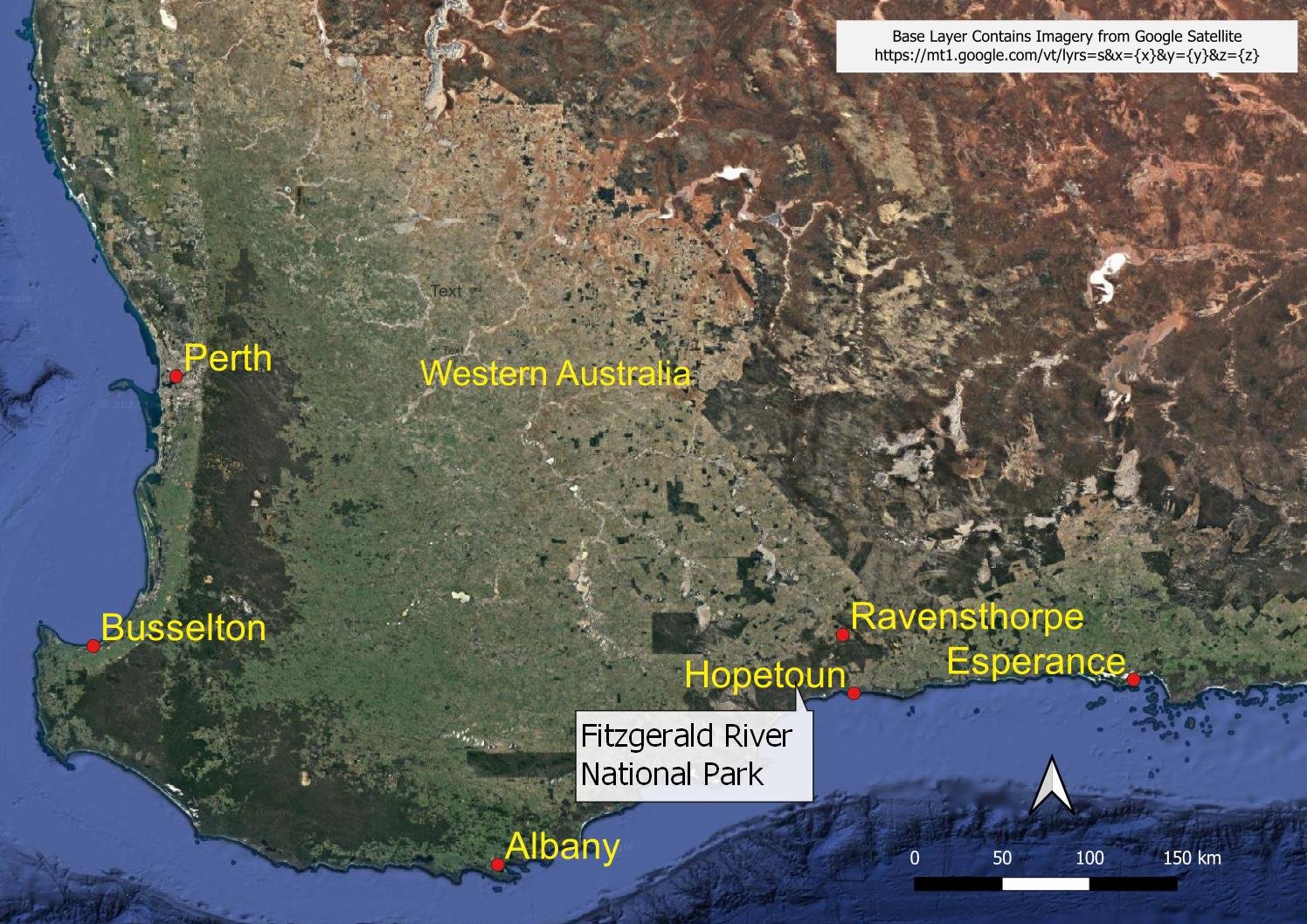
Fitzgerald River National Park location plan. The Hakea Hike Cave Point Trail Head is located near the eastern boundary of the park. Hopetoun is the closest town to Cave Point, approximately 15 km away,
And here are the elevation profile and details for hiking from Hamersley Inlet to Cave Point (one way).
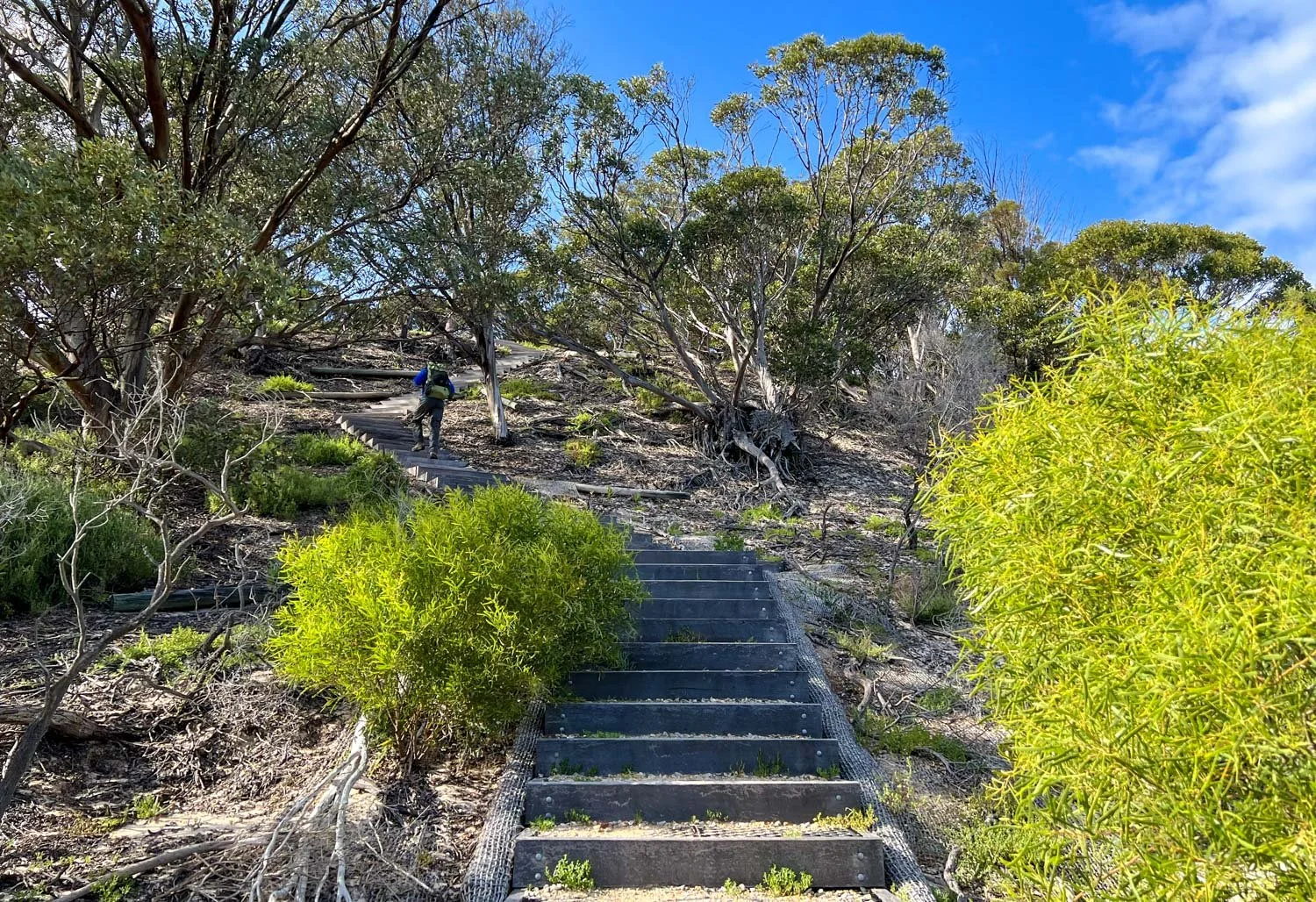
Almost straight out of Hamersley Inlet camp you’ll brush your boots at the boot cleaning station before heading up steps into the consolidated dunes.

And it’s not long before you have your first expansive views over Hamersley Inlet. If you own a kayak, you can launch from a boat ramp at the campground - a day spent paddling would be a lot of fun if you add it to your itinerary, with access to interesting vegetation on the opposite shore.

The campsite is on a spur trail about 1.8 km off the Hakea Trail, but it’s a lovely walk through mallee and melaleuca.

Keep your eyes peeled for wildflowers, here the Green Range Donkey Orchid, Diuris littoralis

More fabulous views westwards across Hamersley Inlet

A sandbar has closed the mouth of Hamersley inlet at low tide in mid September when we hike, so no wading to be done: it could be very different in winter.

Heading east along the first beach. The rain squalls out to sea will hopefully remain there: the weather is unpredictable so pack your raingear. Geoff has donned his lightweight Visp rain jacket as much for the wind as any potential rain.

Check tide times when planning your walk. You can see from this picture that it’s worth hiking at low tide, because high tide comes right up to the foot of the dune. You could hike along or behind the dune but it would not only be hard work, but you’d be contributing to erosion.

Fabulous views west, back along the beach.

You’ll have a tiny scramble at the end of the beach, but nothing difficult.

Watch for trail markers like this pile of stones. Enough people have gone the wrong way to create false tracks, so following footprints isn’t always helpful. However, you’ll see plenty of trail markers if you look for them, especially from vantage points.


The trail alternates between beaches or near sea-level walking and higher ground such as the headland in the background.

Highly varied terrain makes this section a lot of fun. That’s brown sea foam from water rushing up a little gullet.

Weathered and gnarled textures. The trees and rocks aren’t bad either!

Beaches comprise the region’s stunning white sand, as well as rocky ones like this. Either way, none of them are long stretches such as you might find on other walks: there is a change in terrain coming soon, wherever you are!

A seat with a view! And so remote and isolated. We haven’t seen anyone all day, and this continues until we meet two women at the end near Cave Point. If you enjoy solitude, the Hakea Trail is fantastic.

Spectacular inlets and rock formations

We duck inland and find more orchids, here, Western Wispy Spider orchid (Caladenia microchila).

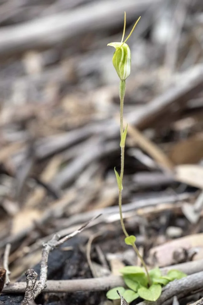
Pterostylis mutica are tiny, usually no more than 8-10cm tall, with each individual flower millimetres across: you have to be very careful to look before kneeling down to photograph them because it’s so easy to squash ones nearby.

Lunch Stop (Homemade Instant Chicken and Corn Cup-a-Soup) with Geoff cooking in the lee of a bush.
The Caldena Cone Tri-Ti alcohol stove system is, however, very wind resistant; we team it with a Toaks titanium siphon stove which blooms better than the standard cat can stove with the volumes we boil for our meals. After numerous hikes we find it suits our leisurely style perfectly, and works in extreme cold as well.

Around our lunch spot is Grevillea tripartita subsp. tripartita

And the Barrens Clawflower, Calothamnus validus

And, a little further on, the Southern White Spider Orchid (Caladenia longicauda ssp australora)

Onwards through fantastic coastal heath. We are just a week or two early for peak wildflower season: many plants are still in bud. Nevertheless, other than on the beach, not a step goes by without seeing something in flower.

A fabulous clump of Donkey Orchids (D. littoralis)

Purple enamel orchid (Elythranthera brunonis)

We are nearing Cave Point. Note the trail marker…

The famous Hakea victoriae, for which the track is named. Its leaves are extraordinary.
Unidentified Pterostylis

Drifts of pink Melaleuca papillosa

We flush mum and two siblings from the undergrowth beside the track as we pass, but one little quail chick is left behind, frozen in place. Isn’t its camouflage incredible?

Lovely late afternoon light

One last view of the rocky beach before climbing to the carpark and heading back to Hamersley Inlet. It has been a spectacular day of hiking with some of the best seascapes we’ve seen.

Back in Hamersley camp, with the Durston XMid Pro pitched for strong wind with all guys deployed. There’s Geoff’s mountain bike, which he rode back from Cave Point after dropping off the car there this morning.

Inside the XMid Pro 2, with our cosy twin quilt. It is an amazingly spacious tent for its weight.

The campsite has toilets and a large undercover cooking area - luxury!
Today’s walk has been marvellous. It is wild and relatively remote, without any roads or car parks and almost no people - amazing considering we are in school holidays and the Ravensthorpe Wildflower Festival is on. We’ve had spectacular views and a rich diversity of wildflowers: I can’t wait for tomorrow!