
Bugiga to Barri Yalug
We respectfully acknowledge the Djab Wurrung and Jardwardjali people as the traditional custodians of the lands and waters of Gariwerd.
Mountain views, scrambly rock and remote bushland

Far from the madding crowd: today is much quieter than yesterday’s popular Wonderland Range.
Today you’ll leave the Wonderland Range and cross westwards to the Serra Range. After climbing Mt Rosea and savouring the magnificent views, you’ll descend the eastern face and cross the valley to Barri Yalug campground at the southern end of Lake Bellfield. At 14.7 kms (9.1mi) it’s a longer day than yesterday, with a similar elevation gain of 550m (1800ft), but over much rockier track. However, with far fewer hikers and day trippers, today’s views are also over rugged bushland: the track feels much more remote. Many hikers love the Serra Range for this reason.
Overview Map
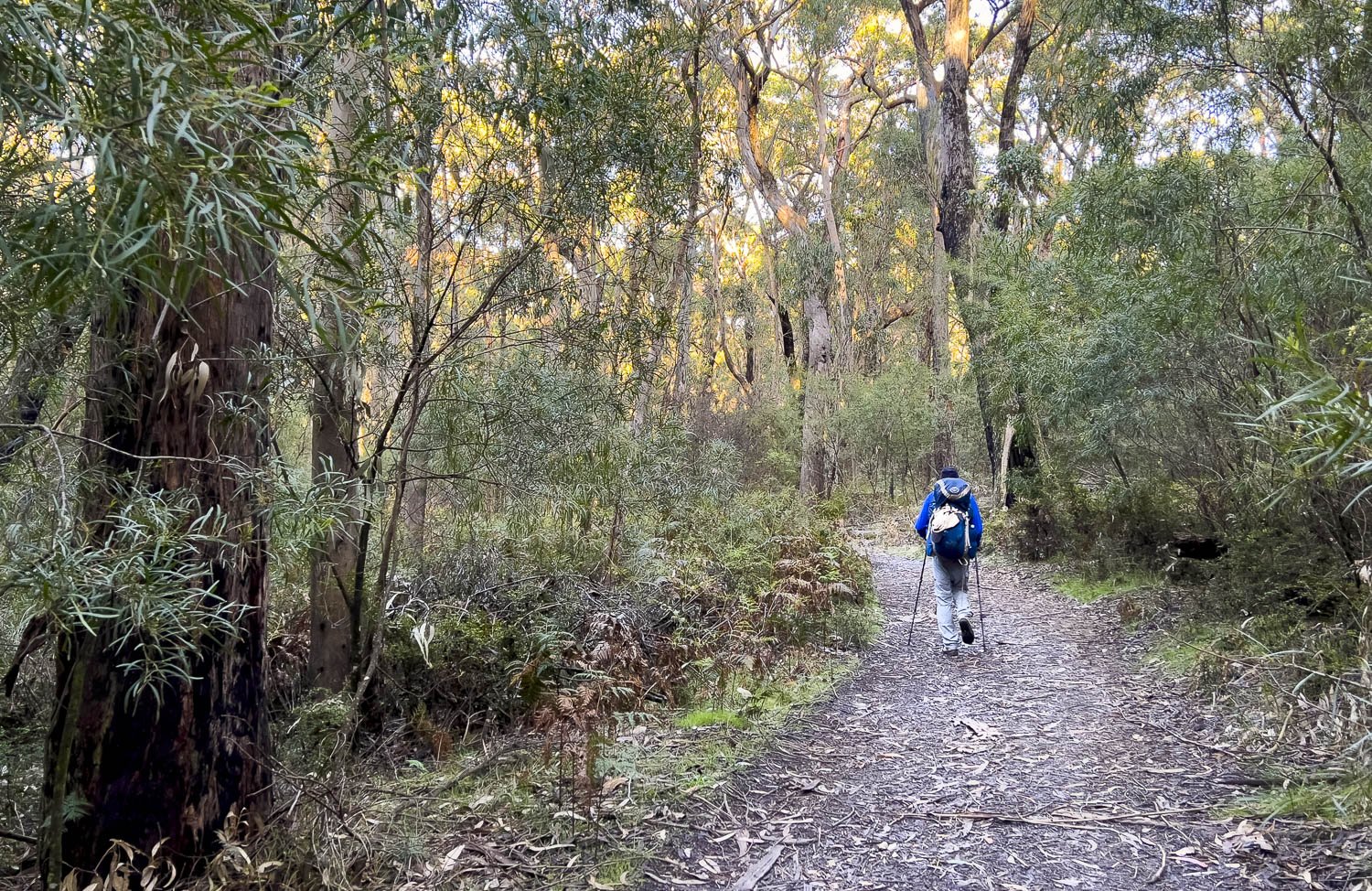
The track is never climbing but it’s definitely scrambly: you’ll need your hands and in some places may prefer to stow your hiking poles. We have many images of the scrambly bits in this blog to give you a good idea of what to expect from the day, and whether it’s within your comfort zone.
Mt Rosea at 1009m (3,310ft) can get snow in winter; the ridge along the top is extremely exposed with blasting sun in summer, and the potential for icy winds, whiteout and sleet at other times of year. Route-finding is straightforward in mild weather — keep your eyes peeled for trail markers painted on or attached to rock — but extremely challenging in whiteout conditions.
In addition, the next three campgrounds have communal ‘gathering places’ with picnic tables and benches instead of roofed shelters. Windbreaks provide some protection but not all have been correctly oriented, funnelling wind in certain directions. Ensure you’re familiar with your tent setup on platforms where you cannot use stakes. In windy conditions, all tents (not just non-freestanding trekking pole ones) should be guyed and attached at upper as well as perimeter points.

Details for today’s hike: a long ascent followed by an even longer descent… and of course an uphill walk into the hut at the end of the day!
How to Make Today Easier
The two road crossings are just 800m (0.51mi) from the campgrounds at either end so you have no intermediate drop off points to halve the day with car shuffles as yesterday. You have less elevation gain travelling south than north so you may as well just push on. Your best bet is simply to start early.
If you are doing a food drop at Jimmy Creek like most people completing the full trail, dropping an earlier one one at Borough Huts at the Grampians Road crossing about a kilometre before Barri Yalug means your pack will be very light with just today’s lunch and snacks, rather than the next three days’ food and water. We highly recommend this extra food drop if you’re concerned about pack weight on these first two days.
Consider collecting and treating water at Borough Huts or Fyan’s Creek rather than going to the Redman Rd Crossing’s serviced tank past Barri-Yalug if you think Barri-Yalug’s small unserviced tank might be empty.
You can also stop at Borough Huts Campground. Although it doesn’t much shorten the day, you can have what is, in effect, a rest day by hiking a very short distance to Barri-Yalug tomorrow. We don’t recommend you hike from Borough Huts straight through to Duwul because it makes that day, the most demanding day of the entire trail, even longer.
Walk with Us:

This little White-browed Scrubwren (Sericornis frontalis) has already become bold around people and joins us at breakfast. If you’re keen on identifying animals and plants that you see, you don’t need to be an expert. iNaturalist is a wonderful resource with plenty of photos. You select an area on the map and set filters for bird, plant, mammal etc. Select grid display and scroll through the images; I’ve always been able to narrow most things to genus if not species. The Atlas of Living Australia is also useful.

Beside the track not far out of camp is Peakall’s Bird Orchid (Chiloglottis peakallii). The genus name refers to the labellum similarity to a lip and throat; to me the flowers resemble the open mouths of little birds waiting to be fed. Many of these orchids also grew trackside on the last day of the Northern Section descent into Hall’s Gap. Together with plants like ferns, they prefer moist, shady easterly/southerly aspects and, as you can imagine, their muted colour makes them very difficult to spot. While photographing one elsewhere, we chatted with hikers who, as they left, stepped on the one I was trying to shoot! Look instead for the fleshy green paired leaves that stand out against the leaf litter.
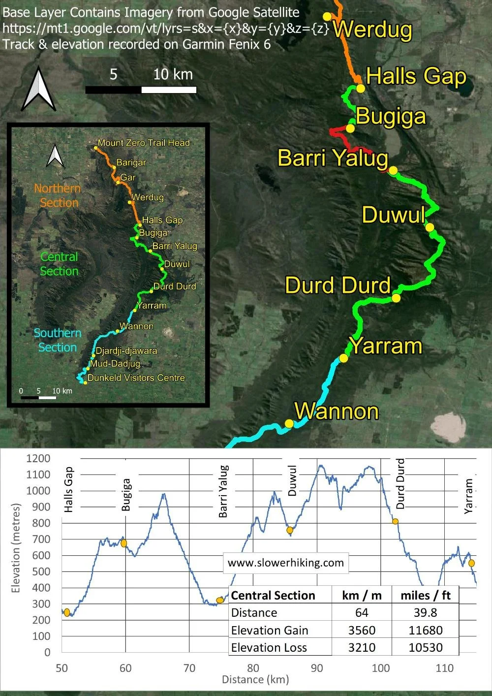
The day starts easily enough, downhill and along an access track through sclerophyll forest.

After crossing Silverband Road you begin to climb, and soon grand views open up.

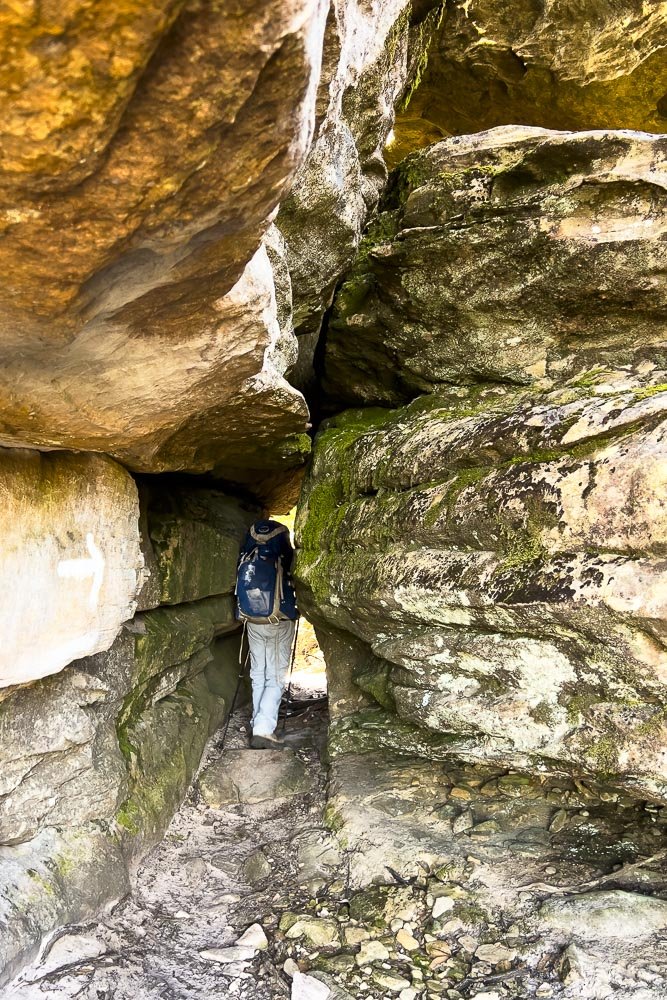
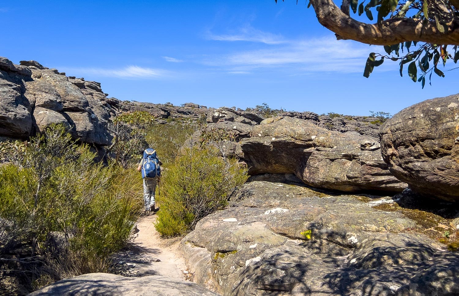
Gently sloping at first, the terrain becomes ever more steep and rocky.

You traverse a little plateau. This section of track feels marvellously remote: bushland as far as the eye can see. We meet only one other couple during the entire day.

Scrambly, but Geoff still has his poles in one hand. It’s not difficult, but tiring.

Pink flame heath with eyebright (Euphrasia collina) behind.

Plenty of mosses and lichens on the rocks and in the cracks between. You’ll have plenty of eye-level views of them!

More scrambling…

… and more rock…

… and more

… and yet still more!

Look for those yellow trail markers, or older white arrows painted onto the rock.

Glimpses of Lake Bellfield through windows.

The Gate of the East Wind was once a vertiginous gap that you needed to leap, but the new bridge makes it a relaxed crossing.
The same rock that make this hike demanding also makes it fun. If you start early, you will have plenty of time.

Rosy Bush Pea (Pulteanea subalpina)
Still climbing, but nearing the top!

A rare image of us together, on the edge of the escarpment. As always on such hikes, you meet kindred spirits and Michael and Anna of the evocative Our Wanderlust took this photo. It’s always fascinating — and useful — to read other blogs about the same walk because different people have different interests and priorities and they notice completely different things.

Black Rock Skink (Egernia saxatilis). You often find these around peaks where they feed on insects carried aloft by thermals.

Descending at last, at first through more rock (but nothing like the ascent)…

… and back into the dappled shade of wet sclerophyll forest. The trail is soft and less steep, a welcome respite for tired feet.

Dense sedge understorey as you near the drainage lines and creek crossings on the valley floor.

When you reach the bridge over Fyan’s Creek, you know you are nearly there; if you have hidden a food drop at Borough Huts Campground, you will pick it up soon.

You can collect and treat water from Fyan’s Creek as well, but check beforehand to ensure it’s flowing.

After you cross the road, you enter the foothills of the Mt William Range for the first time, and stay on the range for the next three days. This historic water flume was built in the late 1800s, a 12km gravity-fed supply for gold rush towns: an impressive feat of engineering that took six years to complete. Amazingly, it hasn’t completely rusted or been burned away!

Skirting the lower end of Lake Bellfield. As so often happens, it is a climb into camp and, although not steep, it is demanding of tired legs at the end of the day.

Barri-Yalug has tent pads as well as platforms. The substrate is hard!
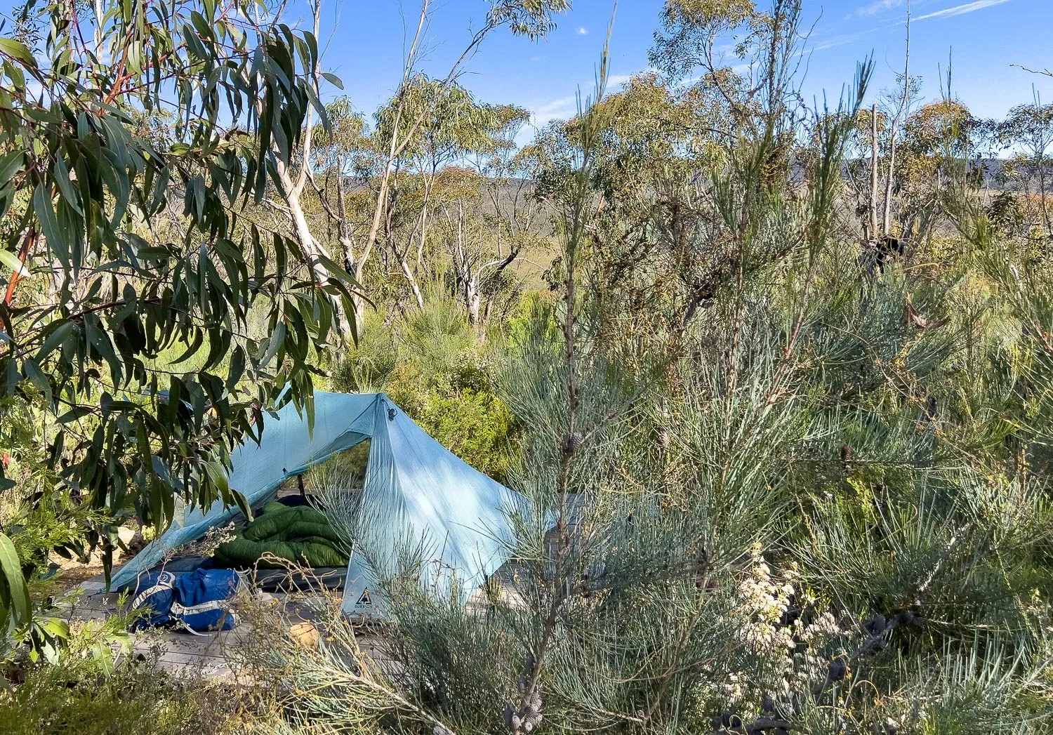
But we are on a tent platform again as we are testing the Pro2 tent on them before we added it to our comparative trekking pole tent review (now complete). We had no problems at all despite the suboptimal platforms.

This is the deck hook model we used (here being used to hold open a vestibule door): it is narrower than the standard aluminium fishbone type and also reaches through thicker decking, but you can see that even this hook won’t fit sideways through some of the gaps. These hooks come with a spring and carabiner which we removed to save weight. Nor do we bring hooks for every anchor point: 4 is plenty (more tips on anchoring on tent platforms here), and you can use chains or rocks for the other points.

Here is Barri-Yalug’s communal gathering area. You can see how the wind can venturi in certain directions, but today is warm and benign. We have just arrived and Geoff is preparing a cuppa.

Always take time to explore the camp surrounds tracks. Up past the toilet are these agricultural seats, placed to take advantage of views over Lake Bellfield.

Here is the view. It has been a big day but, as always, the GPT has delivered on variety as well as views. The amount packed into such short distances is extraordinary (if there is a peak, the GPT will climb it!) and more is promised for tomorrow.
But to be honest, I’m nervous, not least because of a knee injury sustained on the descent into Halls Gap in the Northern Section. The next two days comprise the section of track where the most people bail. We were astonished at the high proportion of hikers who abort their walk here (information relayed to us by track transfer companies). I have found today demanding and the next two days are statistically more difficult. Will we will be one of those groups requesting a pickup?