
Civetta Day 3: Rif. Vazzoler to Pecol

Spectacular limestone near the pass but, slower hikers, don’t be daunted: despite the appearance and unlike other options on Civetta, there is zero climbing or via ferrata on our route.
Today brings more gobsmacking scenery. Fast hikers may cover the 19 kilometres (12 miles) from Rif Tissi, past Vazzoler and back down to Pecol in one day, but photographers or anyone wanting to savour Civetta and her beautiful wildflowers, wildlife and views may prefer our schedule, especially if you want to spend time in Vazzoler’s little Alpine Botanic Garden.
If, as is common in spring, storms are forecast for the afternoon, slower hikers starting early from Rif. Vazzoler should be over the pass and down into more sheltered terrain before the weather arrives.
The conventional circuit around Civetta continues from Rif Vazzoler and over the stunning Forcella della Sasse in the same way as our route, but then swings north/northwest to skirt the higher faces of the mountain with some exposed rock and a very short section of via ferrata to finish back at Rif. Coldai. This route is known to be demanding so, for anyone not confident in their ability to reach Rif. Coldai, our alternative described here branches off towards Pecol rather than continuing along the higher flank of the mountain to Rif Coldai. You will still get to cross the spectacular cirque Van Della Sasse and Force della Sasse. You’ll descend the scree and, after just a few metres of very doable narrow rocky path (pictured later), you’ll branch right onto Path 557 rather than left. Shortly after you’ll turn onto Path 587 and follow it north/northeast all the way into Pecol. Tabacco Map 025 Dolomiti Di Zoldo Cadorine E Agordine shows many alternative routes through Val di Zoldo into Pecol, so don’t be afraid to customise this part of the route!
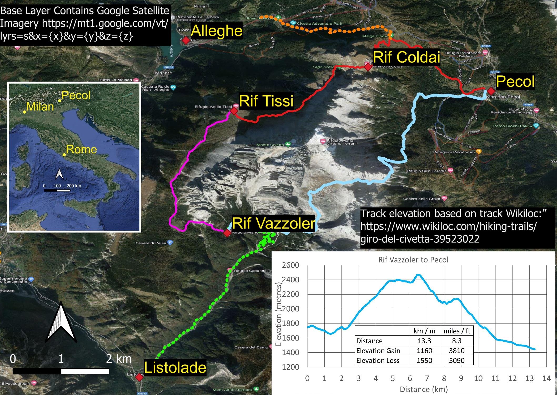
Our route details for the day - it’s still a big day for us leisurely hikers!

Signposting throughout the Dolomites is generally excellent. Not only are rifugios and terrain features named, but so are the Paths themselves. This makes navigation relatively straightforward if you have maps (paper or digital). For more information on accommodation, transport and hiking the Dolomites in general, see here.

Spectacular forest

Torre Trieste is popular with climbers.

Keep your eyes peeled for wildflowers, here the Lesser Butterfly Orchid (Platanthera bifolia)

The beautiful dog rose, R. canina

You’ll keep climbing and here is Torre Trieste closer up, with marvellous views beyond. You can see why it’s worth doing this hike before the cloud rolls in!

More orchids, here, the Small White Orchid, Pseudorchis albida

… and the Short-Spurred Fragrant Orchid, Gymnadenia odoratissima
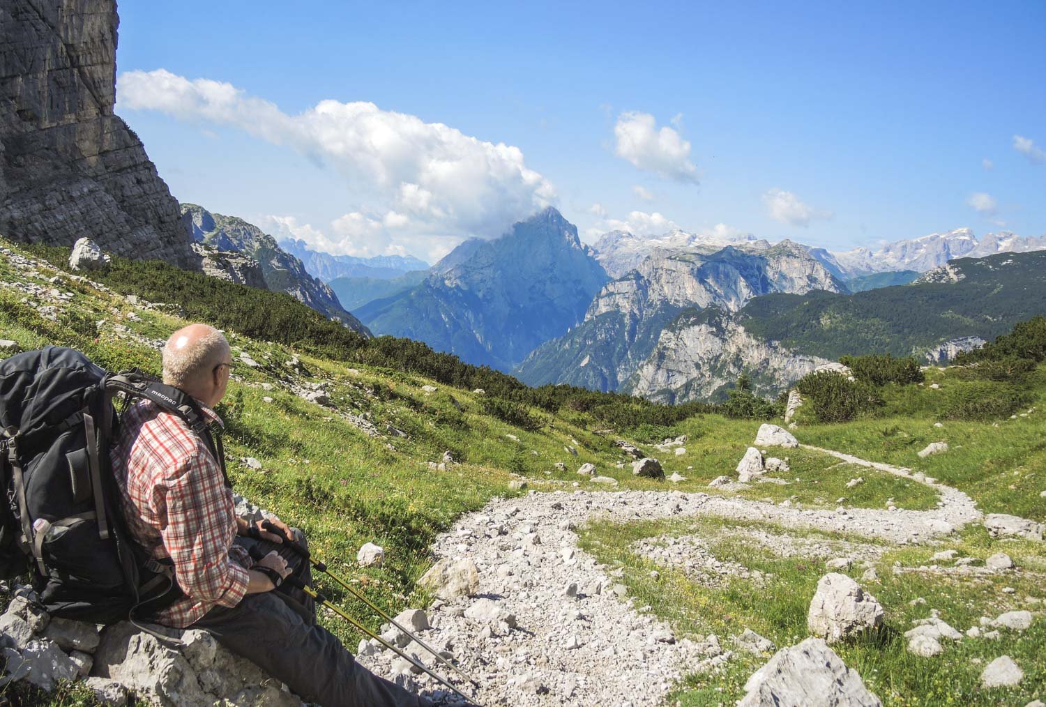
It’s a big climb. Stop often to turn around and enjoy the views behind you.

As you ascend, there are several points where you are faced with what appear to be walls of rock. My heart sank when I first saw them but don’t be misled: there are paths that zigzag up and although some bits are rough, steep and rocky, there is no significant scrambling or climbing here at all. For scale, there is Geoff in the very bottom left corner.
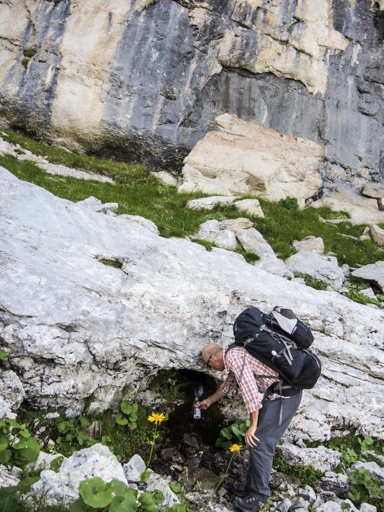
Geoff topping up at a little water point. The dolomitic rock is highly porous so some parts of the mountains are surprisingly dry. You can also see this is before our ultralight days: just look at the size of that pack!

Aquilegia alpina

And again here, with Geoff bottom left, it seems we are to scramble up a vertical face. But no. The path is much less exposed than these images might suggest. Keep reading for pictures of what it is actually like.

So many alpine wildflowers, with plenty of sunlight! Here, the Alpine Forget-Me-Not, Myosotis alpestris

Surely we will need to climb here?

No. You can see that the path is plenty wide and well-formed. It is more or less like this all the way up and, although some sections are a little narrower and/or much steeper than others, the switchbacks largely moderate anything too extreme!

You’ll see countless rock plants, such as Alpine Crowfoot (Ranunculus alpestris) tucked into crevices.

Here is another view back down that wonderful path. You need to be fit, but this is NOT mountaineering. No ice axes, crampons or ropes required, at least for this moment and season!
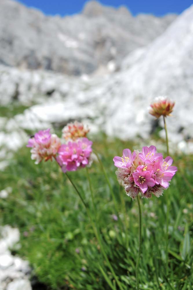
Armeria alpina

Cinquefoil, possibly Potentilla crantzii

The path reveals itself as you climb. It’s wonderfully exciting!

Oh my. A beautiful alpine meadow, followed by… surely, we aren’t going up that?!? Geoff reminds me again of the words in Gillian Price’s ‘Walking in the Dolomites: 28 Multiday Routes’ : “A seemingly impassable barrier”. Okay then.

But first, this beautiful wildflower meadow. I spend a good 45 minutes photographing the extraordinary floral diversity.

Encrusted Saxifrage (S. crustata). The name and silvery edges to the leaves refer to this plant’s fascinating ability to excrete excess calcium in the form of calcite - not a bad move in this environment!

Trumpet Gentian (G. acaulis)

Fantastic. Geoff eventually drags me away because the clouds are starting to build and we’re not sure how much more they will develop.

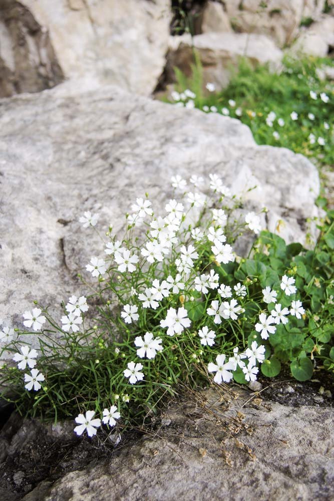
Sigh. Goodbye Alyssum saxatilis.

So here is that “impassable” wall. The path zigzags up and, although parts are steep, it is not too difficult at all.

Here is a better view: you can see its width. And look at the cloud building in the background! It often doesn’t take long once it begins.
One last view back down into the Cirque. This hike is right up there with the very best we have done, anywhere.

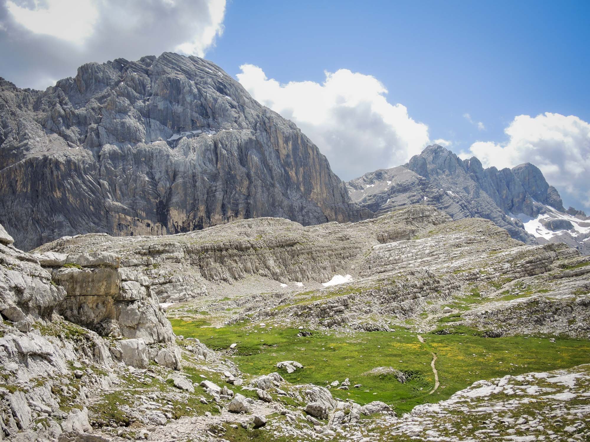
And our first view down from the Force della Sasse into the green Val di Zoldo and a glimpse of Pecol, where we are headed.

Plenty more wildflowers tucked amongst the scree and rocks. Here, Alpine Mouse-ear (Cerastium alpinum)
… and Alpine Catchfly (Heliosperma pusillum)

Geoff starts down the scree. You have plenty of time and it is relatively short: no need to rush.

In fact, the path is sufficiently well-trodden to follow for the most part, but red and white markers are painted on rocks to help.

So this is the one section of ten metres or so that might challenge those who dislike exposure (like me, but it was perfectly doable). It’s still more of a path than a scramble, and is not particularly narrow nor steep nor high. You will be fine!
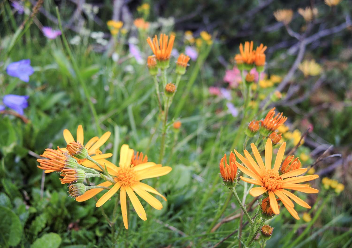
And finally back down into the valley vegetation, with yet more wildflowers (such as this Pinnate-leaved Ragwort, Jacobaea abrotanifolia) to enjoy on our way to the village. I have taken hundreds of photos every day, and there must be hundreds of flowers that I missed! Writing this now, some years later, I want to do this hike for a third time! Out of all the fantastic hikes in the Dolomites, this is one of her jewels. Highly recommended!