
Mount Magog - Stirling Range
We recognise and acknowledge the Goreng and Menang people as the traditional owners of Stirling Range National Park

Atop Mt Magog with glorious views to Mt Talyuberlup and beyond.
Mt Magog is a 7km (4.4mi) Grade 5 return hike that begins gently on the surrounding plain before climbing ever more steeply to the peak of 856m (2808ft), with spectacular 360 degree views.
Recommended time is 3-4 hours return, and faster hikers may prefer to add the nearby Mt Talyuberlup (2.6 km return, Grade 5) to their day, but we suggest leisurely hikers spend longer, with lunch on the peak to enjoy the scenery… and the wildflowers. The Trail Head off 2WD Stirling Range Drive is a 35 minute drive from the Stirling Range Retreat or 45 minutes from Mt Trio Bush Camp.
Bluff Knoll is the most famous peak in the Stirling Range, and this is often the only one people visit but, if you prefer solitude, Mt Trio, Mt Talyuberlup, Mt Toolbrunup and this one, Mt Magog are better. Many of them have wider views than Bluff Knoll due to their topography.
There are approximately 1500 different plant species in the Stirling Range, about 90 of which occur nowhere else. For botanists, every peak is noticeably different, with rare species occuring only on individual ones: I couldn’t believe the variation in terrain and vegetation on adjacent peaks. Don’t think that if you’ve seen one you’ve seen them all, as is the case in less speciated mountain ranges. Visit as many as your timetable permits!

Stirling Range and Mt Magog Hike Location Maps


Mt Magog hike details
The hike from the trailhead has a 600m elevation gain over 3.5 km, but most of it is in the last 25% of the distance. There is some minor scrambling that requires both hands, but these scrambles are neither exposed nor long.

You begin through tall wandoo woodland and, in spring, the wildflowers are immediately fantastic.

Caladenia longiclavata in the understorey.

Then you meander northeast through beautiful scrub. The peak directly ahead for some time is actually Mt Talyuberlup; Mt Magog is far left in this picture.

So many wildflowers! Here, pink Stylidium scandens
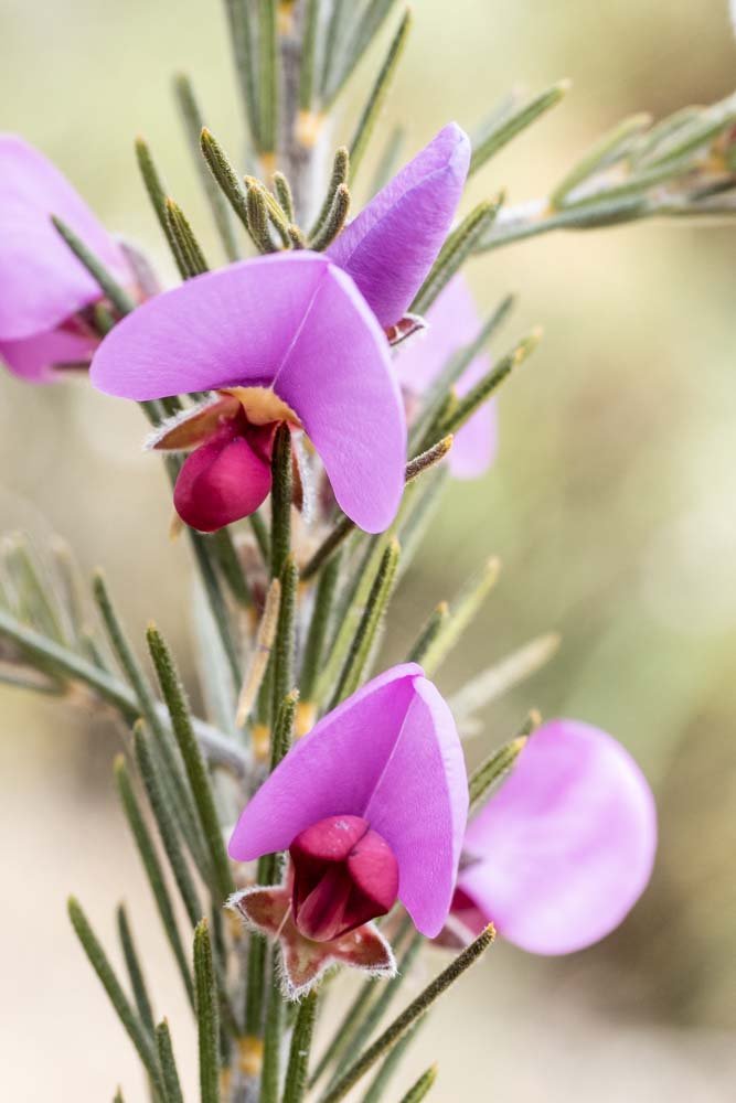
… and, in almost the same shade, Gompholobium scabrum

On many days, timing is important with these peaks. All the tops had been in low mist on the drive here but, just a little later in the morning, cloud is coming and going and beginning to lift. It will likely drop again late afternoon.

Botanists will travel slowly even though the terrain is initially flat: there is just so much to see! Here, Pultenaea ericifolia

… and the stunning blue Conospermum caeruleum

Sandy sections host different wildflowers. It’s easy walking so far.

Zebra orchid, Caladenia cairnsiana

And King in his Carriage, Drakaea glyptodon

In other places, the track is gravelly and stony underfoot as here, with entirely different wildflowers. So much variety!

A partly open Thelymitra cornicina that we catch on the way back

And the tiny orange Drosera glanduligera

That’s Magog on the left; the peak is actually the rounded bit, just left of the rocky outcrop. Talyuberlup is again shrouded in mist far right.

As the track meanders, at times it seems as if you’re heading right for Talyuberlup instead of Magog.

It’s getting ever steeper but there are flowers like this Sphenotoma dracophylloides to entertain you all the way. If you are climbing this peak, the incline continues to increase so, if you find the terrain challenging, don’t expect it to get easier.

Beautiful Isopogon cuneatus

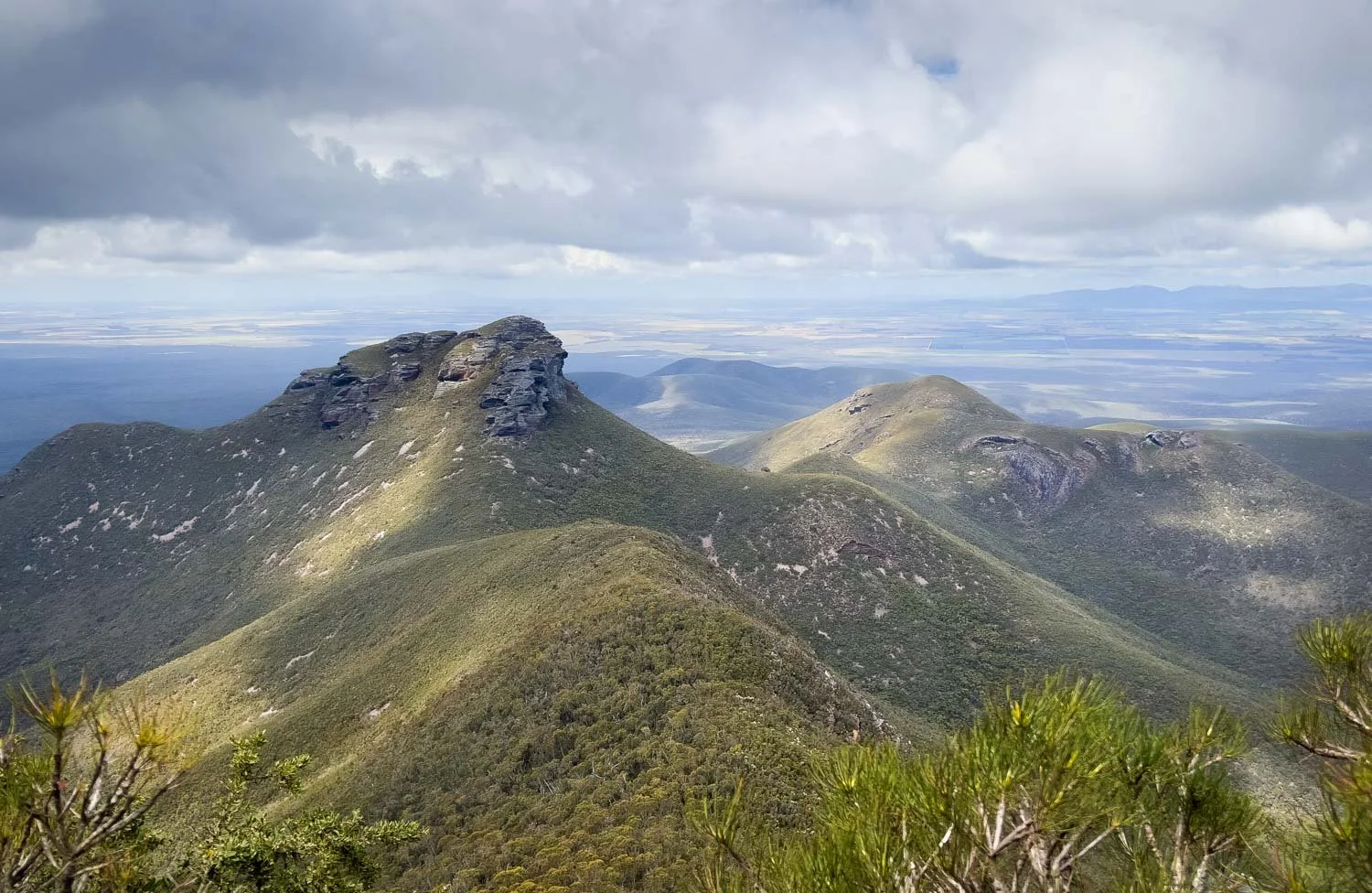
Out of the dense trees fringing the foot of the mountain for a moment, and there is Mt Talyuberlup peeping over the ridge with views further along the Stirling Range. Talyuberlup is close enough that you can hear sounds of hikers and climbers there echoing on the rock.

Golden Banksia formosa

Pterostylis crispula tucked amongst the rocks

And this beautiful Hypocalymma myrtifolia. The vegetation changes quickly as you climb because it’s so steep you rapidly pass through different microclimates.

Fantastic views across the plain to Mt Toolbrunup

And steeper still! It’s worth tucking your poles into the side pocket of your pack when scrambling like this because they just get in the way when you’re using both hands.

Acacia drummondii

A bit more scrambling here and there, but it’s not exposed or difficult.
Wow. You’ll soon climb higher than Mt Talyuberlup (783m)

When you reach the outcrop, there’s just a bit further to go along a narrow, rocky ridge. It’s scrambly but yet again not excessively exposed. Take your time to pick your way along the ridge, staying close to the top.

The top is a great place to stop for lunch and also get a rare portrait shot, thanks to the group that followed us up. You can see the first rocky outcrop behind us and, behind that, Talyuberlup.
It has been a fantastic hike. Faster hikers will combine Magog and Talyuberlup in one day, but we are content to spend longer at this peak to enjoy the views from here rather than rushing back down to complete a second climb. After all, why not save a few peaks for the next time you return to Western Australia!