
Mount Toolbrunup - Stirling Range
We recognise and acknowledge the Goreng and Menang people as the traditional owners of Stirling Range National Park

Lunch atop Toolbrunup with expansive views; here, eastward towards Mt Trio with Bluff Knoll and the eastern Stirling Range stretching to the horizon.
Mt Toolbrunup is a fantastic 4.2 km (2.6mi) Grade 5 return hike that many locals say has the best views on offer in the Stirling Range. It is just 42m lower than the famous Bluff Knoll, but Toolbrunup’s peak is so pointy and small - perhaps 16 sqm - that you get true 360 degree vistas. Not only that but, if you prefer solitude, Mt Toolbrunup, like Mt Trio, Mt Talyuberlup and Mt Magog, is much less visited.
The trail up Toolbrunup is not manicured with steps like the one to Bluff Knoll, and the elevation gain from the trailhead is 600m over 2.1 km. You’ll have some rock scrambling that requires both hands, but these sections are not exposed and the views at the top are stunning and worth the effort. The loose boulders on the steep upper scree section become very slippery when wet so we recommend you avoid rainy days - this hike is best done in fine, dry weather and when the peak is not in cloud.
Recommended time is four hours return, but we took about six hours to enjoy lunch and the views, and to account for the warm weather. We suggest leisurely hikers also spend longer, and lunch on the peak to absorb the scenery, wildlife and wildflowers.
Because Toolbrunup is also fantastic for wildflowers. There are approximately 1500 different plant species in the Stirling Range, about 90 of which occur nowhere else. For botanists, every peak is noticeably different, with rare species occuring only on individual ones: we couldn’t believe the variation in terrain and vegetation on adjacent peaks; Toolbrunup has several critically endangered species that occur nowhere else. Don’t think that if you’ve seen one peak you’ve seen them all, as is the case in less speciated mountain ranges. Visit as many as your timetable permits!

Stirling Range and Mount Toolbrunup Hike Location Maps


The Trail Head is at the end of 2WD Toolbrunup Road (you turn off the main bitumen highway, Chester Pass Road) and is a straightforward 15 minute drive from the Stirling Range Retreat or 20 minutes from Mt Trio Bush Camp.

It’s really important to stay on the trail here to prevent the spread of phytophthera and trampling the endangered species. The sign is inspiring and I hope I get to see at least one of the endangered species in bloom.

Almost immediately there are orchids alongside the track. Here Pterostylis, probably P. ‘Ravensthorpe’ or P. crispula.

And Purple Pansy Orchid, Diuris longifolia

The trail begins through woodland and the banks of a small creek. Toolbrunup is not promoted as particularly rich in wildflowers, but a great deal depends on the recent fire regime. Toolbrunup was burnt after a lightning strike in the summer of 2019, and the fire-responsive wildflowers are prolific.

Coral vine, Kennedia coccinea, is often prolific after wildfires, draping bushes in dense orange capes.

Heberle’s Spider Orchid, Caladenia heberleana
Xanthosia rotundifolia with a native bee

And yet more donkey orchids right beside the track. Here, another Purple Pansy Orchid with more subtle coloration.

Crossing the first scree slope. The track follows the contour and the rock is compacted, so it’s not difficult.

Interesting plants growing in the scree, here Platytheca galioides.
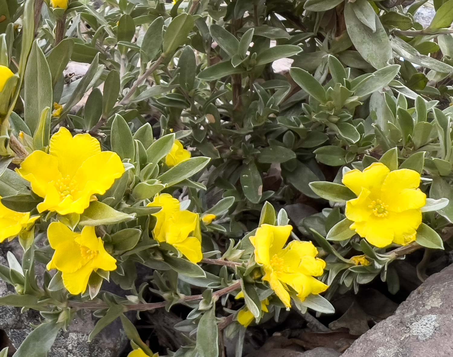
…And an exciting find, critically endangered Hibbertia barrettiae with its silvery foliage and bright yellow flowers.

The peak nears. This is the lower end of the ridge.

Into the boulder field. You climb directly up rather than contouring this time. The boulders are uneven, different-sized and many are loose underfoot. Take your time!

Make sure to look back and enjoy the view whenever you stop for a breather!

This cheeky Yellow-Footed Antechinus, (A. flavipes) greeted us in the boulderfield. His beady little eyes peeped out at us from under a rock on the scree slope, then he popped up for a closer look when we froze in place.

The climb gets steeper and more scrambly the higher you go, but it’s very doable.

Views to the west are equally fabulous.

The penultimate climb through a narrow chute.

Skirting along the contour, this is perhaps the most exposed section of the entire hike. However, you can see the path isn’t too narrow.

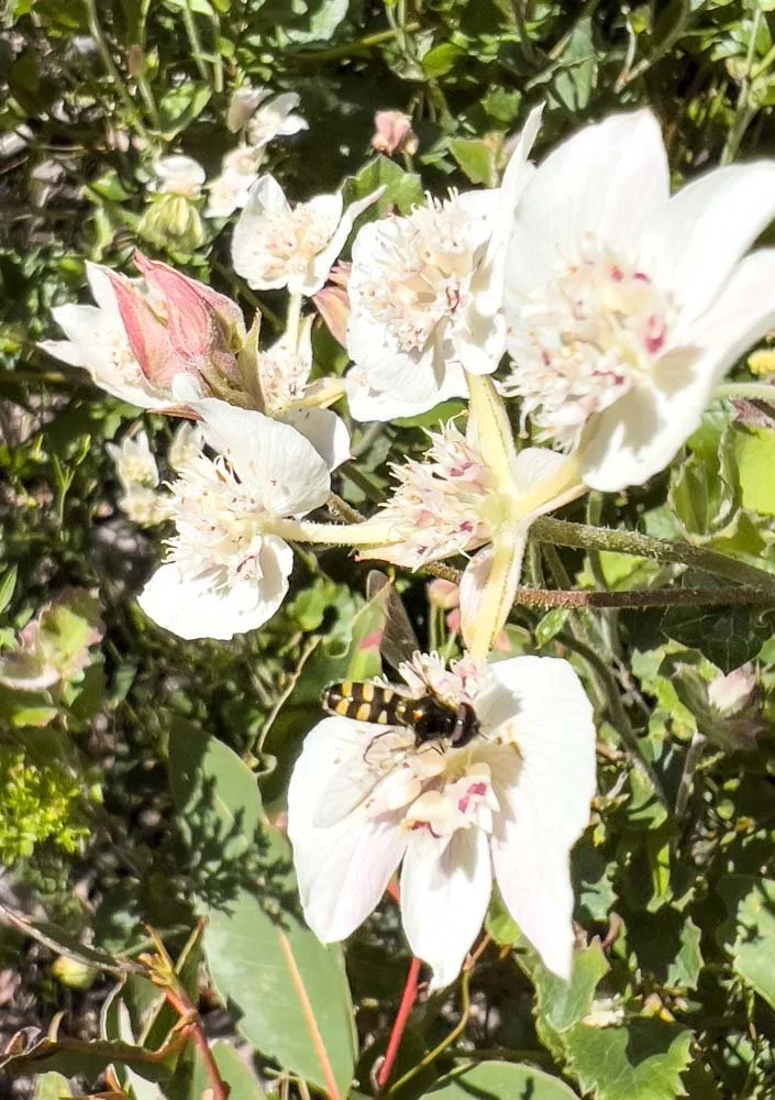
Oh, wow! Right beside the track, the critically endangered Gastrolobium vestitum in full bloom! It’s spectacular!

These guys, the Southwestern Crevice Skink (Egernia napoleana) are everywhere on the top. They look fat, healthy and somewhat unconcerned by us - I put a hand on one whilst climbing!

Right at the very top with gobsmacking 360 degree views, this one to the east. Wow. The air is alive with insects of every size and shape - those reading on computer screens or ipads will see the large black and white butterfly centre top. There are so many bugs considering the paucity of plants on the rocky peak; we are reasonably confident that they have been carried aloft to this point by strong thermals wicking up the mountain. No wonder the skinks are so relaxed and fat! And the peak is small: I’m at one end, Geoff at the other.

Enjoying lunch seasoned with an unforgettably glorious vista (and a little flying protein!).
This is one of the more challenging day hikes we’ve done in the Stirling Range, but it’s also been the most rewarding. The wildflowers, wildlife, scenery and views are all exceptional and we highly recommend it.