
Day 5: Ironbounds Low Camp to Turua Beach
Waterfalls, forest, creeks and rocky beaches to explore

A long lunch at Little Deadman's Bay.
Today’s short hike of just 4.9km (3mi) is welcome after yesterday’s demands. Leaving Ironbounds Low Camp, the still-challenging descent through rainforest ends when you emerge onto the coast, with glimpses of the sea and rugged cliffs. It’s 3.3km (2.1mi) from Low Camp to Little Deadman’s Bay with its rocky shelves and beach. Then hike a short distance inland through forest and more buttongrass plains with new views, before cresting another forested headland to Turua Beach and its pretty campsite beside Deadman’s Creek.

You can see from the elevation profile that there is little elevation gain and loss, but the descent in the first kilometre is rough, rooty and slow, much like your descent the day before. Once you reach the cliffs with their cosy bays and sea birds perched on boulders, the track becomes easier, and the last 2km (1.2mi) through forest and along beach are easier again.
How to Make Today Easier
Today is short and many slower hikers will be tempted to push on, but here is Geoff’s reasoning:
4.9km (3.1mi) from Ironbounds Low Camp to Turua Camp is not far, but we were pretty confident that Prion at 12.7km (7.9mi) would be too much for me after a big day. Low grassy dunes line Prion Beach: it lacks the intermediate campsites seen elsewhere, so offers no opportunity to stop short (please don’t make new campsites). We weren’t sure how soft the 4km (2.5mi) of sand might be on Prion Beach. Nor could we find any information about a campsite on the near bank at New Lagoon, though we figured there must be one for hikers who are forced to wait for better crossing conditions.
More significantly, pushing on would mean a boat crossing at the end of the day when we were tired rather than early morning; winds are also usually lighter before 11am. We expected the three boat crossings to total anywhere from 50-90 minutes depending on conditions.
But we would remain flexible, see how we are travelling at Turua beach and decide there. In the end, it is so pretty that we elect to stop for a leisurely afternoon that includes a refreshing dip in the creek, rather than hurrying to make Prion Campsite and the crossing.
Such flexibility in planning is essential for slower hikers if we are to enjoy our hikes, because standard itineraries rarely suit us. It’s easy to assume that the hike is therefore beyond us, but this is rarely the case: all you need to do is change that itinerary. Geoff’s planning for this day can be applied to most hikes, so remember this when next you’re looking at an itinerary that seems too daunting!
Walk with Us:

Breakfast noodles at Ironbounds Low Camp. On their own, instant noodles aren't ideal hiking food, but add protein and vegetables to them and they become nutritious as well as delicious! A little bottle of olive oil, visible bottom right next to the two taller fuel bottles, adds calories to almost every meal.

You reach the creek and a lovely little waterfall 300m (328yd) past Ironbounds Low Camp. We filled up at the top of the Ironbound Range yesterday at the start of the descent, because an extra 600m (0.4mi) out and return at the end of the day sounded less appealing than carrying an extra 3L of water. YMMV (literally!).

We expected the terrain to be much easier below Ironbounds Camp but, for another kilometre, it remains steep. Mossy rock like this is extremely slippery.
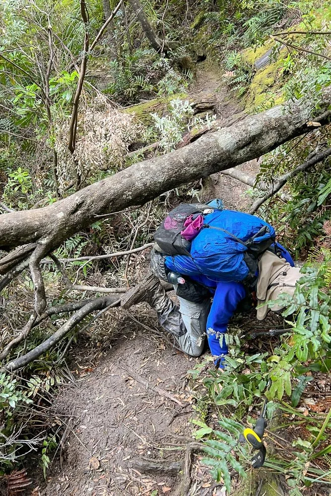
Deadfall slows you down...

... and again.
This little section reinforced in our minds that our decision to stop at Low Camp was a good one. Doing this in twilight or, worse, darkness, when you are very tired would not be fun.

Once you near the coast with tantalising glimpses of the sea, the walking becomes much easier.
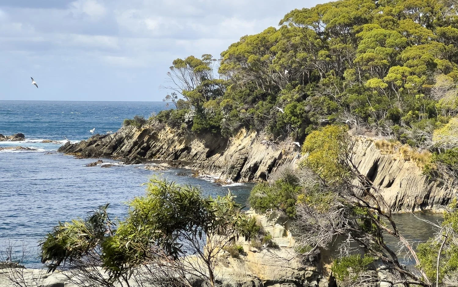
Little Deadman's Bay with its wheeling seabirds is sheltered and inviting.

Tidal rock shelves with small pools and interesting sea life invite exploration, here with views to Ile du Golfe island.

Nearing Little Deadman's Campsite. Old guidebooks say that campfires are permitted here, but this is no longer the case.

And here are the sites, perched on a slight rise right beside the sea. It's delightful, with plenty of large, flat open areas. A naughty quoll frequents the place, stealing food from bags and tents even during daylight hours: you have been warned!
The toilet is pungent but, if you plan to camp at Turua, use it pre-emptively if you can, as Turua has none.

Little Deadman's sheltered bay has polished pebbles and is perfect for an early lunch. If you are following our itinerary, you will be able to spend a couple of hours here too, with time to explore the tidal shelves and pools, or for a paddle if it is warm.

Our cold soak bean salad makes a yummy nutritious lunch, and of course everything tastes fantastic when you are in such a beautiful place!

After lunch, continue along the beach. There is no flotsam marking the exit, just a marker pole -- can you see it? We watched several hikers lose the track in the campsite, and we too had initially looked in the wrong place for the continuation of the track.

Dense ferns form a green carpet, so much softer to push through than Tasmania's infamously spiky scoparia!

Geoff's ancient Zpacks Vertice gaiters. After at least 1,800km (1,100mi), this is their last outing, and they are more Gear Aid Tape than Vertice. These ultralight gaiters have been fantastic and you can see how effective they are in protecting your boots and pants on such a muddy track.
Sadly, we cannot recommend Zpacks' current gaiter offerings, which are much stronger but which don't breathe at all. Our legs got as wet from sweat as they would have without, and Geoff also developed Golfer's Rash , harmless but itchy and annoying. The blue gaiters you see me wearing on this hike are also non-breathable, and later I replaced both with lightweight, relatively cheap Outdoor Research ones (possibly the Helium model). When paired with long pants or thick socks, even light gaiters like this provide protection from Australia's short-fanged elapid snakes.

One of the most engaging aspects of the South Coast Track is its variety. Every day you alternate between rainforest, beaches, plains, creeks and, yesterday, montane environments. This makes it fun and exciting, with something new every few hours.

You have a couple of small creek crossings today. You can see Geoff's Dawgs river crossing sandals; they are a women's model in black. Women's models are usually less chunky than men's models and are therefore lighter; men with narrow feet can save some grams. Choose ones that comfortably double as camp shoes, or vice versa: years ago I had a pair that absorbed water, making them useless for camp. They should be light, as you carry them most of the day.

Down onto Turua Beach.

The bay is stunningly beautiful with sun on the water and a cloud-dappled sky.

Keep your eyes peeled for Turua Campsite, immediately east of Little Deadman's Creek. No flotsam or marker: here you are looking right at the entrance to the campsite from the beach!

It is one of our favourite campsites of the whole trip and we have it to ourselves.

Geoff hanging the food bags. These are Ultrasil bags, which are light (30g for the 8L bag), strong and waterproof.

Collecting water from the creek.
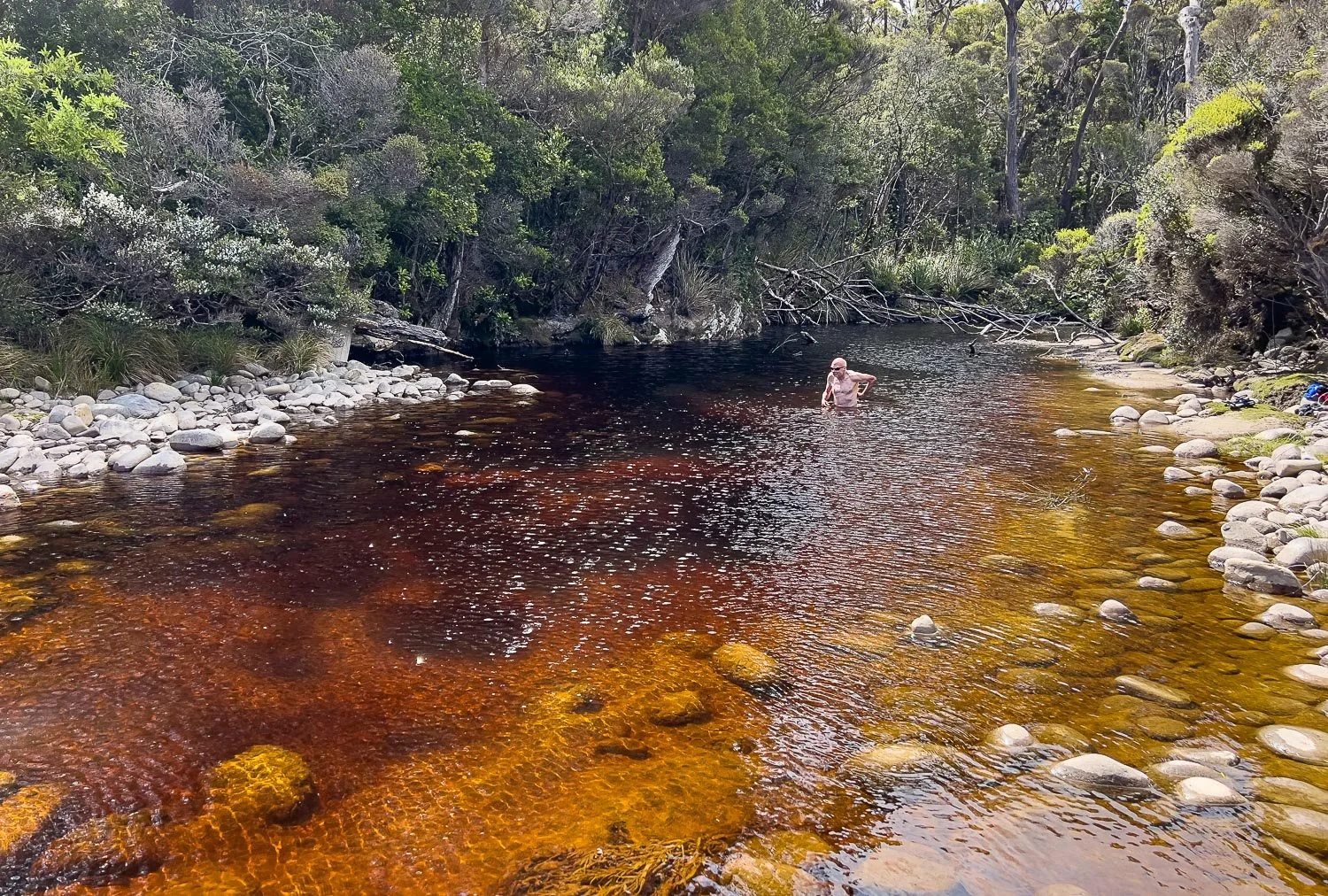
And then you have a leisurely few hours for a dip in the creek, to bask on the sun-warmed stones on the bank, and to eat dinner on the edge of the beach, watching the waves rolling in. A delightful end to an easy day, leaving you refreshed and energised for whatever tomorrow brings!
We acknowledge the Tasmanian Aboriginal people and their enduring custodianship of lutruwita (Tasmania).