
Mamang Hike Planning
We recognise and acknowledge the Goreng, Menang and Wudjari people as the traditional owners of Fitzgerald River National Park.

Mamang means whale in the Noongar language and, if you are hiking between July and October, you are very likely to see them.
Why Hike the Mamang?
The Mamang Track in Fitzgerald River National Park is a two day overnight hike that traverses Western Australia’s spectacular southern coastline in an area renowned for its flora and fauna, comparable to the Galapagos Islands in diversity. It is amazing.
The world heritage-listed Fitzgerald Biosphere, with the 330,000ha park at its heart, contains over 2,000 plant species plus dozens that occur nowhere else; it’s home to an incredible 20% of Western Australia’s plants! It also has 22 mammal species, 41 reptile species and over 200 bird species - more than any other reserve in the southwest! - making it the cherry on Western Australia’s diversity hotspot cake.

Wildflowers all the way to the beach…
Botanists, whale watchers and ornithologists will all enjoy this hike, as well as the stunning coastal views that accompany them. If you’re a nature-lover visiting Western Australia, don’t miss this park.
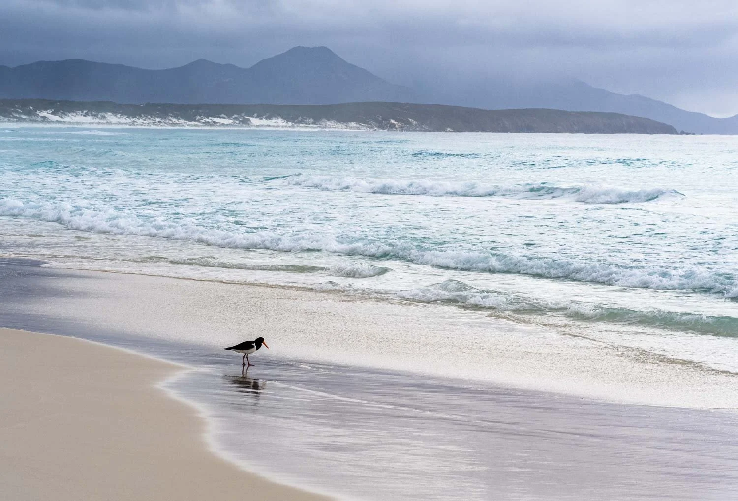
Pied oystercatcher and other shorebirds on the beach, numerous waterfowl in the welands and inlets, parrots and malleefowl in the mallee, and honeyeaters in the coastal heath. Ornithologists will love this hike. Photographers: bring your long lens or you will get shots like this!
Vegetation varies greatly within the park - we hiked the completely different Hakea Trail, as well as exploring inland and roadsides surrounding the Park for orchids and other wildflowers, and there was great variety throughout: it is defintely worth hiking both the Mamang and Hakea Trails.
When to Hike
Prime wildflower season is September to November; the wonderful Ravensthorpe Wildflower Show is held in September each year. In terms of wildflowers, we were a scant 10-14 days early due to a late-breaking season, with numerous species in late bud rather than the carpeting kaleidoscope of colour the park is famous for. Nevertheless, other than on the beaches, not a step went by without something in bloom at our feet and I was not disappointed.
Nearly all of the hike is highly exposed either on beaches and through coastal heath, so you’ll be in sun most of the time (in all but windy weather, this is a good track for those who carry hiking umbrellas). Summer and early autumn can be extremely hot, and you have to carry all the water you need for two days. Winter provides wild seascapes but fewer flowers, although something will be in bloom at any time of year.
From July to October, Southern Right Whales come to the sheltered bays to calve, while migrating humpback, minke and orca whales are also regularly spotted. Schedule time to enjoy these sights as you watch them broaching and tailslapping close to shore.

When the sandbar has gone, or recently opened with a high volume of water passing through a narrow gap, Fitzgerald River Inlet can be dangerous. Check with the ranger as to the current state of the crossing.

Dry feet all the way across the inlet when we hike in early October.
Tide Times
Check tide times to plan your walk - there are sections along the beach that may be problematic at high tide. While it is possible to hike behind or on the foredune, this causes erosion, damages vegetation, and is much more strenuous. Diversions are in place, however, so you can climb off the beach via a number of tracks that are illustrated on this sign:

You can see the various route options: the red dotted line is a car track that you could use at high tide, or you could take the centre track to Lake Nameless lookout. Keep your eyes peeled for the orange trail marker posts on the dunes so as not to miss them - this is trickier than you might expect, as you will likely be gazing at whales out to sea!
Leave No Trace
If you’re caught Big Time between the toilets at St Mary’s Inlet Campground and Fitzgerald Inlet camp, please bury your waste away from the path and 20cm deep. Mix the poo and soil with a stick before burying to speed decomposition. Folk with vaginas, please consider using a Kula cloth for pee, or pop your used pee paper in a ziploc bag that you keep with your toilet paper, hand sanitiser and trowel - pee is sterile, so it’s perfectly hygienic to carry out used paper in a sealed bag.
We all know not to pick wildflowers, but preventing the spread of phytophthera, the introduced fungal disease that kills plants in the Proteaceae and Myrtaceae families, is even more important. This means using boot cleaning stations wherever you see them, and sticking close to tracks.

Boot Cleaning Station before Fitzgerald Inlet. Why am I looking glum?

This is why. A token effort at best.
Getting There
Fitzgerald River National Park is midway between Esperance and Albany on the south coast of Western Australia, approximately 550 km from Perth. There are two small towns located close by. Ravensthorpe is near the northeastern boundary of the park and Hopetoun is on the eastern boundary on the coast. Both towns have basic supplies such as groceries, hotels, cafes, hardware, fuel and a small range of accommodation options.
Ravensthorpe and Hopetoun are accessible by regional bus, but the park is large (just under 3,300km2) so you still need a car to get to the trail head; for us it was over 60 km from the park entrance to the trail head!
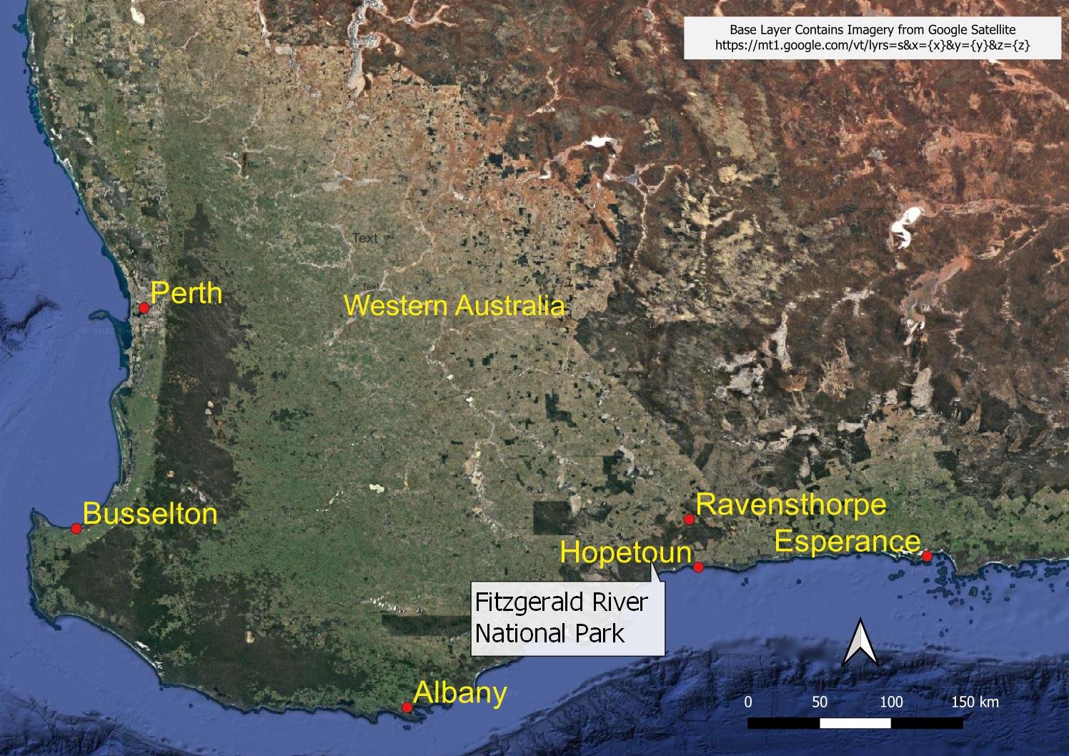
Locality map for the Fitzgerald River National Park
When we prepared this blog there were no car hire, taxi or track transfer options in Ravensthorpe or Hopetoun, so you will need your own or a hire car to reach the trail head near Point Ann. Car hire is available from Albany (300 km to the west) or Esperance (200 km to the east). Both these large regional centres have flights to and from Perth as well as regular bus services.
Campgrounds

There is a pretty camping area (St Mary Inlet Campground) with toilets about 1.5 km from the trail head. The camping area is set up for car campers and caravans. It has designated sites (about 12) but you can’t book them, so they are only available on a first-come, first-served basis. Most users are car campers and it can apparently get very busy, but we had no trouble getting one of the smaller sites even in school holidays. YMMV.

Barbecue and shelter designed for sun rather than rain at St Mary Inlet Campground.

The Fitzgerald Inlet Campground is somewhat basic. It has fallen into disrepair and the toilet is horrendous; it had not been cleaned in many months, if not years, and was full of sand, spiders and debris when we visited. Pee elsewhere.

Still, don’t let this deter you. The actual campground is sheltered and pleasant if not pretty, and every step to it and from it will more than make up for it in beauty.
Track Configuration
The hike is an out and back from Point Ann to Fitzgerald Inlet, but you can vary the way out from the way you return. The total distance is between 25 and 31 kilometres depending on the route you take and whether you travel along the beach for part of the way. The loop route we took was just over 28 kilometres, with only a small elevation gain and loss of around 260 metres. This hike is done as a day hike by many, but we strongly recommend that slower hikers take the two day option.
The main trail head is at Point Ann, which is a popular whale-watching site. It has toilets, viewing platforms and a large parking area so it must get busy at the height of whale watching season.

Hike details for the route we took. Doing this over one day would be a push for slower hikers, and would allow little time to enjoy the whales and wildlife.
We had read about the state of Fitzgerald Inlet Campground and wondered whether this hike would be worth it without a beautiful campsite at the end. Worry not: it turned out to be one of the best coastal hikes we’ve done in Western Australia, with seclusion, long beaches, stunning views and incredible wildlife. 10/10!