
Cape Du Couedic to Sanderson Bay (Day 3)
Spectacular rocks, sea views, mallee and wildflowers
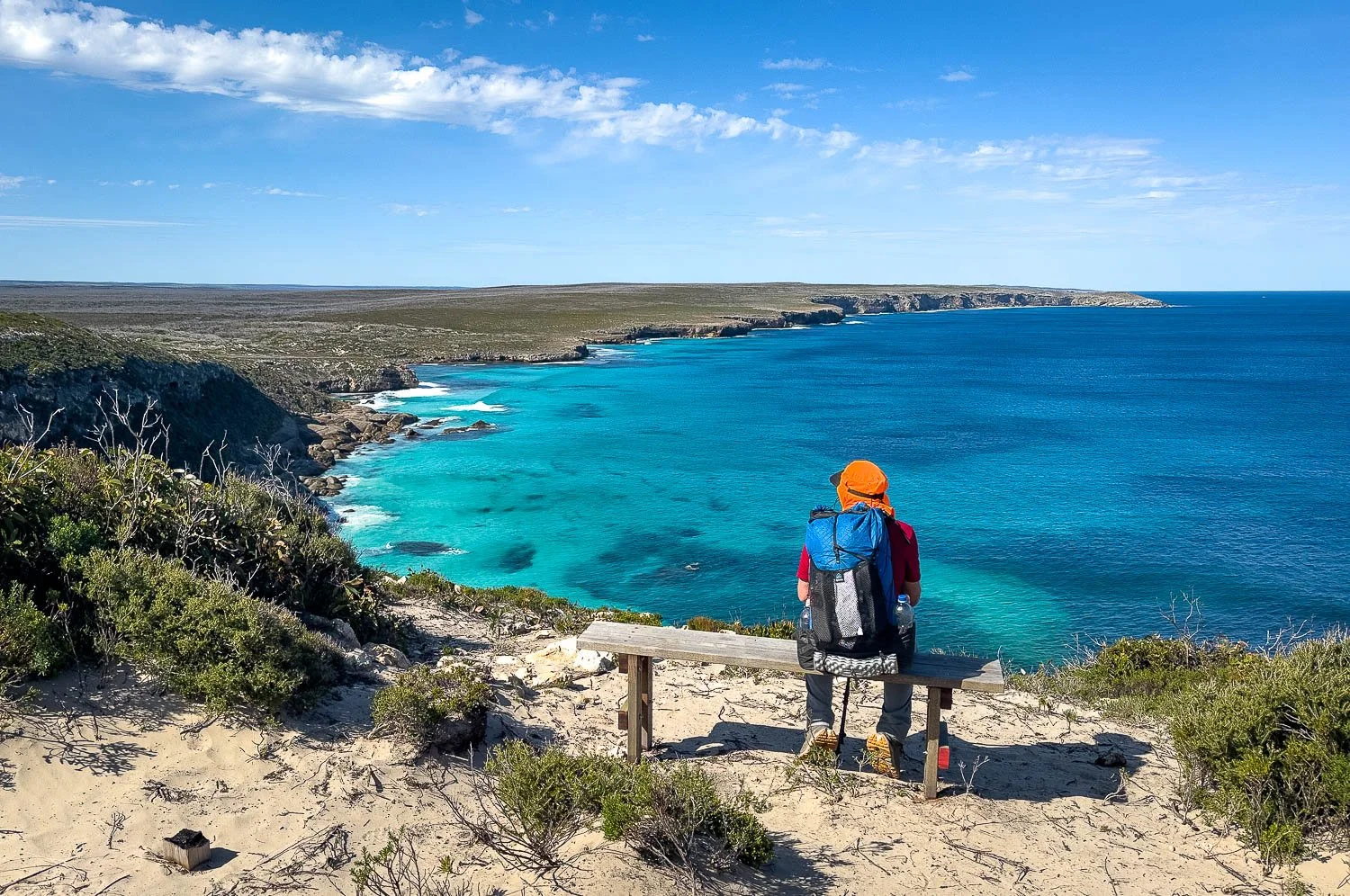
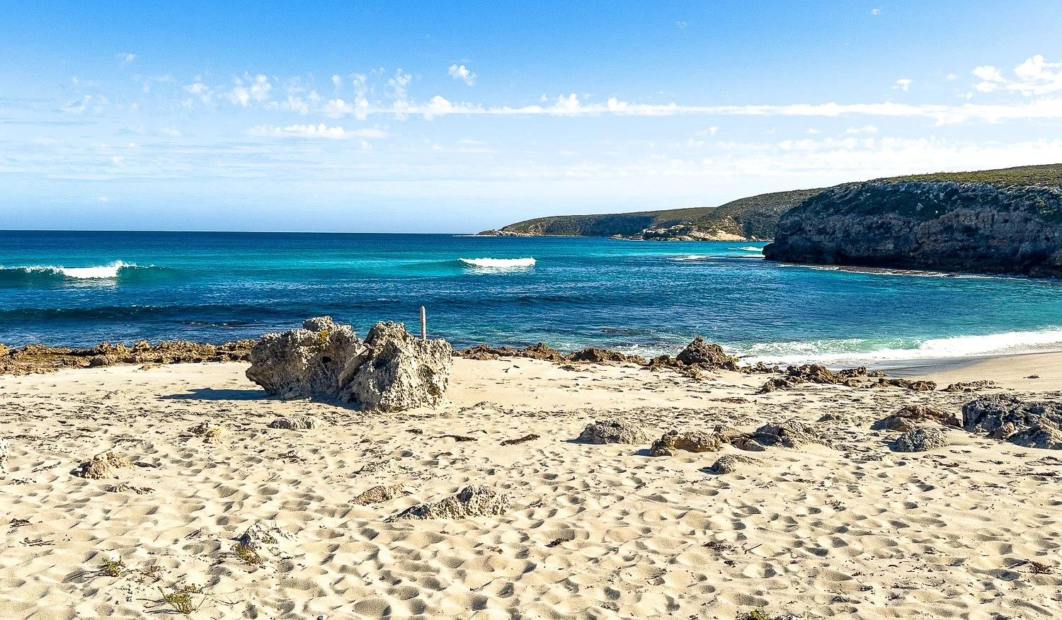
A welcome bench with marvellous views of Sanderson Bay, rocky coastline and frolicking seals.
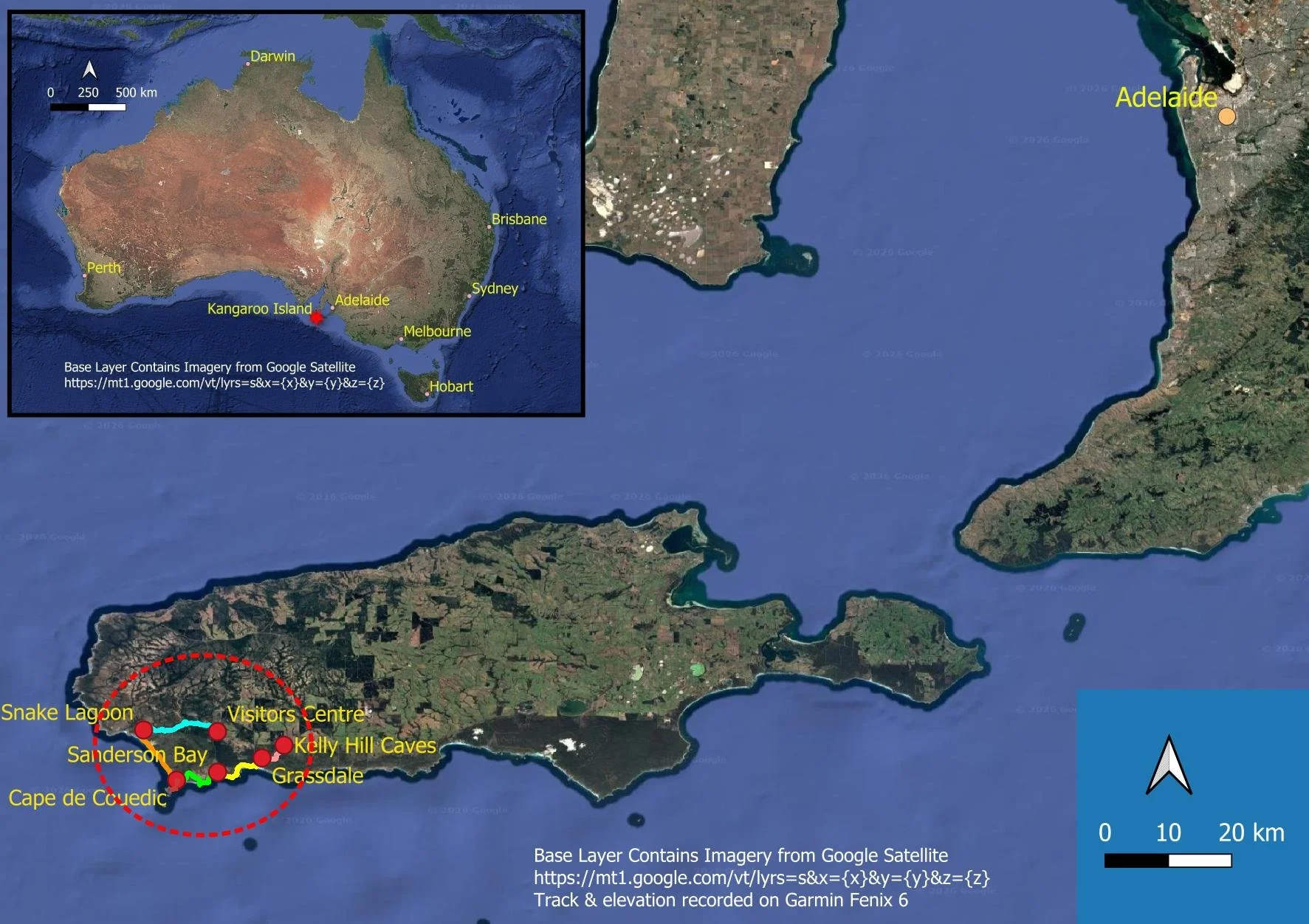
Hike Locality Map
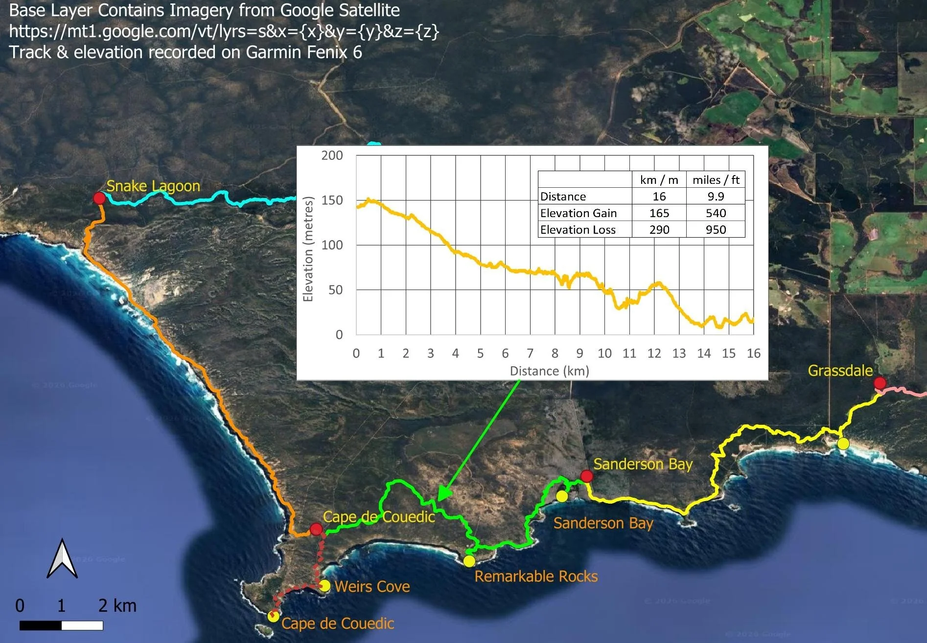
Today’s Hike: Hakea Hut to Banksia Hut (Sanderson Section), 13km/8.1mi, 6.5hrs*, plus any spur trails you elect to do.
*NPWS suggested hike time; we took 7.5 hours (omitting Admiral’s Arch and Weir Cove, but including Remarkable Rocks and Sanderson Bay)
More fantastic hiking today along cliffs covered in drifts of heathy wildflowers and mallee further in. The Remarkable Rocks spur trail is just 1.8km/1.1mi (total return) and easy; if you see Admiral’s Arch and Weir Cove before or after your hike as we recommend, you won’t be taking the 9km/5.6mi spur trail today and will have plenty of time to enjoy Remarkable Rocks. You also have the 1.2km/0.75mi return spur trail to Sanderson Beach today; slower hikers should take the spur trail when they pass, rather than returning to it from Banksia Hut as recommended in the walk notes.
Day 3 Details Map
NPWS suggest an additional 4 hours totalling 10.5 hrs to include Admiral’s Arch/Weir’s Cove spur trail (dotted red above), but slower hikers would then probably be walking for about 12 hours to cover the 25km/15.5mi. This is because the trail remains extremely rocky for much of the way and you won’t make the distance in daylight, especially April-September.
Walk with Us
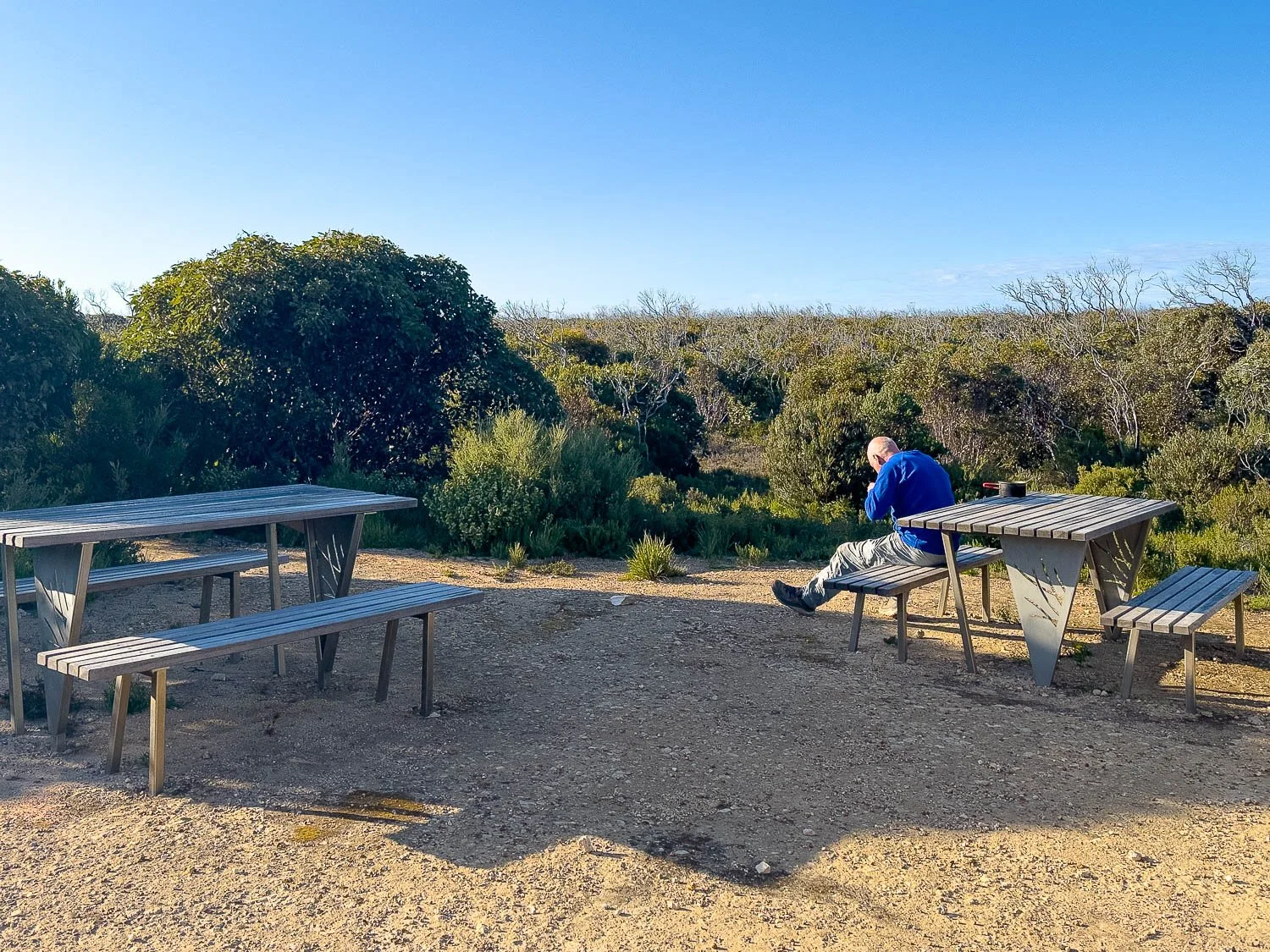
Comfortable picnic tables with warm morning sunlight at breakfast
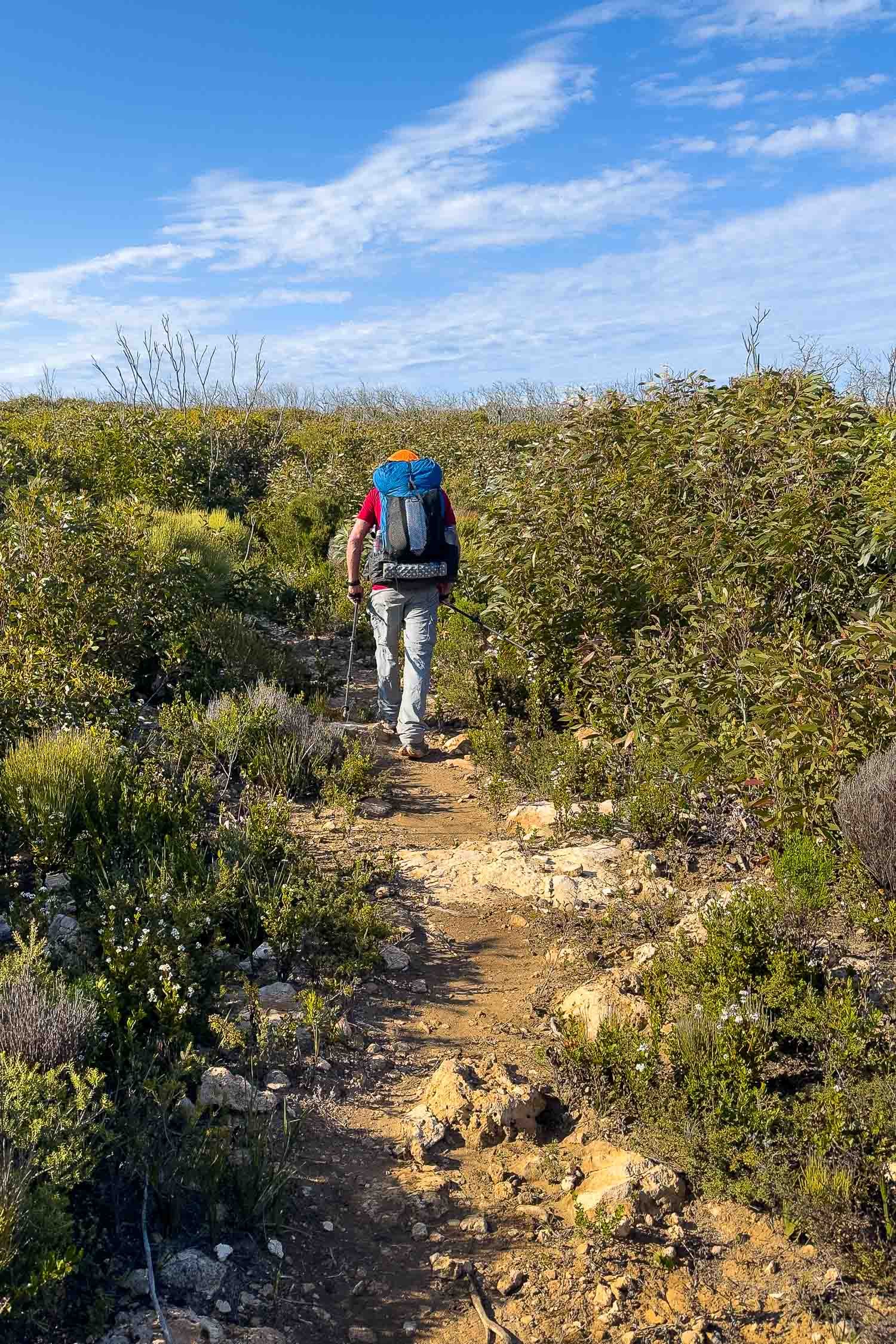
Walking through dense regrowth; it will take time for the canopy to re-establish.
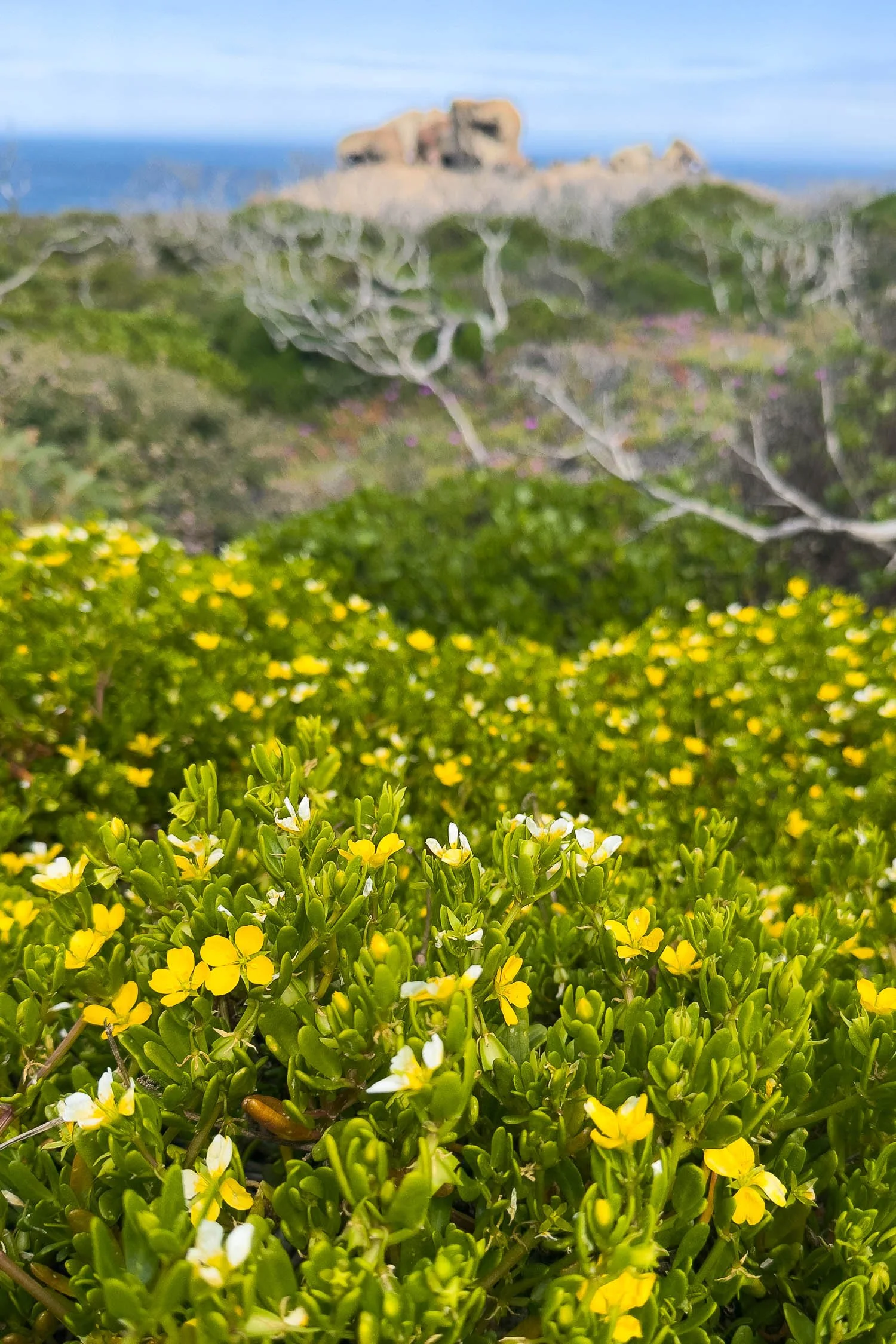
Coast Twinleaf (Roepera billardierei) forms mounds of yellow
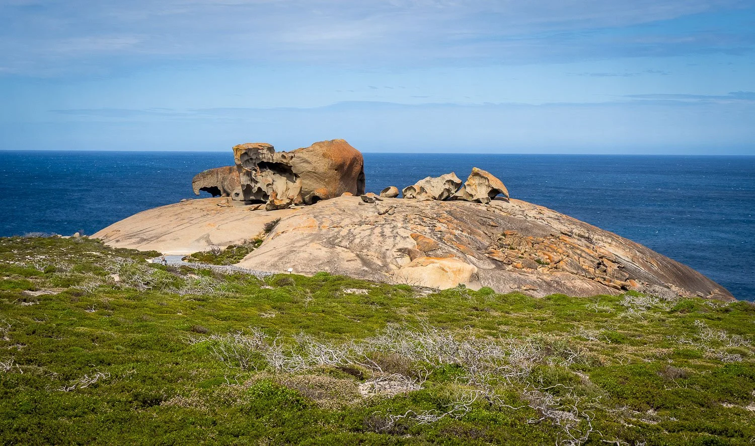
Approaching Remarkable Rocks. Few people now nor while we are on the rocks, but it is a must-visit for every tourist on the island and three busloads drive in as we are leaving: it looks very different then! Aim to arrive as early as possible to avoid the crowds.
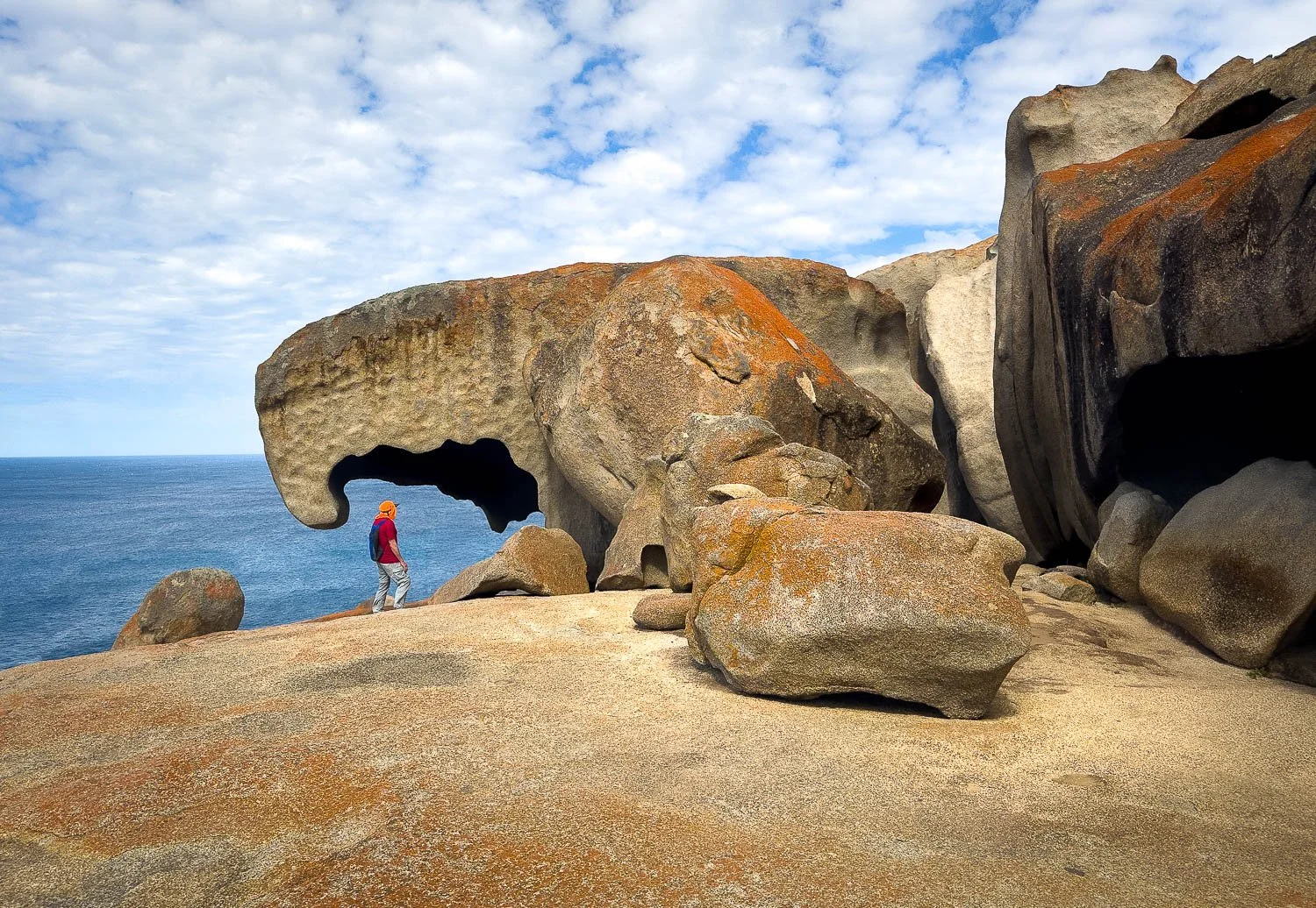
Remarkable rocks are indeed… remarkable!
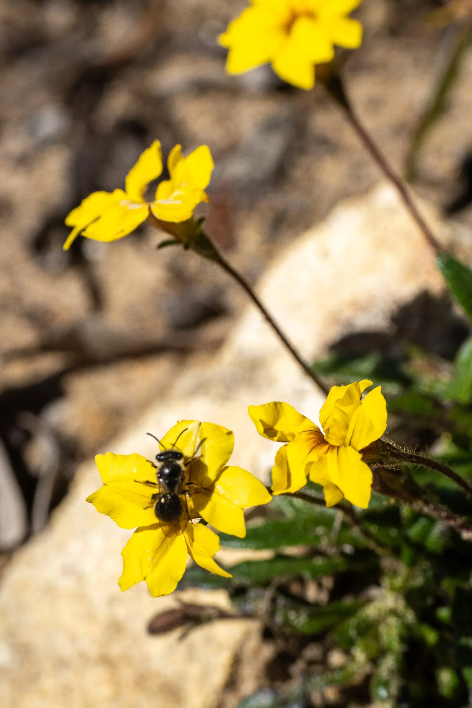
Native bee on Bent Goodenia (G. geniculata)
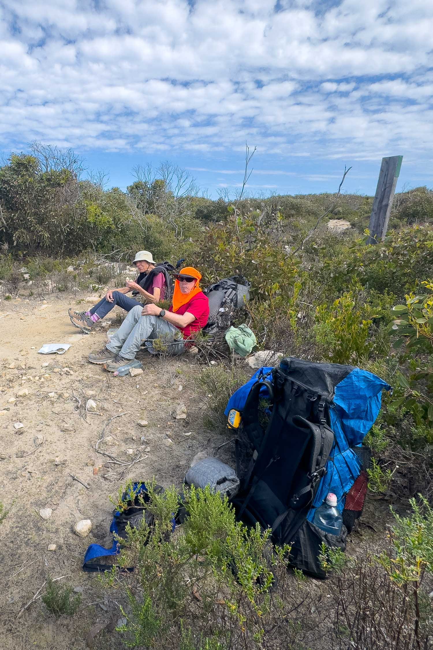
Our friend has seen Remarkable Rocks before so we have left her at the spur junction, and the return timing is good for lunch. Here as we often do, we’re using packs leaning up against small shrubs as back rests, and sitting on tyvek, closed cell foam or sitpads.
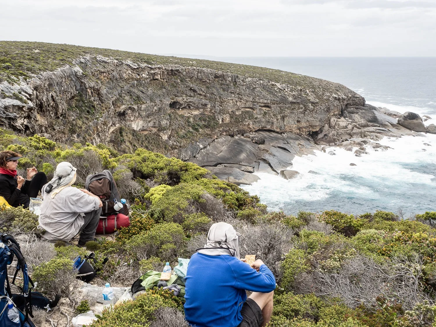
However, you can stop almost anywhere right beside the trail for a lunch with a view, here a little further along in 2017 and again with friends.
Although we almost always hike as a couple, the KIWT is ideal for taking less experienced people on their first multiday excursion provided they are moderately fit and sufficiently sure-footed to manage the limestone, and you’ve checked their gear. Daily distances are relatively short, elevation gain and loss are negligible, and huts, tables, water and toilets at the end of each day give them a gentle introduction to overnight hiking.
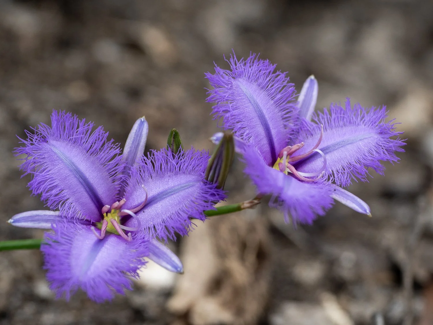
Spectacular Zig Zag Fringe Lily (Thysanotus fractiflexus)
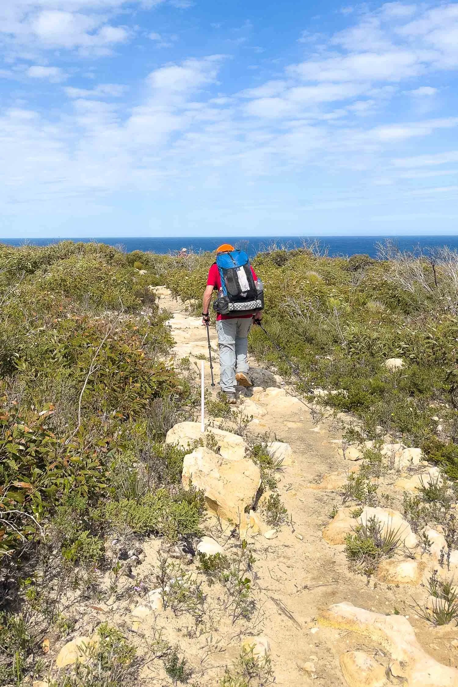
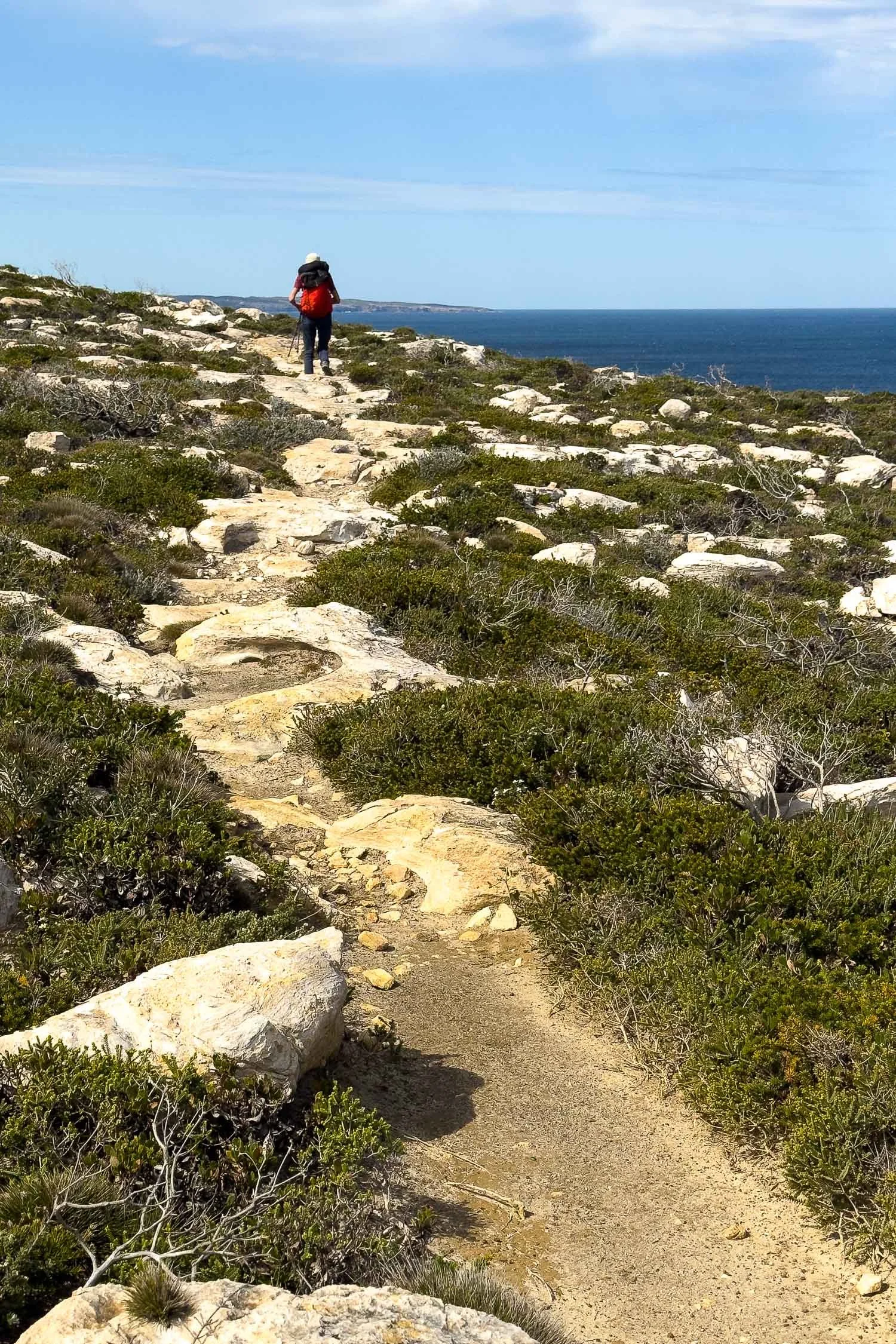
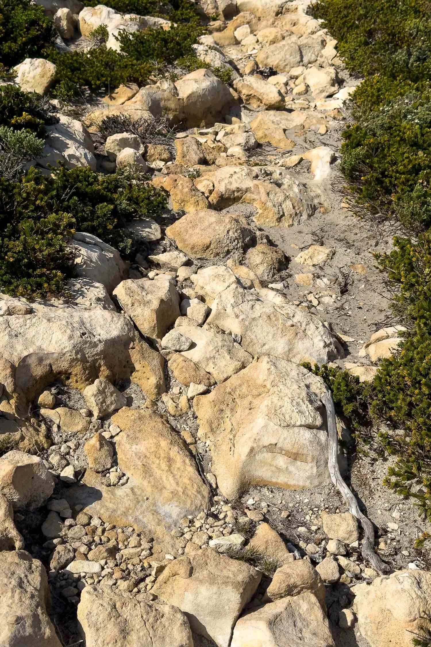
You may think that yesterday was the day with the most rock, but you would think wrong:
We find lightweight boots with a moderately firm but not stiff rock plate the most comfortable on this kind of terrain, but there is no one right or wrong answer or right or wrong brand, as long as the shoe fits well (go half a size up for hiking to allow feet to swell).
Younger folk have walked this in barefoot style footwear, others wear trail runners. Generally, the footwear you hike in most often, on similar terrain, will always be best because your body’s biomechanics and feet are used to them. Here are our tips for choosing hiking footwear.
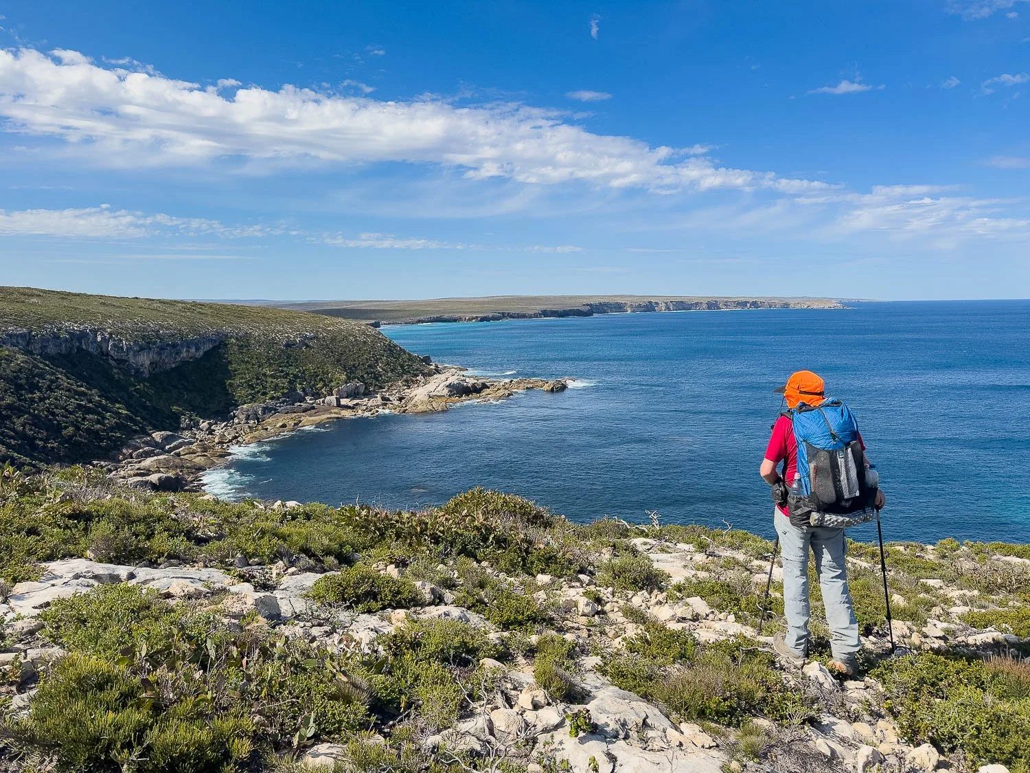
Views east towards Sanderson Bay. Geoff is standing beside a bench out of shot here, but seen in the lead image.
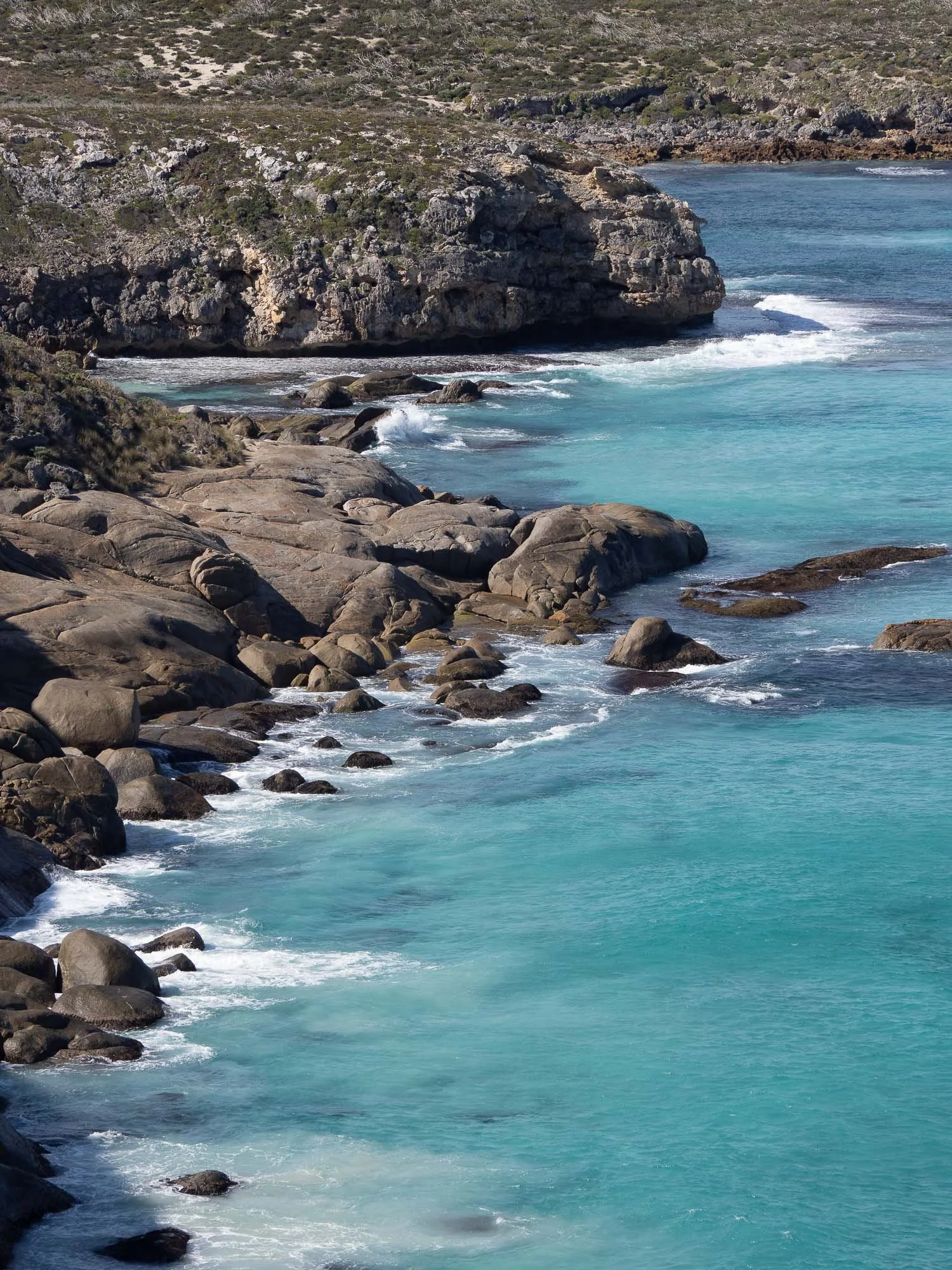
Plan for a leisurely break here on that bench. We watch a large ray moseying through the clear water while…
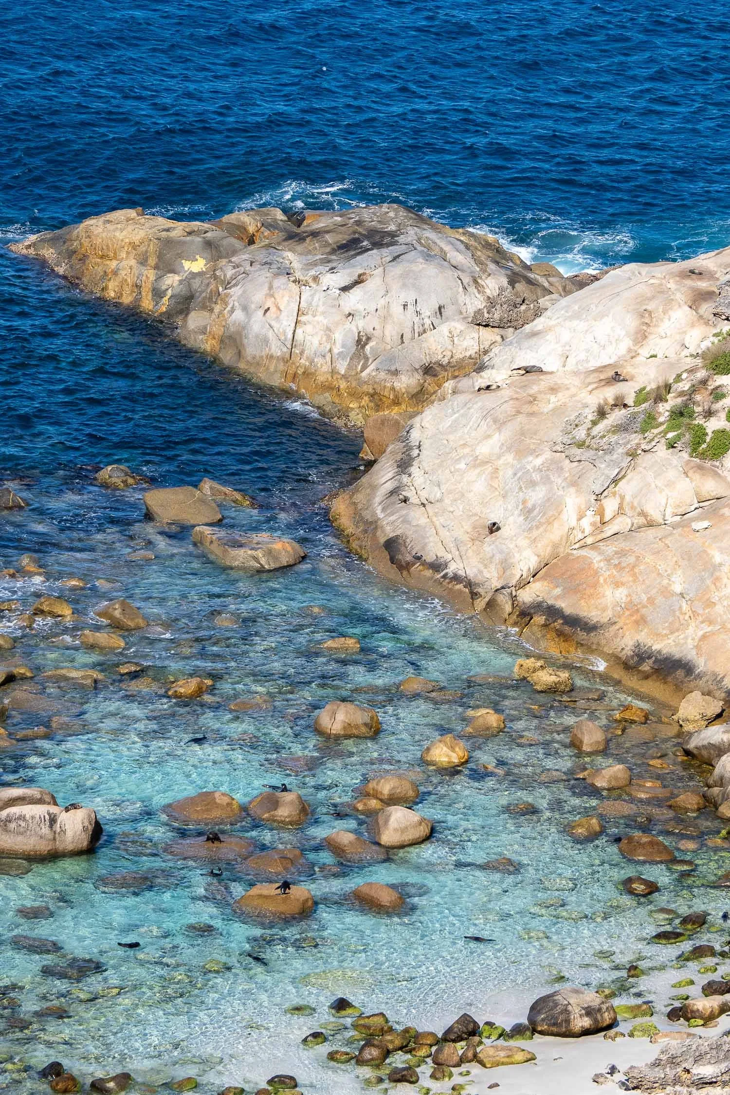
… to the right, seals bask on rocks and frolic in the shallows.
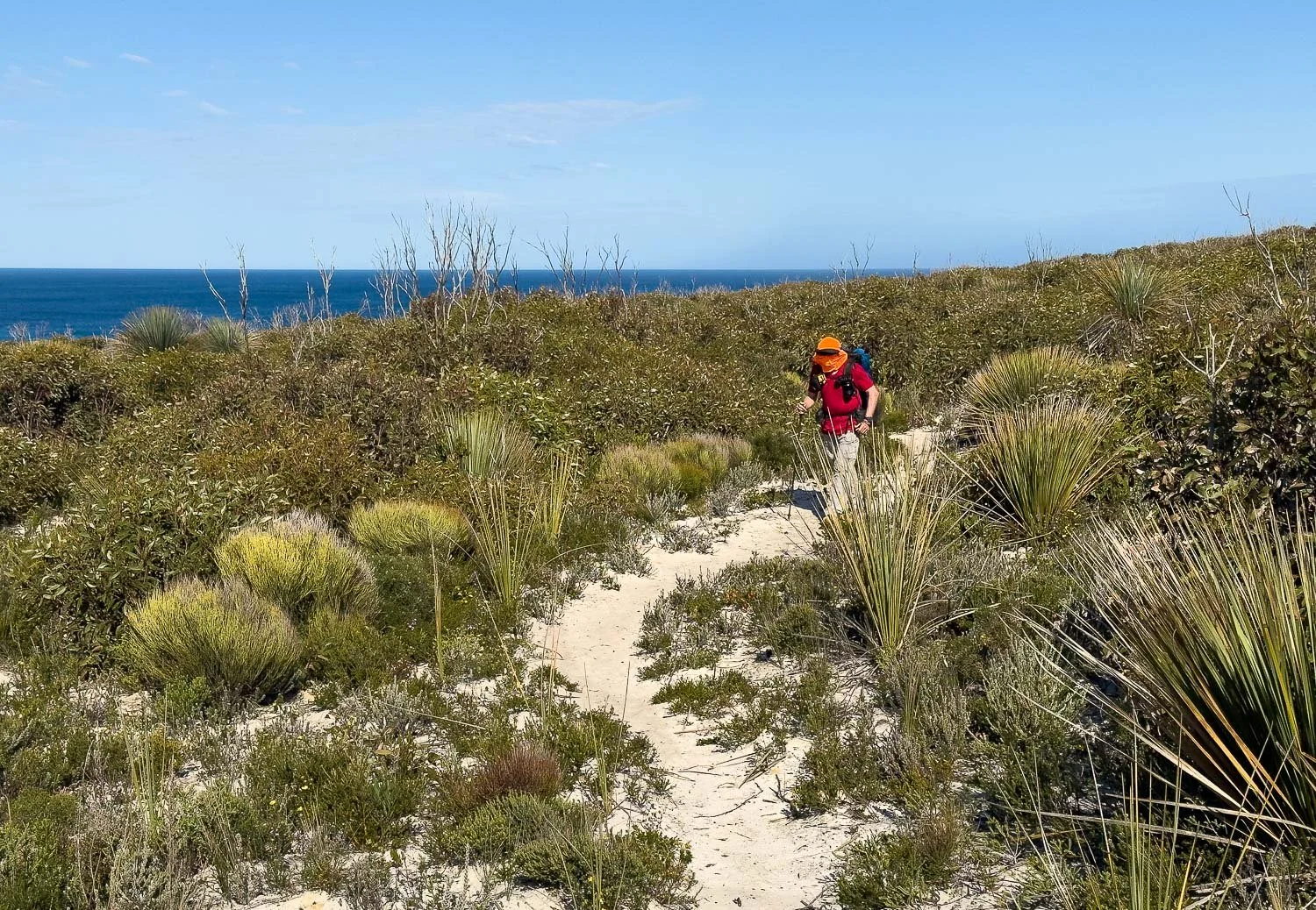
The trail finally becomes sandier underfoot and your pace increases.
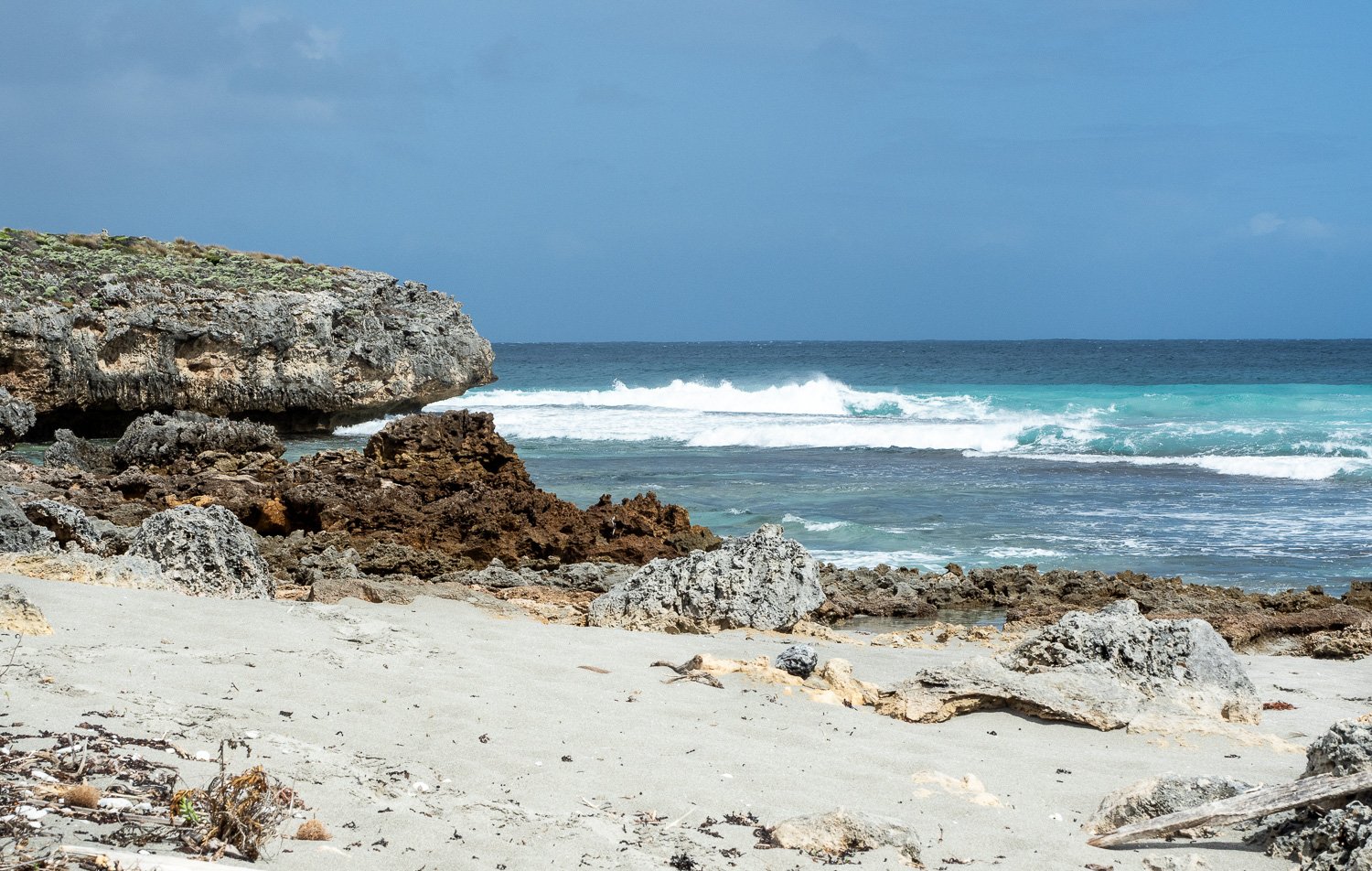
Take the spur trail to Sanderson Bay when you pass it, leaving your pack at the junction. The beach is sheltered and, unlike much of the wilder coastline, great for a dip in warmer weather:
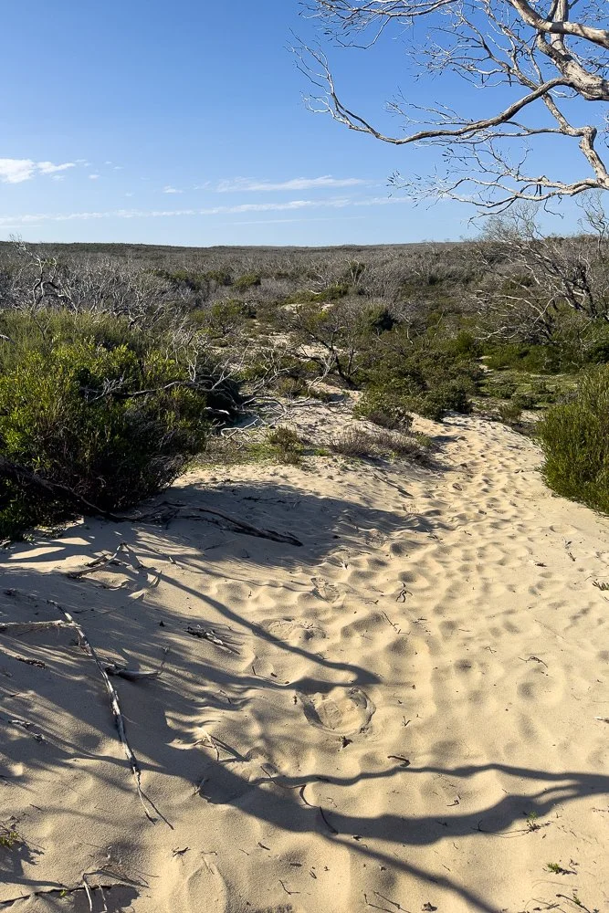
The trail remains inland for the remainder of the day, primarily sandy and with gentle gradients.
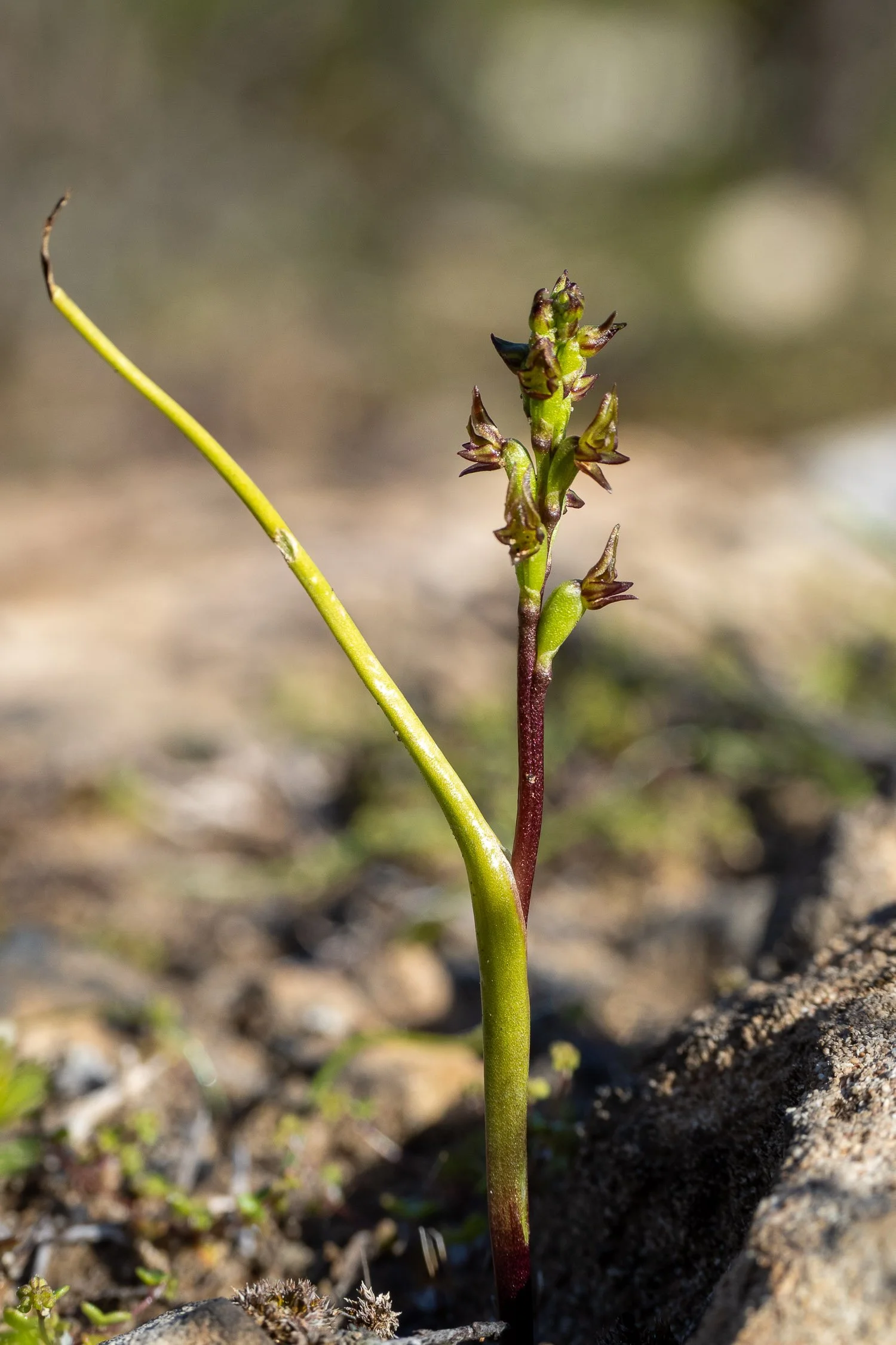
In winter and spring, orchid enthusiasts will find a range of rare and unusual species, here the tiny and cryptic Prasophyllum calcicola, growing in mossy limestone.
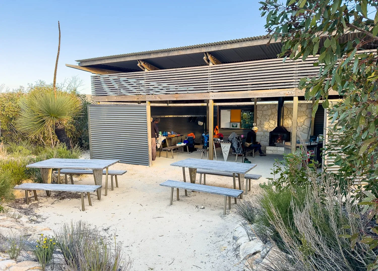
There are just five of us who set off hiking the trail on the same day — truly astonishing for a hike of this calibre in peak season! — and we are in only two groups. Hut etiquette requires that you arrange gear in a compact area but, with so few people, we have the luxury of spreading out.
Our friend already has the fire going. Etiquette is to fill the barrow from the wood shed, collect kindling and stack the fire in the hearth in the morning before you leave so it’s ready for the next group and they need only set a match to the firelighters or newspaper.
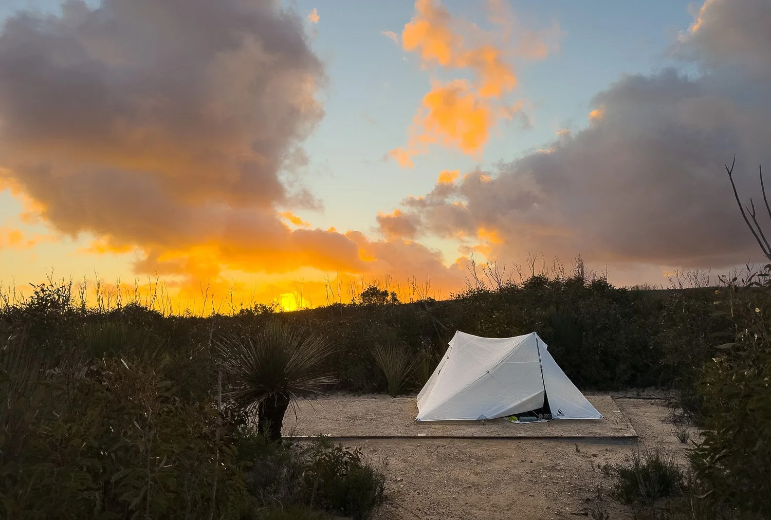
The campsites are slightly more exposed here so, if possible, choose based on the prevailing wind direction (storms normally come from the northwest or south/southwest). As for Hakea, the campground will become completely sheltered as trees recover.
Cliffs, incredible rock formations, sheltered beaches, seal colonies, wide sea views: it’s been another marvellous day, with a spectacular sunset to finish. How good is the KIWT!