
Hugh Gorge Camp to Fringe Lily Creek (Day 14, Sect. 5 part)
Scramble, wade and swim through a spectacular remote gorge.

So much variety today, with spectacular cliffs plus a fun wade and swim!

Location Map: past halfway already!
Today’s hike of 9.1km/5.6 mi to Fringe Lily Camp is fantastically fun and varied. You enter the gorge, wide at first, before the walls, adorned with wildflowers and Ghost Gums, narrow and steepen. You have a swim/wade through one pool, doffing and donning clothes and boots, a bit of easy scrambling, and a little pack haul. Continue until you reach Hugh Junction with a few small campsites; leave your packs there and take a day pack with lunch, first aid kit and necessities for the bouldery, bushy 1.8km/1.1mi return side route to remote Hugh Gorge.
After returning to the junction and collecting your pack, you have a long but steady climb to Rocky Saddle with abundant wildflowers, with the last part of the day downhill zigzagging along a creekline. Once you reach Fringe Lily and set up camp, you’ll still have time to explore the downstream rockpool for a swim.

Today’s hike of 9.1km/5.7mi (which includes the 1.8km/1.1mi return to Hugh Gorge waterhole) will takes slower hikers the better part of a day. Don’t be deceived by the apparently short distance - it took us 6.9 hours! You should still have time and energy for the short for the 600m/0.4mi return side trip to Fringe Lily waterhole - it’s worth the effort.

Campsites at Hugh Junction, with at least one more up off the river bed.
How to Make today Easier
Section 5 from Hugh Gorge to Section 4/5 Junction is one of the most spectacular, but it’s also the one that many people underestimate, deceived by the distance of 14.9km/9.3mi. We look at the distance from Hugh Gorge to Fringe Lily (7.3km/4.5mi) and Fringe Lily to Section 4/5 Junction (7.6km/4.7mi) and think that we should combine them.
Parks suggest this section (Grade: Difficult) takes 9.5 hours; it took us 13.8 hours over two days, including rest stops and the bouldery 1.8km/1.1mi return side trip to Hugh Gorge Waterhole plus .6km/.37mi return trip to Fringe Lily waterhole (both extra to the park figure of 14.9km/9.3mi). Although the distance is similar to what we have done on previous days, the terrain is vastly different, with today through the bouldery gorge, and tomorrow up Razorback Ridge and down Spencer Gorge. We strongly recommend that slower hikers — perhaps even most hikers? — stop at Fringe Lily Campground in line with Parks advice.
If you’ve been following our itinerary and comparing your hike times to ours each day (or checking against the table in Itinerary), or comparing your times to official Parks estimates, you’ll know by now whether you will be faster or slower than us or Parks on these more demanding days, and whether you need more time, or less. Adjust accordingly. If you are MUCH slower than us, consider how you might adjust by splitting days further, starting earlier, or perhaps even skipping Ellery Creek to Standley Chasm. Study our many trail images so you can also compare the terrain, and factor in your own strength and agility.
Despite today’s short distance, the bouldery terrain through the spectacular gorge is slow going. It’s a truly beautiful section, not to be rushed — you want the scrambles to be fun, taking your time picking your way along small ledges and over boulders. Everyone we spoke to, from runners (who were hours late arriving at Hugh Gorge camp the previous evening) to the most leisurely, took longer than they expected. Many of the hikers we spoke with had not done the spur trail to upper Hugh Gorge; others had not seen the Fringe Lily rockpools. Start early.
At the Junction of the spur trail to Upper Hugh Gorge waterhole are a couple of small emergency campsites (pictured above), but logistics for the following days ideally see slower west to east hikers finishing at Fringe Lily tonight. We saw no comfortable camping options in the hilly terrain between Hugh Gorge Junction and Fringe Lily.
If you think the distance is too far, omit the spur trail to Hugh Gorge Waterhole; decide when you reach the Junction. We don’t recommend that you hike the spur trail and then camp at the junction campsite with the aim of finishing at Section 4/5 Junction instead of Fringe Lily tomorrow, because the trail between Fringe Lily and Section 4/5 Junction traverses Razorback Ridge and is also slow going: we took the same amount of time each day.
If you arrive early at Fringe Lily in calm weather, still have fuel in the tank and are worried about safely being able to complete the more demanding day to Section 4/5 Junction tomorrow, you could top up your water and continue to one of the exposed high westerly camps on Razorback Ridge. However, this means a steep climb carrying extra water (for both the evening plus tomorrow) at the end of the day when you are likely already tired. We recommend slower hikers stay at Fringe Lily tonight.
Walk with Us:

The inviting start of your day, and it only gets better! The Sections from here to Standley Chasm are some of the the most demanding but also most varied and beautiful of the entire track.

Plenty of little scrambles…

… and wending your way around, between and over boulders.

None of it is especially difficult, and you can always wade these shallow sections, especially if you’re wearing non-waterproof footwear that dries quickly.
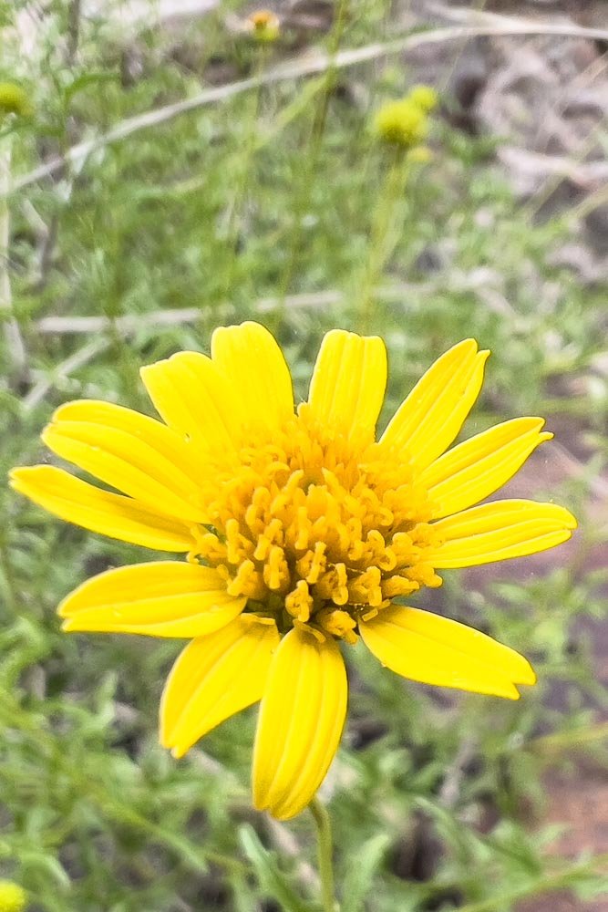
Look for wildflowers in the more open sections, as well as on the walls. Here, endemic Apowollstonia stirlingii subsp. fontaliciana.

Every now and then the gorge widens slightly. We kept our eyes peeled for emergency campsites but, other than a couple on tiny sandy edges of pools, you would struggle to set up anywhere.

Another open area, probably Pocket Valley, covered in spinifex...

…before the terrain again narrows. You can see from this picture how higher water levels make a huge difference, with more swimming and wading. High flows are extremely dangerous in the narrow sections.

Edelweiss Everlasting Cremnothamnus thomsonii on the shadiest, most sheltered walls.

Keep your eyes peeled for those blue triangles - both in front of and behind you. There are a few small false leads, notably near Pocket Valley and Hugh Gorge Junction: this day is definitely one where you should have a clear idea of the track and its place in the terrain, so study the map the night before. Later, when you arrive at Hugh Junction, it is a three-way split, with a small false lead to the west as well as the spur trail, and the continuation of the track to Fringe Lily to the east.

Here is the famous wade/swim: don’t worry, it’s cold but the swim is less than four metres at this water level and, even in cool weather, it was fun!
This is the approach that west to east hikers take; east to west of course come towards the photographer.
You can see the greyish rock jutting into the pool, with a couple of branches leaning up against it directly ahead of me. The pool is shallow along the edge all the way to those sticks, but you have to swim around that grey rock.
A solo hiker will carry their pack to the branch and hang it on a fork, then swim around the rock and haul up the branch to retrieve their pack.
With a hiking partner you can each do this too or, alternatively, the weaker one goes first, swims around the point and clambers onto the rock to lean down and hoist up the packs from the stronger hiker who passes them up.
I’m wearing my hiking lululemon enlight bra — by far the most supportive and comfortable sports bra I’ve found for larger-breasted women (up to an E cup) — plus lightweight quick-drying running shorts; the latter are much more versatile than swimwear.
Hikers were approaching from the opposite side and we expected to meet more; if alone we would have swum naked because then no clothing needs to be dried.

I’ve taken this photo from the rock. Geoff has passed both packs to me and is about to swim around; note that it’s deep only for a few metres before becoming shallow again immediately around the corner. Some hikers told us that they were able to sidle around the very edge of the rock in hip deep water without having to swim. This option has the potential to go horribly wrong if you don’t have a pack liner; we use them on every hike, even arid ones like the Larapinta. I killed a very expensive camera on a day hike where we were carrying our training packs without liners and encountered an unavoidable swim (thank you, Telowie Gorge!).

After drying off and dressing, you scramble down the back of that rock…

… and continue upstream, zigzagging either side of the water. It’s fun!

Hugh Junction. You arrive from the left of this picture and the spur trail is to the right; this shot is taken from the track that continues to Fringe Lily. The sign far left is difficult to see on the west to east approach. Leave your packs here (you can see Geoff’s far right) and take a daypack with lunch, rainwear, a first aid kit, PLB etc to Upper Hugh Gorge. Even in benign weather, you should still take a rain jacket in such a remote location in case you are injured or delayed and need protection from weather or a cool night.

The spur trail is more bouldery and scrubby than the main track; you’ll be pushing your way through areas of tea tree too. But just follow the river bed; navigation is straightforward because the walls are too steep to go anywhere else! Further along, the gorge becomes more scrambly than what you’ve done thus far:

Increasingly bouldery and scrubby as you approach the waterhole…

Not just more, but bigger boulders…

…And finally the waterhole itself. With mist curling around the ridgetops, it’s breathtakingly beautiful and quite different to how these gorges look in midday sun. We’re lucky to have the change in weather!

This pool just before the main waterhole makes a perfect spot to backtrack for lunch. Behind Geoff is a narrow sandy bank that could serve as an emergency camp for a small one person tent.

Bouldery!

Once you return to the junction and head up the trail towards Fringe Lily, you’ll spot this small campsite just above the river. It’s way too small for our XMid Pro 2P.

Following the gully, with Hugh Gorge’s tors looming behind. The misty drizzle creates a quiet, moody ambience — you really do need to be prepared for all kinds of weather.

It’s a long, steady climb to Rocky Saddle, with abundant healthy spinifex and native grasses.

Once you reach Rocky Saddle, the rest of the day is downhill. No distant views today, but the gully is stunning, with new and plentiful wildflowers lining the track.

Native Scurf-Pea (Cullen australasicum) is in the pea family but mimics mint.

Native scurf pea and Olearia ferresii

The descent is steep in places and slippery when wet as it is now…

… but eventually the trail flattens and you follow the creekbed and its banks into Fringe Lily Camp.

You’ll find plenty of campsites scattered about, some on the surrounding little floodplain and banks…

… with more further in. Note the sad little pool far right; considering there is no toilet here, we didn’t collect from this spot. Instead, Geoff walked upstream (north) a couple hundred metres and collected from larger pools there. Treat all water collected from natural sources on the Larapinta.

After you’ve set up your tent, take a 600m/0.37mi return walk south to visit the rockpools and little waterfalls, perfect for a swim on a hot day.
Today has been demanding but, with so much variety, the hours have flown by. Stopping here at Fringe Lily means that we slower hikers have had plenty of time to explore the upper Hugh Gorge spur trail, as well as Fringe Lily’s hidden gems. If you have been following our itinerary successfully thus far, you can be confident that you will almost certainly be okay with the next few days too, with more views and more difficult scrambling, but not exponentially so. You may even surprise yourself as I did, and find yourself thinking that this demanding day might even be your favourite one thus far!
We respectfully acknowledge the Arrernte People as the traditional custodians of the land on which we walk and pay our respects to Elders past and present and to the Aboriginal people present today.