
Fringe Lily Creek to Section 4/5 Junction (Day 15, Sect. 5 part)
A magnificent scrambly spine with grand views (in clear weather!) plus a steep rocky gorge

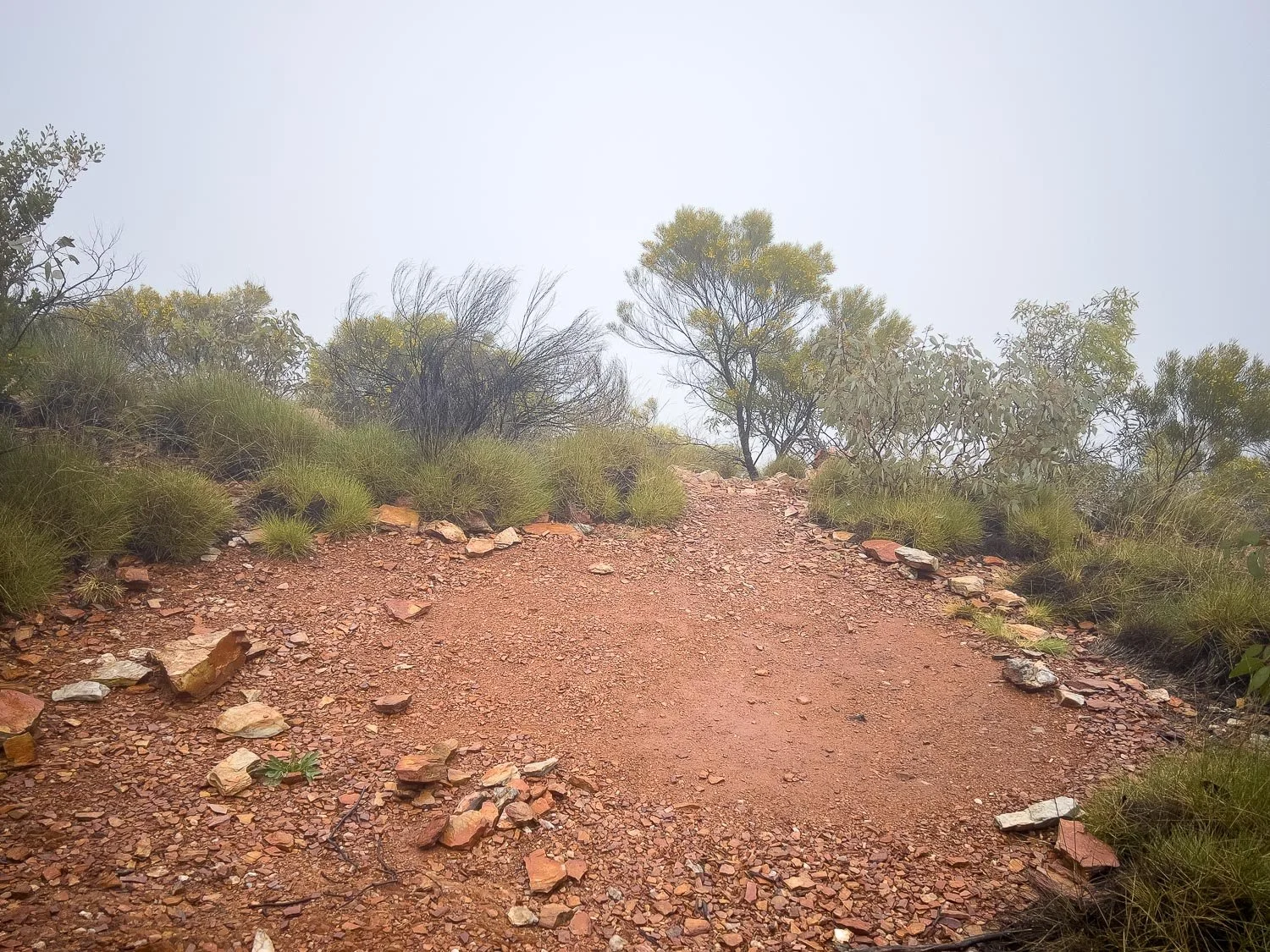
Razorback Ridge, spectacular even in mist!

Short daily sections either side of Standley Chasm reflect the challenging terrain.
Today’s spectacular hike of just 7.6km/4.7mi takes you on a long, scrambly climb up the aptly-named Razorback Ridge with gobsmacking views both north and south… in clear weather! Although it’s precipitous and graded Difficult, pictures (not ours, it was foggy!) make it look worse than it really is: there’s no actual climbing, and the razorback, while daunting, is sufficiently wide that you’re unlikely to plummet anywhere if you slip; we found Spencer Gorge more demanding, perhaps because we were descending but also because there is a little easy climbing. Both are slow going. However, despite (or perhaps because of?) the challenge and the weather we experienced, today was my favourite Type 2 Fun day of the trail, instilling a real sense of achievement. Although for me it was the most difficult day of the entire trail, the mist, wildflowers and scrambling combined for banner memories.

Today’s hike comprises an eastwards climb up onto Razorback, followed by a steep southerly descent down Spencer Gorge, before you turn east again in the valley to reach Section 4/5 Junction.

The terrain opens and flattens out right at the end of the day, and pretty Birthday Waterhole is 900m/0.56mi away for an out and return of 1.8km/1.1mi from the campground. Or you can camp there, but you’re sharing with 4WDers. This sunny photo was taken on an extra side trip whilst retrieving food drop boxes after completing our hike; it was cold and wet and I was too tired to explore the waterhole on the night we stayed at 4/5 Junction.
How to Make Today Easier
That tiny distance — just 7.6 km/4.7mi — is incredibly deceptive, and it’s the reason so many hikers glance at the number on paper and combine the day with the Hugh Gorge traverse. Slower hikers should definitely not do this. Like yesterday, you have a rocky gorge, but you also have a scrambly narrow spine, and this time they are combined with a steep descent and climb respectively. That is, challenging trail PLUS elevation gain and loss. It took us nearly 7 hours to cover the distance, graded Difficult.
f you’ve been following our itinerary and comparing your hike times to ours each day (or checking against the table in Itinerary or official Parks figures) you’ll know by now whether you will be faster or slower than us on these more demanding days, and whether you need more time, or less. Adjust accordingly. If you are MUCH slower than us, consider how you might adjust by splitting days further, starting earlier, or perhaps even skipping Ellery Creek to Standley Chasm. Study our many trail images so you can also compare the terrain, and factor in your own strength and agility.
Your best bet is to start early for maximum daylight hours.
You’ll pass several emergency campsites: some at the western end of Razorback Ridge are too close to Fringe Lily to be of practical use to west to east hikers unless you stayed there last night, but another is at Windy Saddle about halfway. However, the latter is extremely exposed so only suitable for calm weather. Ideally, aim to complete the entire distance to Section 4/5 Junction.
With Forecast Strong Winds Tomorrow at Brinkley Bluff
Check the weather forecast for tomorrow when you arrive at the Section 4/5 Junction Hut. If — and only if — moderate-strong winds are forecast for Brinkley, you’ll need to go all the way to Standley tomorrow: another Grade ‘Difficult’ day with another big climb and descent. With windy forecasts, pushing on today to the wild camps at Stuart’s Pass cuts 4km/2.5mi from tomorrow’s distance, making it 12.7km/7.9mi instead of 16.7km/10.4mi. However, in our opinion, although today is shorter it’s more demanding, so it depends on what time you arrive at the hut and how you feel.
So first preference overall for slower hikers in calm to moderate weather is 4/5 Junction (7.6km/4.7mi today) - Brinkley (7.9km/5.6mi tomorrow) - Standley (9.9km/6.2mi the day after). But this isn’t feasible in high winds.
With a windy forecast, those who have energy left at 4/5 Junction should probably top up and continue to Stuarts Pass (12km/7.5mi today), and Stuart’s Pass - Standley tomorrow (12.7 km/7.9mi), so that they can complete the distance safely.
And those who are buggered when they arrive at 4/5 Junction will stop but then have a very big day all the way to Standley tomorrow (16.7km/10.4mi)
Look carefully at the many trail pictures in today’s blog to decide whether it’s within your ability envelope; in rain, the descent down slippery Spencer Gorge is, as descents often are, more challenging than the climb up and along Razorback Ridge. Some hikers find the ridge itself mentally challenging due to its topography; our images don’t convey exposure because it was so misty. If you think this might be too much for you, seek out images taken on a clear day, but remember that west to east hikers are climbing, which is usually less daunting than a descent with exposure. I found none of the scrambling technically difficult, there was just a lot of it.
Walk with Us:

Preparing breakfast in the vestibule. The forecast is for high winds and light rain all day, with a maximum temperature around 10C/50F. Brrr!

And misty! For the first time, we’re wearing gloves. It is bitterly cold but the climb should soon warm us up. Ha, famous last words!

View down into pretty Fringe Lily Campsite from the start of the climb.

The spiderwebs are jewelled with dew, and all the spinifex looks soft and green. When it’s dry, spinifex leaves appear cylindrical, but they are actually flat. They unfurl in this weather to absorb as much moisture as possible.

Easy scrambling…

… with a few rough steps here and there.

The views are apparently spectacular, but not today! Nevertheless, this is quite special too, and the vistas have been grand every day thus far. Relish the variety!

One of a few scattered campsites: you can see how exposed the spot is.
Another campsite. I seem to recall there were a few in a small grove of trees, too.

The trail follows the spine, dropping to the northern and southern sides now and then. In the howling southerly, the sheltered northern side seems noticeably warmer.

Desert Rock Myrtle (Rinzia polystemonea) is endemic to the region.

Big steps up rather than scrambling…

… and still more up!

We stop to eat a high sugar snack and to put on more layers. With windchill of about 30kts in the most exposed areas, the apparent temperature is around 0C and we are moving too slowly in this terrain to generate much heat.
A good layering system is essential. I’m wearing woollen long bottoms under my pants and rainpants. On my upper half, I’m wearing:
a merino short-sleeved baselayer
a merino long-sleeved baselayer
a fleece
an ultralight breathable rainshell. I add
an ultralight Ghost Whisperer down puffy, worn between fleece and rain shell, whilst we are on the high parts of the ridge. This puffy has only ever been used in camp and it’s the first time I’ve ever hiked in it: down quickly collects moisture if worn under a rain shell, losing its loft and insulating properties. However, I’m moving so slowly today, the Visp rain shell is so breathable, the rain is so light, and it’s so windy, that it will stay dry.
In addition, I’m wearing
a lightweight woollen balaclava (a great design that doubles as a beanie and neck buff; the brand we have has been discontinued but search for ones under 190gsm; you can find cheaper but thicker and heavier models, plus others incorporating different materials) under
a lightweight but warm fleece beanie with ear flaps and
warm gloves.
As soon as I stop moving, even all these layers are insufficiently warm unless we are out of the wind. Geoff is wearing the same as me but for the balaclava, thermal bottoms and puffy. It is extremely cold. If it were raining more heavily, the thermal bottoms and long-sleeved top, plus the puffy, would have to be left safely dry in my pack, but the drizzle is too light to be a problem when wearing good rain shells. The rain pants are especially useful: wet long pants or wet bare legs in such windy weather would suck even more heat away.
Yesterday, whilst nearing Fringe Lily Camp, we met a trio of young hikers wet to the skin, wearing drenched puffy jackets. A puffy jacket is not waterproof. They were all cold and they had no dry clothes to change into; I kept thinking about them in today’s weather. You may be in dry Central Australia, but it is far away from the moderating influence of coastal waters, and peak hiking season is in winter. Bring suitable clothing!

Olearia ferresii

Just look at that colour in the mist, with great swathes of yellow Hill Mulga (Acacia macdonnellensis) and white Desert Rock Myrtle. Gorgeous!

At last we begin the descent, with new plants still to find! Here I’m trying to use my iphone with its broken camera lens, wet screen and recalcitrant attitude to gloves.

Still so rocky! The dense fog is extremely disorienting — Geoff and I generally have a good sense of direction — and today only the southerly wind gives a clue. However, here it’s swirling and rotoring so much over and around the terrain that even wind direction is of no help. Fortunately it is so steep and rocky that there is nowhere else to walk but the trail itself!

Here is Windy Saddle, with a couple of small campsites. Wind venturies (funnels) through this spot, and even light breezes howl through here.
The following nine images illustrate the Spencer Gorge descent, which includes a little that’s almost-climbing. None of the descent is technically difficult, although the wet rock makes it more challenging on the day we are there. Rather, it is the relentlessness of the rough terrain — you’ve been picking your way over and around rocks for about 3.5km/2.2mi, and now you have have 800m/0.5mi more of almost constant scrambling and boulders, initially steep, before you exit the gorge.

A little easy climbing descent (almost scrambling), with plenty of foot- and hand-holds.

A lot more of it is like this.

Angling down a narrow ledge.

More steep descent.

Around and between boulders, still descending steeply.

Finally beginning to level out…

… but wait, there’s more!

Time for a late lunch. It’s still a little drizzly but this spot is nicely sheltered. Old farts like us are likely to be moving slowly rather than skipping lightly down this terrain, so I and even Geoff are still wearing all those layers.

Continue along a towering vertical wall that dwarfs the trees, and you. The terrain is still bouldery…

… but eventually, just before you leave the river bed, it eases. This is one place the very unobservant might overshoot the turnoff but, recognising this, Parks have placed not one but two waymarkers on a tree dead centre in your path.

You follow a beautiful valley east.

At last, just before you reach the campsite, it opens out. There have not really been any emergency campsites between Windy Saddle and here.

This is why you need a tent. On the wettest days such as this one, many inexperienced hikers will be struggling with drenched gear and need to sleep in the hut. A family of five, plus two couples and a solo hiker are all inside, with wet gear, including drenched sleeping bags — use a pack liner because few packs are waterproof! — draped from beams. Countless hikers have wet clothing with no dry ones to change into AND IT IS BLOODY COLD. When you pack for the Larapinta, remember these pictures and our descriptions, and pack for potential rain and cold if hiking in winter.
Our first priority, even before setting up the tent, is to brew a hot cuppa to ward off the chill. We squash congenially into the hut with other hikers doing the same thing.

A break in the drizzle, and it’s time to pitch the tent. This is when we discover a few frayed line extensions at the ends of our guylines and swap them out (see also FAQ in Planning and Tips and take spares, the Larapinta rocks are brutal!). Be grateful for your good tent and dry gear. We fall asleep listening to light drifts of rain sweeping over us: there’s nothing nicer than lying in a good tent listening to the rain, and nothing worse than lying in a leaky tent listening to the rain!
We respectfully acknowledge the Arrernte People as the traditional custodians of the land on which we walk and pay our respects to Elders past and present and to the Aboriginal people present today.