
Day 22: Simpsons Gap to Wallaby Gap (Sect. 1, Part)
Pools, contouring flanks and wide southerly views

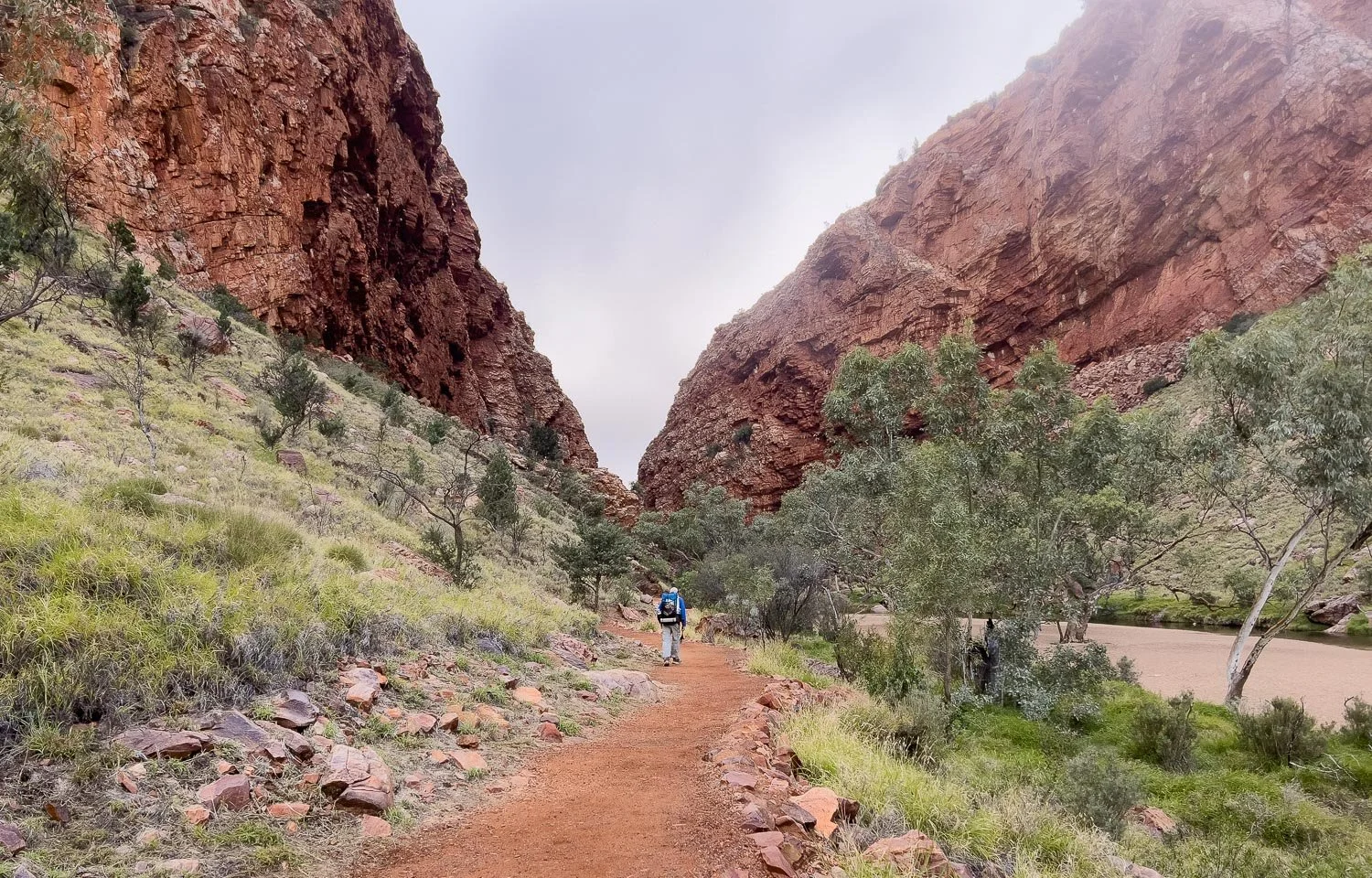
Peaceful early morning light in Simpson’s Gap

Your penultimate day on trail!
Today’s Hike
Today’s 13.6km/8.5mi hike (including side trips to Simpsons Gap, Fairy Springs and Scorpion Pool) is shorter than yesterday’s but with similar elevation gain and loss, primarily first up as you climb and descend the saddle by Hat Hill.
The terrain has gradually become more undulating rather than steep, but the climb out of Simpson’s Gap over Hat Hill and the final flanks of the range will have you warmed up in no time! After offering grand views from the saddle, the trail contours along the flanks of the range and then hills and valleys, with wide southerly views much of the time. By now you can also see Heavitree Gap behind Alice Springs: your destination is in sight! Sheltered Fairy Springs is off a short spur trail, followed by Scorpion Pool, but much of the time the walking is in open country with little shade.
Wallaby Gap is your last campsite; it has a covered rotunda and two sleeping platforms but no hut. In good weather, it’s the perfect opportunity to spend your last night under the stars.

Today’s route
How to Make Today Easier
If you’ve hiked from west to east, you should again find today straightforward. The 13.6km/8.5mi distance is reasonable — less than yesterday — and the major climb is at the start of the day when you are fresh and the weather is cool. East to West hikers may be dismayed as they discover that the trail is not flat, but ‘Larapinta Flat!’
Skipping the spur trails to Fairy Springs and Scorpion Pool saves you only 1300m/1420yds and perhaps 50m/164ft elevation gain. If you want to omit one of them, Scorpion Pool is less picturesque.
Start early, especially if the forecast is for high temperatures, so that you arrive at Wallaby Gap before the heat of late afternoon. Much of the hiking today is across exposed flats and sloping flanks, rather than in the shade of a steeper section of range.
Walk with Us:
Explore Simpson’s Gap if you haven’t yet done so the previous night. Here, early morning cloud swirls around the surrounding ridges.

The Gap is serene and peaceful; we squint to spot rock wallabies but presumably they are all tucked securely under overhangs near the top of the scree, which you are not permitted to climb.
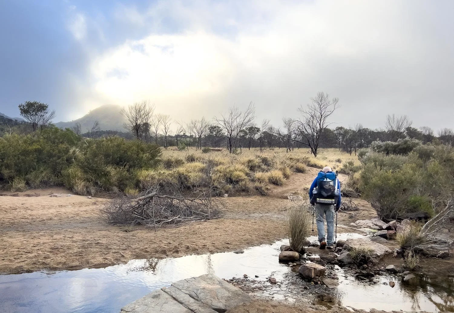
Through the car park and across Roe Creek, with Hat Hill peeking through the mist.

Flat trail, easy underfoot initially…

… before you begin your (still relatively easy) climb to the saddle beside Hat Hill. As you can see, excellent smooth trail and the morning cloud is dramatic, fun for any photographer.

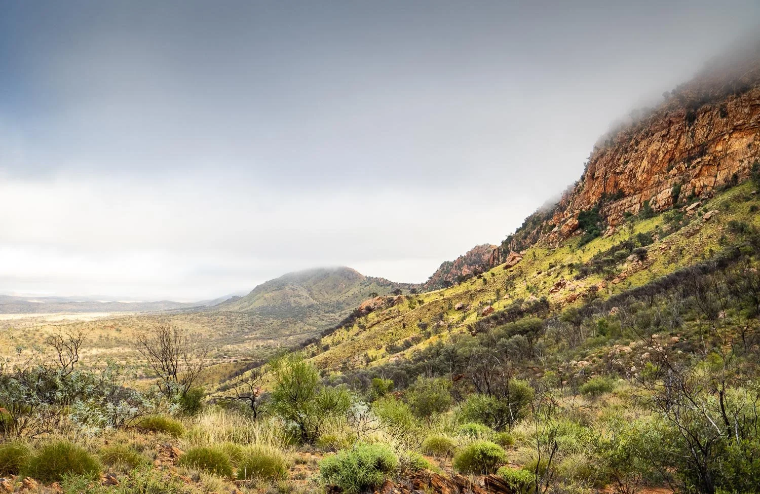
Even though you are only on the flanks of the Chewings Range, you have fantastic views across sun-dappled plains to the Heavitree Range to the south.

Hat Hill Saddle has emergency wild campsites, but it is too close to Simpson’s Gap for W2E hikers, and E2W hikers who have reached here should be able to make the extra downhill 2.6km/1.6mi to the designated camp; you really have no excuse to stop here unless you are injured or exhausted. We include these wild campsites only in case you need them for safety reasons: please plan for designated campsites, and wild camp only if you really need to.
Grand views to the west from Hat Hill Saddle.

The trail near Hat Hill is relatively steep…
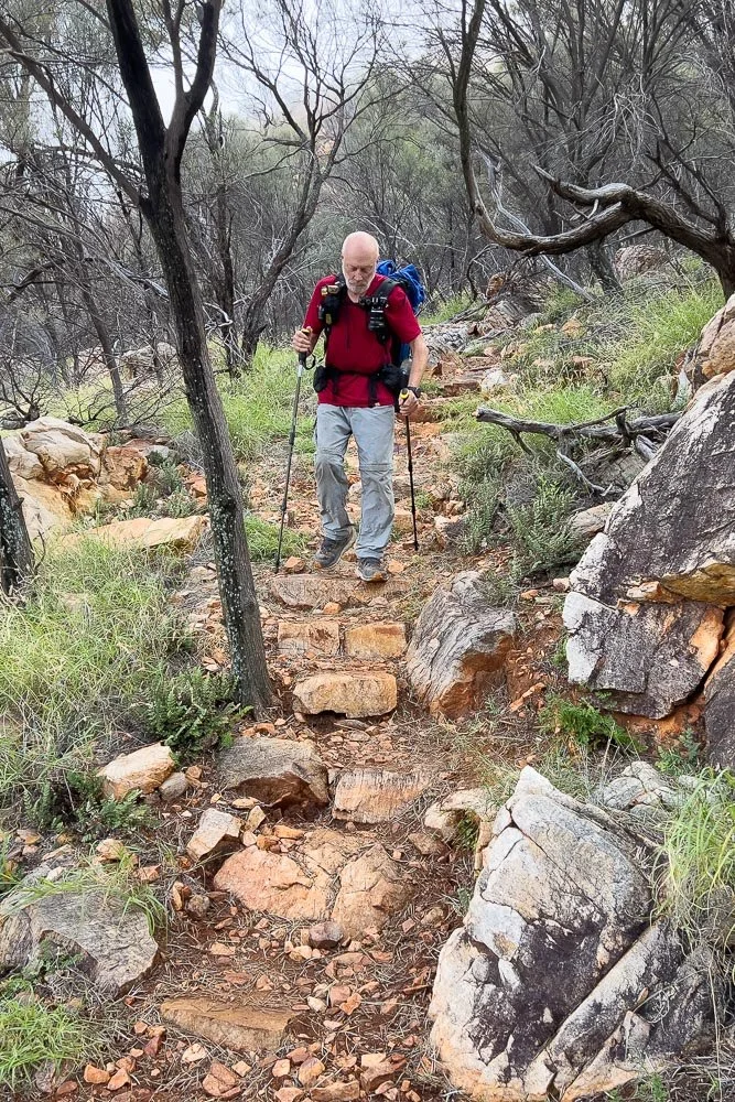
But this is as tough as the day gets! Easy-peasy!

Tiny Dwarf Justicia (Rostellularia adscendens)

The trail continues to contour the flanks of the Chewings Range with views all the way: marvellous stuff!

This is what is meant by the term “Larapinta Flat!” Don’t be deceived by those relatively widely-spaced topo lines, because there are plenty of little bumps and dips between them!

Spur trail to Fairy Springs.
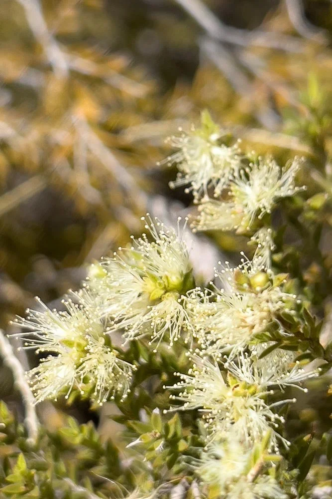
Desert Honey-Myrtle (Melaleuca glomerata)
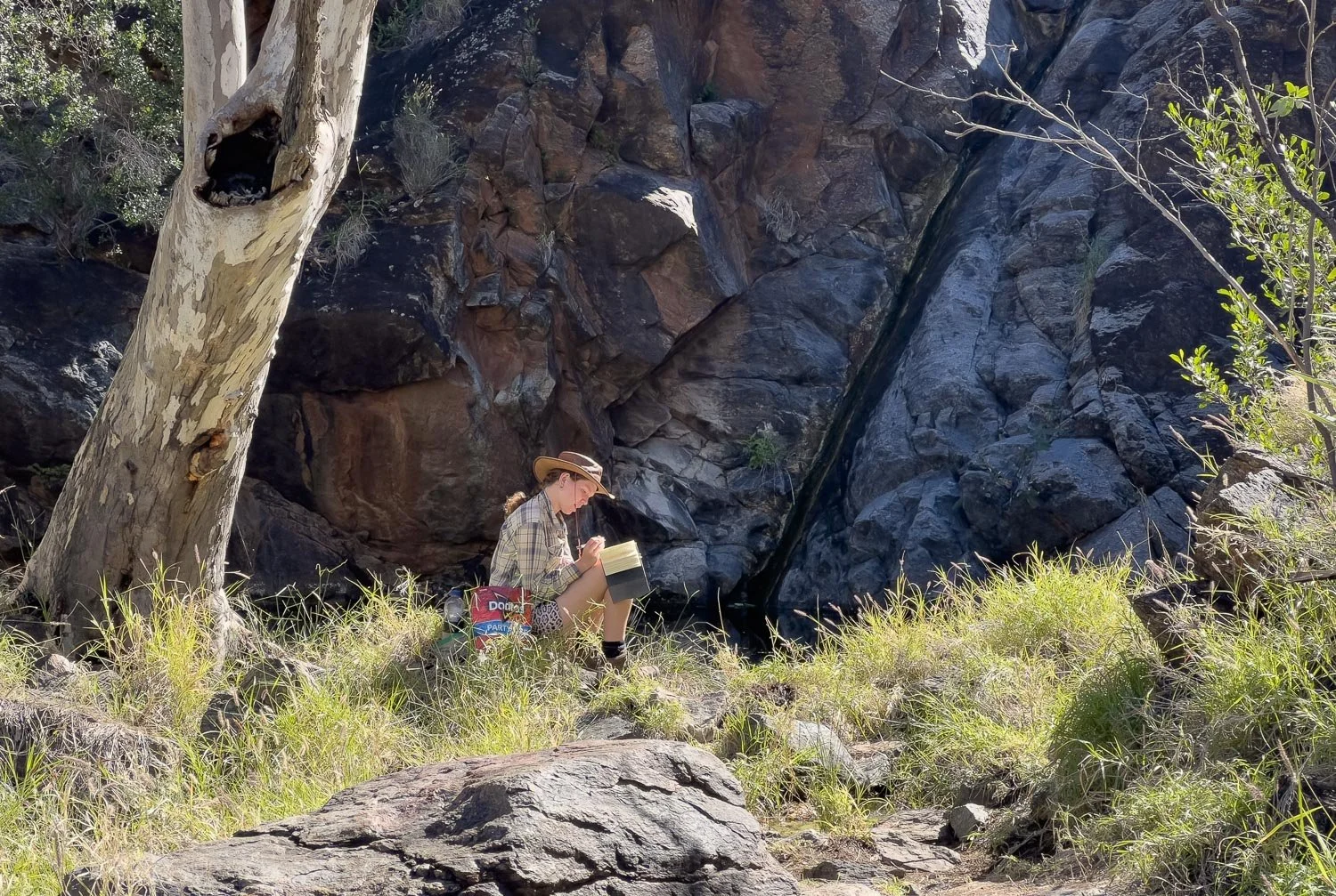
When you are on a trail like this, you meet many hikers and it’s always congenial getting to know them over a few days… before they leave us slower hikers behind! Young solo hikers are invariably exceptional people: for a young person to be sufficiently organised and motivated to complete a long hike speaks volumes about their personality, intelligence and their future success in life. They could do or become anything and, regardless of the specifics, you know it will be interesting.
They usually also have completely different hobbies and passions to the average young person, and this lass was no exception. She has a bag of excellent high calorie hiker snacks beside her, but she was also carrying bush meat jerky she’d made herself: we shared a few provisions the night before and the jerky was delicious. Running low on food the previous night at Simpson’s Gap, she’d gone to party with the Indian family and returned laden with edible gifts!
As older folk, we love meeting delightful youngsters like this. Whatever you might read about the current crop of supposedly useless millennials, there are countless competent gems amongst them.

Not far past Fairy Springs is a second spur trail to Scorpion Pool; it would be pretty with little cascades but, in the dry, is a little underwhelming compared to the spectacular gorges and gaps you’ve seen thus far.

Back onto the Larapinta; you’re off the flanks on the range here, and onto the “flats”. Smooth and comfortable underfoot: you’ll likely make good time.
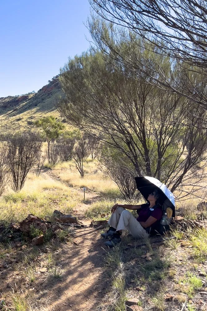
When it’s hot, stop for rests in shade when you find it!

Western Stork’s bill (Erodium cygnorum)

Finally at Wallaby Gap, with a story hanging on the sign.
It is your last night on trail, but it is the first camp that east to west hikers reach, and one poor inexperienced sod has realised that they are carrying way too much unnecessary equipment. On the Larapinta, you’ll find a billion rocks at any spot you might need to hammer in a tent stake. We met many hikers in this section carrying enormous packs; hence why the hiker freebie boxes in Standley Chasm are generously filled with superfluous food, gas bottles, alcohol fuel, batteries, toiletries and more.

Wallaby Gap is close to Alice Springs and has an open rotunda instead of a hut, perhaps to discourage non-Larapinta hikers. There are, however, two sleeping platforms and we set up on one of them.

Once you’re set up for the night, pop out to Wallaby Gap. It’s almost dry when we hike but it would be very pretty after rain.

Here you can see our sleep system. The central neck baffle on a twin quilt is crucial for preventing drafts. The sky has cleared completely and you can always expect heavy dew on calm nights: it will be cold, and without a lightweight blanket you know a down quilt will likely be quite damp by morning.
But it is your very last night on trail, and your last opportunity to enjoy the stars, satellites and meteors (we saw all three) in famously crisp skies. Now and then, the distant sounds of traffic reach you from the highway and Alice Springs, a reminder that your experience in this uniquely special landscape is almost finished. We are sad to be finishing, but looking forward to hot showers, fatty pub food, and soft beds!
We respectfully acknowledge the Arrernte People as the traditional custodians of the land on which we walk and pay our respects to Elders past and present and to the Aboriginal people present today.