
Day 20: Tangentyere Junction to Mulga Camp [Millers Flat to Jay Creek via High Route*] Sects. 3 & 2 Part.
Creeks, waterholes, springs and pools
*Although we walked Tangentyere Junction to Mulga, we recommend other slower hikers choose Miller’s Flat to Jay Creek via the high route today.

Many beautiful pools and springs today.

So few days left on this spectacular trail!
Today’s Hike
From Tangentyere Junction, today’s 14.4km/8.9mi hike to Mulga Camp has plenty of variety as you follow a flower-filled valley that gradually opens out to a plain before narrowing and ducking north through a gap with a little scrambling to the beautiful Fish Hole and a series of pools (no camping permitted). On the other side is Jay Creek campsite off a short spur trail, where you’ll collect water if you haven’t already done so at Fish Hole.
The terrain opens again past Jay Creek and the track is smoother and less rocky until you reach Spring Gap, another spectacular waterhole (again, no camping permitted). You’ll have a little scrambling through the gap, and then the trail continues gently downhill along drainage lines for another two kilometres to reach Mulga Camp: no shelter but with a toilet, water tank and picnic table.
However, if you’ve followed our recommendation and stopped at Miller’s Flat last night, you’ll start your day with that marvellous high route that we hiked yesterday, and today you’ll stop at Jay Creek, continuing to Mulga Camp tomorrow. Your itinerary for the entire trip will then be one day longer than ours. The only exception to our recommendation of the high route is if you’re injured or if winds are strong; in that case you may have elected to continue along the low route from Miller’s Flat yesterday, and be at Jay Creek already.

You can see from the elevation map that stopping at Miller’s Flat splits the most demanding sections of track into two days.
How to Make Today Easier
If you’ve been following our itinerary and comparing your hike times to ours each day (or checking against the table in Itinerary), or comparing your times to official Parks estimates, you’ll know by now whether you will be faster or slower than us or Parks on more demanding days, and whether you need more time, or less. Adjust accordingly. If you are MUCH slower than us, consider how you might adjust by splitting days further, starting earlier, or perhaps even skipping the most difficult sections. You may prefer the low route in this section, though the trail west of Miller’s Flat is the more challenging. Study our many trail images to compare the terrain, and factor in your own strength and agility.
Because we hiked from Tangentyere Junction, we arrived at Jay Creek too early to stop: it’s just 4.6km/2.8mi over much easier terrain. This meant we decided to continue to Mulga, making the day a total of 14.4km/9.9mi. Both days at 7.9 hours and 6.9 hours each respectively were just a bit too long for my comfortable ability in this terrain and Standley to Tangentyere was particularly demanding; YMMV. Had we stopped at Millers Flat (which was our original pre-hike plan), 9.2km/5.7mi from Jay Creek, we would have had more appropriately distributed daily hike times, distances and level of challenge:
Our hike:
Standley to Tangentyere Junction 9.6km/6mi: Our time; 7.9 hours
Tangentyere to Mulga Camp 14.4km/9.9mi: Our time; 6.9 hours
What we recommend for other slower hikers:
Standley to Millers Flat - 5km/3.1mi: Our time; 3.8 hours (have a leisurely breakfast at Standley before setting off!)
Millers Flat to Jay Creek - 9.2km/5.7mi: Our time; 6.4 hours
Jay Creek to Mulga Camp - 9.8km/7.1mi: Our time; 4.6 hours
Walk with Us:

Two minute noodles is one of our favourite breakfasts. We now never eat it on its own or with only vegetables. Instead, we also add protein in the form of TVP, wheat gluten, or thin bean curd sheets. Freeze dried minced beef would work well too but it’s expensive. All rehydrate in the time it takes for 1200ml water to come to the boil (in our alcohol stove, about 10 minutes).
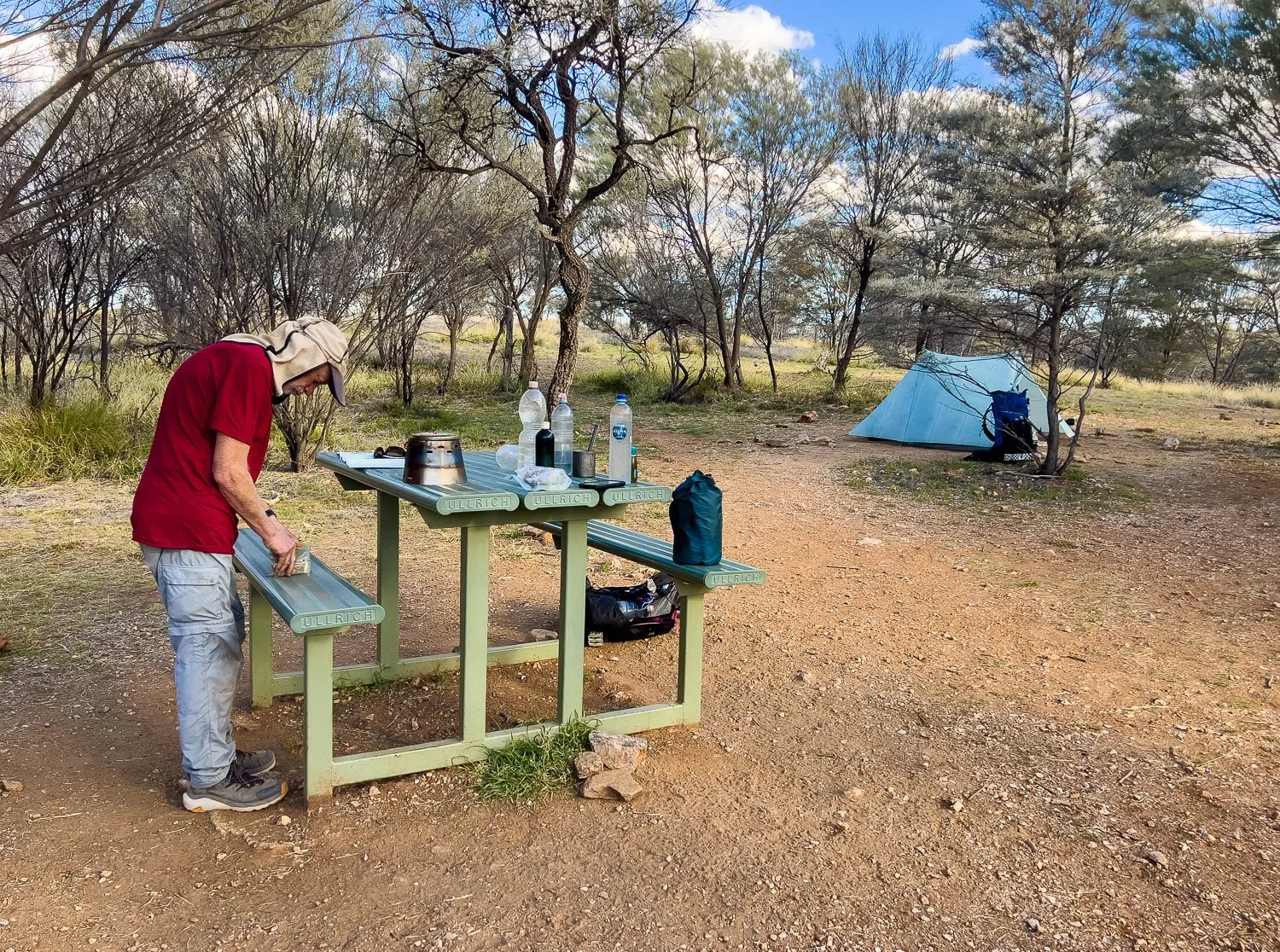
When there are two of you, a hot breakfast is more time efficient than for solo hikers because, rather than completing tasks sequentially, one person can boil the pot and cook while the other packs up camp.

So while Geoff cooks breakfast, I pack up the tent. Ultralight tents are a boon to those of us who are not as strong as we used to be but they are less robust than conventional offerings. Ultralight tents manufactured in the northern hemisphere, particularly Canada and North America, are not designed for Australia’s spiky hard-leafed vegetation, fine dust, rough granite, limestone and especially the kind of shredding knife-edged rock found on the Larapinta. Even some of their bespoke footprints are too thin.
We have tried ultralight footprints — polycro is widely used in the US and is also available here — but it was hopeless the moment it got wet (think: crumpled wet Gladwrap). It’s good for dry camps.
The best thing we have used by far is Tyvek. However, ensure it is the fully waterproof branded Tyvek by Dupont. Tyvek comes in multiple forms; some are water and vapour proof, whereas others are waterproof but not vapour proof. The generic/offbrand stuff we bought in Australia from a hiking shop allowed vapour through so that moisture collected annoyingly between the footprint and the tent floor. When we compared our vapour- and non-vapour proof tyvek, we could see and feel the difference: the vapour-proof material had a much tighter weave without gaps, and felt stiffer and more crinkly.

But anyway, soon you will be off from Tangentyere Junction through much easier terrain; you can see the track is smooth underfoot.

Plenty of interesting vegetation — this area is particularly rich in wildflowers. Here, Stenopetalum nutans…

… and Hoary Darling Pea (Swainsona flavicarinata)

Absolutely glorious country!

Everyone falls in love with those elegant Ghost Gums, so different to the equally beautifully gnarled River Red crones.

As you approach Jay Creek the valley narrows and steepens, becoming more rocky.
Rather than following the bank, you climb a rocky spur with views over the creek before descending again.

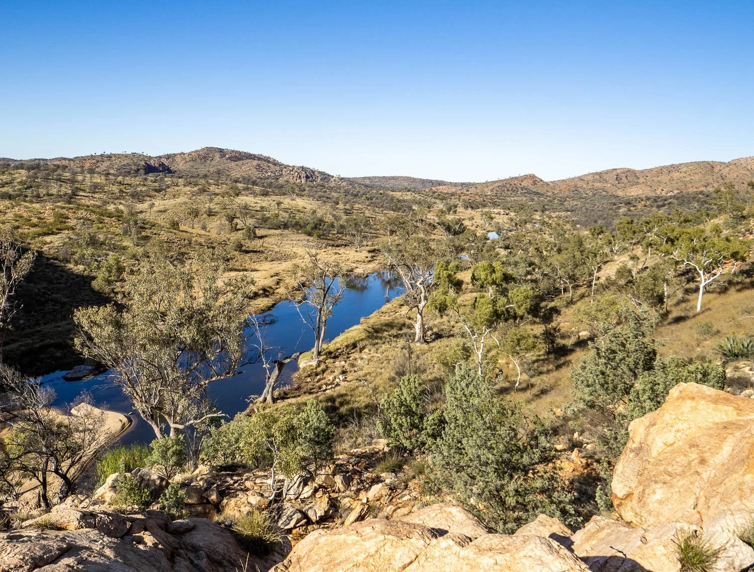
You pass Fish Hole with its inviting sandy bank and sun-warmed smooth rock slabs — sadly no camping here, but you can replenish water if you’re running low.
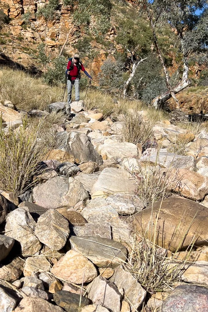
A little bouldery creek bed: you will be well accustomed to this kind of terrain by now!

You continue to follow Jay Creek northward. The wide sandy bed is dry here, but you can see from flood debris caught in the foreground tree that heavy rains change the landscape completely!

Corrugated Sida (Sida corrugata)

More delightful rock pools

About 1.75km/1.1mi on from Fish Hole you reach a short spur trail to Jay Creek Campground.

You’ll pass campsites in the sandy riverbed…

… with more around the hut. If you’re hiking from Miller’s Flat or even Standley Chasm via the low route, slower hikers will arrive much later in the day and stop here. We pause for second breakfast, have a chat to a park ranger doing maintenance work, then continue to Mulga Camp.

The track is still much easier than in previous sections to the west!

Burr Daisy, Calotis latiuscula

A few scattered emergency camps along the way.

The flood Plain narrows and becomes hilly as you approach Spring Gap.

Spring Gap is delightful. Follow the western (true right*) bank— the eastern bank has a precipitous cliff beside a rock pool ahead.
*To describe which side of a watercourse to follow without any chance of misunderstanding when a stream winds a circuitous route and compass direction is therefore confusing, the terms true left and true right are unmistakable. True left is the left hand bank when facing downstream, and true right is the right hand bank when facing downstream.

There’s that cliff on the true left, with a rocky scramble on our side of the rock pool.

It’s neither high nor tricky.

Back down again.

Marvellous vegetation, and just look at that smooth track! It’s easy to see how east to west hikers starting in this terrain are lulled into underestimating potential hike times around Standley Chasm.

Only a couple more kilometres along the valley to Mulga Camp, and still easy underfoot. You’ll likely make good time.

Hairy Mulla-Mulla (Ptilotus helipteroides)
At Mulga Camp. No shelter, but two picnic tables, plenty of well-spaced campsites, and a toilet with a small rainwater tank that is kept full for hikers.
Onto our last map today! Last map is always a bit sad because you know your journey is almost over, in our case just two more sleeps after tonight.
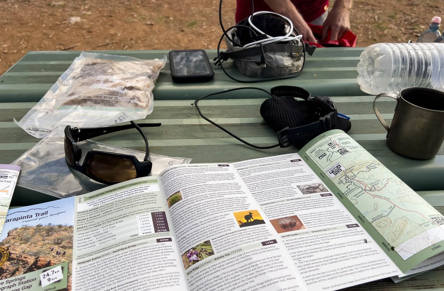
Still, there is dinner to cook, electronics to charge and batteries to swap in readiness.

Another absolute gift of a sunset. We are hiking in peak season, yet there is only one other person at the campsite to enjoy it with us — faster hikers generally go straight from Jay Creek to Simpson’s Gap. We’re not complaining!
We respectfully acknowledge the Arrernte People as the traditional custodians of the land on which we walk and pay our respects to Elders past and present and to the Aboriginal people present today.