
Day, Short and Section Hiking the Larapinta Trail
No time to complete the entire Larapinta? Read on for shorter ways to experience the West MacDonnells, slowerhiking style!

For slower hikers, this iconic view is accessible via a day point-to point hike (Serpentine Gorge to Serpentine Chalet Dam), a day out-and-return from Serpentine Chalet Dam, or an overnight out-and-return hike from Serpentine Gorge! Unless otherwise specified, every image on this page is accessible as a day hike at a leisurely pace.
The spectacular 230km/143mi Larapinta stretching from Alice Springs in the east to Redbank Gorge in the west is an iconic Australian thru hike, with world class views and landscapes. Usually done in 15-18 days (20+ for slower hikers), the walk traverses spines, bluffs and ridges with vast views, and winds through rocky gorges with cool, deep pools and walls that glow orange in the midday sun. It is stunning, ancient country, a unique and unforgettable landscape.
Why Shorter Options?
The full end to end distance requires at least one pickup or dropoff, as well as several food drops. You may need to organise secure storage for luggage or your vehicle in Alice Springs: logistics aren’t difficult but require planning.
Also, many hikers cannot spare 18+ days. This track is relatively demanding, so it’s important not to squeeze the entire distance into a shorter time: yes, some people run it in seven days, but we more leisurely folk are not them! Instead, cherry pick.

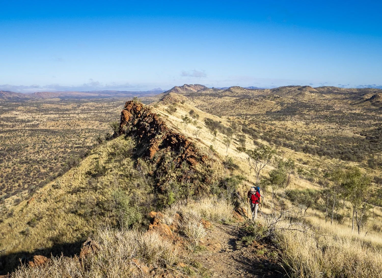
A short hike into Simpson’s Gap.
Or perhaps you aren’t confident multiday hiking, or unable to carry your gear. Are you only accustomed to day walks, or one or two nights? Or perhaps your available time is only one week: is there an option for you?
The answer to all of the above questions is yes! You have grand day walks, overnight loops or return hikes, short multiday point to points, and Section hikes through the West MacDonnell Range to suit your timeframe, strength and experience.
Supported/Guided Options
Although this website is for slower hikers who prefer to walk independently, guided walks are available: you see selected highlights and get picked up at the end of each day, or at the end of a few days, with all food supplied. Tour Companies include:

Even though Parks recommends hikers stop at Fringe Lily campsite, many of the supported tours omit this designated intermediate camp because there is no road access, which means the day’s hike is all the way from Birthday Waterhole to Hugh Gorge, a distance that took Geoff and me 13.8 hours over two days, including upper Hugh Gorge. Razorback Ridge isn’t accessible as a day hike for slower hikers.
Check what distances over what terrain you are required to cover each day. Some of these tours omit either entire sections or intermediate designated campsites like Fringe Lily that are inaccessible by car, so slower hikers miss views on some of the most picturesque parts of the trail because you’ll have to start at 3am, as two disappointed slower hikers told us. Not only that, but these same two were excluded at short notice from a demanding day because their slower speed reportedly endangered the group of five.
Some tour companies offer end to end options over just 14 days, which would be at best unpleasant and at worst unsustainable for slower hikers. I would have loathed the Larapinta at that pace. Little photography, a struggle to keep up, starting in the dark. Ugh. And be prepared to spend A LOT of money: an end to end guided tour costs more than AUD11,000 (USD7178) per couple at time of writing (2025). So, independent slower hikers with less time — or cash! — read on.

Far from the crowds at the southern end of Ormiston Gorge, you are likely to have the entire Pound Loop to yourself
Independent Day, Short and Section Options for Slower Hikers
Below is a list of walks. Groupings are for slower hikers: we have seen examples, such as a Section 3 circuit hike from Standley Chasm listed as a one nighter, that we could not complete comfortably in the recommended time. Other hikes listed as day hikes that are too far for us to enjoy as slower hikers are Sect.1, Alice Springs to Simpson’s Gap (24.7km/15.4mi), Birthday Waterhole to Hugh Gorge, and an out-and-return from Standley Chasm to Brinkley Bluff (again, a great overnighter for slower hikers, but too far through steep and rough terrain as a day hike).
Alice Springs to Simpson’s Gap is recommended as a day hike, or as an out-and-return from Geoff Moss Bridge, but slower hikers will be happier stopping at intermediate Wallaby Gap campsite for a two-day, one night hike.
Direction of walk for point to point hikes is chosen to simplify logistics, though this varies with transport. Circuit and return hikes are cheapest and simplest logistically, especially with your own or a hire car. Some hikes have been recommended over other similar ones because access and logistics are easier.
Logistically, a section hike is usually also simpler than seeing the same highlights as a number of day hikes. The Sections between Ormiston and Standley have the most features.

Helicopter views from atop Mt Sonder
Highlights accessible via day hikes at a slower pace:
Redbank Gorge, Mt Sonder, Ormiston Pound, Standley Chasm, Simpson’s Gap, Serpentine Gorge, Serpentine Chalet dam, Count’s Point, Hugh Gorge, Ellery Creek South/Big Hole, Bond Gap.
Accessible via one night/two day hikes, add to the above list:
Ellery Creek North, Brinkley Bluff, Reveal Saddle.
Two nights, three days add
Giles Lookout, Waterfall Gorge.
Three nights, four days, add
Fringe Lily Pools, Razorback Ridge, Spencer Gorge.
Have more time? Then consider:
Redbank Gorge to Ormiston Gorge, or Ellery Creek South to Standley Chasm (both 6 days),
Serpentine Gorge to Standley Chasm via Ellery Creek North (7 days),
Ormiston Gorge to Standley Chasm (10 days)
Read on for:
Access Options (Own/Hire Car, 4WD, AWD, taxis, Ubers)
Accommodation, Fees, Bookings
Summary Table of shorter hikes, accommodation and access
Day Walks for slower hikers, 1 - 8 hours:

Ormiston Gorge short loop and Pound walks. The Pound Circuit is, in our opinion, the jewel of the West MacDonnell day hikes, more varied than the Mt Sonder return hike.
The links below go to daily blog(s) about that part of trail. They include lots of pictures of the trail itself, so you know what to expect even if you’re hiking in a different direction:

Spectacular Redbank Gorge
Ormiston Pound Circuit** 8.5km/5.3mi circuit
Redbank Gorge return** 3km/1.9 miles
Mt Sonder** 14.2km/8.8mi return
Woodland Circuit at Simpson’s Gap, including spur to Bond Gap 19.5km/12.1mi
Serpentine Gorge return* 1.6km/1mi
Simpson’s Gap return* 0.97km/0.6mi
Standley Chasm return* 2.4km/1.5mi
Hugh Gorge Upper return* 9.2km/5.7mi
Serpentine Chalet Dam to Serpentine Gorge** 15.2km/9.4mi
*recommended
**highly recommended

The highly recommended Ormiston Pound Circuit Hike
NOT recommended by us as day walks for slower hikers: Telegraph Station to Simpson’s Gap, Geoff Moss Bridge to Wallaby Gap return, Standley to Brinkley Bluff return, Serpentine Gorge to Count’s Point return. In our opinion, these are fine for hares but too far as day hikes for us leisurely folk.

The Woodland Circuit above showcases woodland terrain, but the Serpentine Gorge walks also traverse woodland with more variety. If doing the Woodland Circuit, extend it to include Bond Gap.
Serpentine Chalet Dam to Serpentine Gorge is logistically more complicated but a more varied and shorter hike than the return (overnight for slower hikers) route to Count’s Point from Serpentine Gorge.
1-2 night multiday hikes (for slower hikers; faster hikers usually do these as day hikes):
If you camp overnight on the Larapinta, Trail Fees apply as well as camp fees. You need a Parks Pass for entering the park. Some trailheads such as Hugh Gorge and Birthday Waterhole take time to reach by car, so factor this into your itinerary.

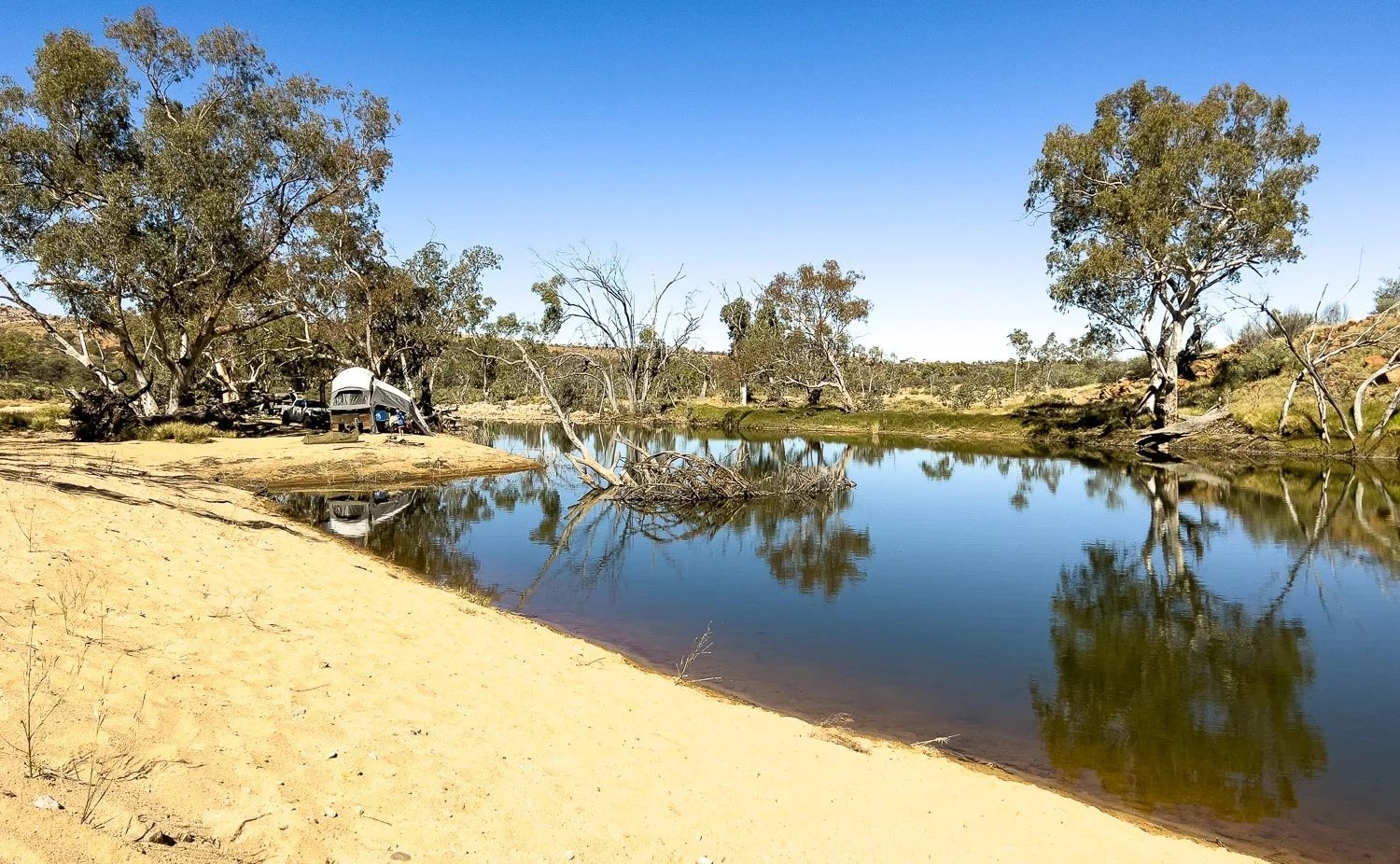
Ellery Creek North
1 night, 2 days:
Ellery Creek South to Ellery Creek North circuit* , 32.3km/20.1mi includes Ellery Creek Big Hole (South and North)
Standley Chasm to Brinkley Bluff return ** 19.8km/12.3mi includes Standley Chasm, Reveal Saddle, Brinkley Bluff
Birthday Waterhole to Standley Chasm** 18.8km/11.7mi with 850m/2900ft elevation gain and loss, includes Birthday Waterhole, Brinkley Bluff, and Standley Chasm.
Serpentine Gorge to Count’s Point return 18.2km/11.3mi return includes Serpentine Gorge and Count’s Point
*recommended
**highly recommended
2 nights, 3 days:
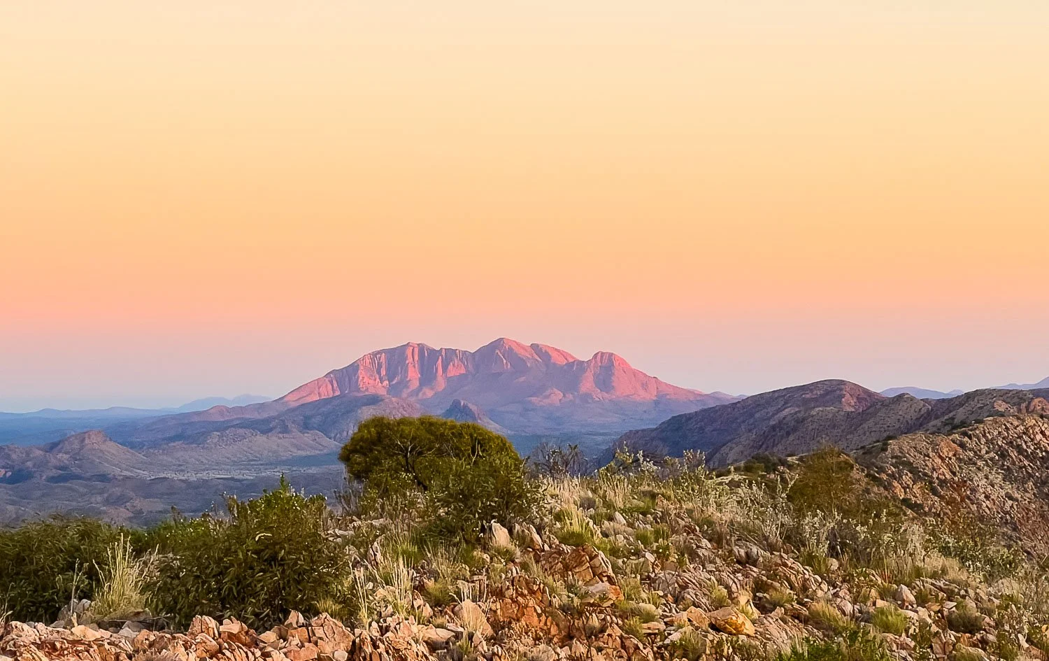
Dawn view of Mt Giles (2 nights, 3 days)
Serpentine Gorge to Ormiston Gorge** 46.1km/28.6mi includes Ormiston Gorge, Giles Lookout, Waterfall Gorge, Serpentine Gorge, Count’s Point, Inargala Pass, Serpentine Chalet Dam.
**highly recommended
Standley Chasm to Tangentyere Junction Circuit/return is not recommended for slower hikers even with a two-night timeframe because you will need to carry water for TWO dry camps, and the scrambling on the first day will likely be demanding. Instead, we recommend you hike over 4 nights from Simpson’s Gap to Standley Chasm or in the reverse direction.
Longer Hikes 3-9 nights (number of days calibrated for slower hikers) include:

Fringe Lily Pools (3 nights, 4 days)
3 nights, 4 days:
Ormiston Gorge to Ellery Creek South* 58.4/36.3mi includes Ellery Creek Big Hole, Ormiston Gorge, Giles Lookout, Waterfall Gorge, Serpentine Gorge, Inargala Pass, Count’s Point, Serpentine Chalet dam.
Hugh Gorge Trailhead to Standley Chasm** 34.5km/21.4mi includes Hugh Gorge, Fringe Lily Pools, Razorback Ridge, Spencer Gorge, Birthday Waterhole, Brinkley Bluff, and Standley Chasm.
Simpson’s Gap to Standley Chasm, 40.9/25.4mi includes Bond Gap, rocky gorges, Chewings Range, Fish Hole, Jay Creek, Spring Gap
*recommended
**highly recommended

High Route on the Chewings Range (3 nights, 4 days)
5 nights, 6 days:

Finke River (5 nights, 6 days)
Redbank Gorge to Ormiston Gorge *52.3km/32.5mi includes Redbank Gorge, Mt Sonder, Rocky Bar gap, Hilltop Lookout, Finke River, Ormiston Gorge, add 1 day for Ormiston Pound Loop Walk.
Ellery Creek South to Standley Chasm* 64.8km/40.3mi includes Birthday Waterhole, Hugh Gorge, Fringe Lily Pools, Razorback Ridge, Spencer Gorge, Birthday Waterhole, Brinkley Bluff, and Standley Chasm.
*recommended
6 nights, 7 days:

Hugh Gorge, also accessible as a day out and return.
Serpentine Gorge to Standley Chasm via Ellery Creek North * 75.4km/46.9mi includes Serpentine Gorge, Ellery Creek Big Hole, Hugh Gorge, Fringe Lily Pools, Razorback Ridge, Spencer Gorge, Birthday Waterhole, Brinkley Bluff, and Standley Chasm.
*recommended
9 nights, 10 days:

Looking west from below Brinkley Bluff from Ormiston to Standley on a 10 day hike (this section also possible as an overnighter from Birthday Waterhole)
Ormiston Gorge to Standley Chasm *** 121.5km/75.5mi includes: Ormiston Gorge, Giles Lookout, Waterfall Gully, Inargala Pass, Serpentine Chalet dam, Count’s Point, Serpentine Gorge, Ellery Creek North, Hugh Gorge, Fringe Lily Rockpools, Razorback Ridge, Spencer Gorge, Birthday Waterhole, and Brinkley Bluff, and 1 day for the Ormiston Pound Loop Walk)** with a food drop at Serpentine Gorge.
**super highly recommended

Grand view of Count’s Point from the west accessible only as a multiday for leisurely hikers.
The most spectacular and varied Sections comprise Ormiston to Standley, but they are also the most demanding with a lot of scrambling, plus elevation gain and loss. If, after reading our daily blogs, you think this section may be too demanding, choose Ormiston to Sonder.
Standley Chasm to Simpson’s has the most demanding scrambling of the entire trail on the first day, though it is only a short distance:

Scrambling east of Standley Chasm
Simpson’s Gap to Alice Springs includes the marvellous Euro Ridge, but is far less varied than the other sections, so not recommended by us as a section hike unless everything else looks too challenging.
Getting There and Transport

A spectacular morning atop Brinkley Bluff, accessible as a two day, one night hike for leisurely hikers, or a day hike for faster ones.
Fly or drive to Alice Springs. You then have three options to access Larapinta trailheads: private car, hire car (or here), track transfer company or, to some trailheads, taxi or Uber.
Pick up hire cars from the airport or in Alice Springs. Book well ahead. At time of writing, prices per week for peak June-July season 10 months hence ranged from AUD1900-3000. Compare with Track Transfers: car hire may be cheaper for groups or those travelling to multiple locations for day hikes. Track Transfers may be cheaper (see below) for solo hikers, couples, or those hiking just one section. Taxi is often cheapest of all.
Depending on where you are hiking from and weather, you may need a 4WD vehicle. Although some unsealed roads are accessible by 2WD, hire car insurance is void if you travel them in a 2WD.
Accessible by 2WD are:

Serpentine Gorge
Simpson’s Gap (7km from Larapinta Dr) 25km from Alice Springs
Standley Chasm ( distance from Larapinta Dr) 50km from Alice Springs
Ellery Creek South (20.4km from Namatjira Dr) 90km from Alice Springs
Serpentine Gorge (10.4km from Namatjira Dr) 100km from Alice Springs
Ochre Pits, 110km from Alice Springs
Ormiston Gorge (8km from Namatjira Dr) 135km from Alice Springs
Accessible by AWD or 4WD (depending on recent rain), add
Serpentine Chalet Dam (3km from Namatjira Dr) 105km from Alice springs
Redbank Gorge and Mt Sonder (5km from Namatjira Dr) 156km from Alice Springs
Accessible by high clearance 4WD, add
Birthday Waterhole
Birthday Waterhole (14.4km from Namatjira Drive, ie, a long, slow drive) 70km from Alice Springs
Hugh Gorge Trailhead (22.3km from Namatjira Dr, also a very long, slow drive) 77km from Alice Springs
Track Transfer Companies
Track transfer companies drop off and/or pick up from all of the above locations. Most have fixed am or pm schedules, and availability depends on demand; popular spots like Standley Chasm, Redbank Gorge and Ormiston Gorge are reliable in peak season, but book well ahead. Locations furthest from Alice Springs, plus Hugh Gorge and Birthday Waterhole down long, high clearance 4WD tracks, are the most expensive. Small groups have a better chance of booking these. At time of writing in August 2025 (prices change with season and year so check again before planning),
Trail support minimum per person costs at time of writing:
Standley Chasm am dropoff AUD160, pm drop off AUD170, pm pickup AUD170
Ellery Creek South am dropoff AUD250, pm pickup AUD260
Ormiston Gorge am dropoff AUD270, midday pickup AUD280
Ochre pits am pickup AUD340
Serpentine Gorge am dropoff AUD260, midday pickup AUD270
Serpentine Chalet Dam am dropoff AUD480 pm pickup AUD440
Hugh Gorge 4WD remote am or pm dropoff AUD690, pm pickup AUD690
Birthday Waterhole 4WD remote am drop off AUD640, pm pickup AUD640
Redbank Gorge am pickup/dropoff AUD300
Taxis and Ubers
Taxis to some of these destinations are significantly cheaper, sometimes vastly so for groups of two or more:
At time of writing (2025), fees from the airport to:
Simpson’s Gap AUD 85-AUD104 for 1-4 passengers, or as low as AUD21pp
Standley Chasm AUD150-AUD183 for 1-4 passengers, or as low as AUD37.50pp
Ellery Creek South AUD245-AUD298 for 1-4 passengers, or as low as AUD61.25pp
Serpentine Gorge AUD272-AUD331 for 1-4 passengers, or as low as AUD68pp
Ormiston Gorge AUD350-AUD425 for 1-4 passengers, or as low as AUD87.50pp
Redbank Gorge AUD396-AUD480 for 1-4 passengers, or as low as AUD99pp
So if section hiking, mix and match pickups and dropoffs for the cheapest option. If you are hiking as a group with a hire car, you can drive to one destination, hike, and then have just one member of the party picked up and returned to your start point to pick up your hire car. Book well ahead.
Accommodation (on trail or nearby)

Stunning campsites atop Brinkley Bluff, now with a toilet!
You need to book campsites on the Trail and/or at Trailheads. If car camping, you may not stay at a Larapinta Trail hut or campsite with your car. However, you’ll find non-Larapinta campsites at multiple trailheads, several of which allow motorhomes and caravans. For example, you may not stay at Larapinta Trail campsites at Ormiston Gorge, Redbank gorge, Section 4/5Junction, Ellery Creek South, Serpentine Chalet Dam or Hugh Gorge, but you may stay at car camping/trailhead campsites near or at all of them. Book campsites here and book Standley Chasm here (Standley also has an admission fee).
Second, although you are not permitted to stay in Larapinta Trail campsites with your vehicle, if you are hiking along the Larapinta to a Larapinta campsite, you can stay there. For example, camp at Standley Chasm and book Brinkley Bluff campsite for an out-and return. Or stay at Ellery Creek South Car camping site, then book Ellery Creek North for a circuit hike. Or park at Serpentine Gorge carpark and hike to Count’s Point for an overnight out-and-return.
Car camping locations:
Redbank Gorge (Ridgetop and Woodlands, latter allows caravans, motorhomes)
Ormiston Gorge (allows caravans and motorhomes)
Standley Chasm (allows caravans and motorhomes)
Serpentine Chalet Dam Bush Campsite (2WD access but 4WD to Serpentine Chalet Dam)
Ellery Creek Big Hole (2WD access, allows caravans, trailers, motorhomes)
Birthday Waterhole (high clearance 4WD)
Hugh Gorge Trailhead (high clearance 4WD)
If doing a single Section hike, such as Ormiston Gorge to Standley Chasm, you can get dropped off from Alice Springs, and picked up as well. However, if you are doing two or more day or short multiday walks with your own or a hire car, you are better off basing yourself somewhere more central, such as Ormiston Gorge or Standley Chasm, or camping at and leaving from the relevant trailhead for out-and-returns or loops.
Safety, General Tips, FAQs

Serpentine Gorge
You may be doing day walks or short multiday hikes rather than the entire trail, but you’re still in a remote area and all the standard safety protocols — PLB, first aid kit, appropriate clothing, sufficient hydration etc — apply. If you plan to camp, know what substrates to expect and of course follow Leave No Trace principles. Know in which seasons to hike, and which are too wet and/or hot.
Please read the Safety Information, General Tips and FAQ in Larapinta Trail Planning and Tips:
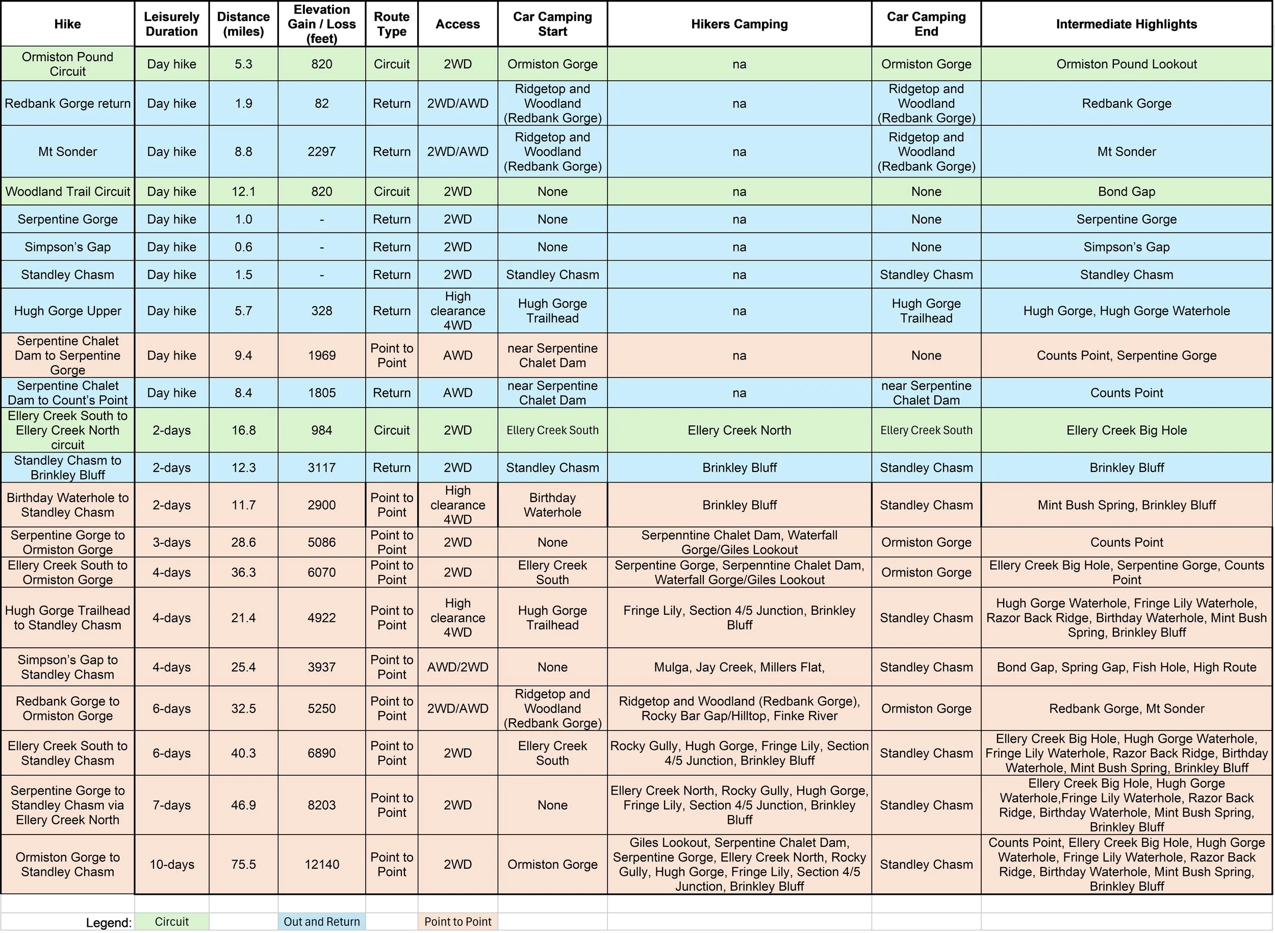
Shorter Hikes Summary Table (best viewed on a laptop or desktop)
Metric

Or here is a link to download the spreadsheet file. (Click on tab at the bottom of the spreadsheet to toggle between metric and imperial).
Imperial
We respectfully acknowledge the Arrernte People as the traditional custodians of the land on which we walk and pay our respects to Elders past and present and to the Aboriginal people present today.